Available online at www.pelagiaresearchlibrary.com Pelagia Research Library Advances in Applied Science Research, 2016, 7(3):214-221
ISSN: 0976-8610 CODEN (USA): AASRFC
Flood hazard vulnerability mapping using remote sensing & GIS: A case study along the villages of Anand taluka 1
Praful M. Udani and 2Dhruvesh K. Mathur 1
Director, ISTAR-CVM, Vallabh Vidyanagar Research Scholar 14SC703002, Faculty of Sciences(Physics), CU Shah University, Wadhwan _____________________________________________________________________________________________ 2
ABSTRACT Flood is a natural disaster almost occurs in every part of the world. India has longest rivers passing from high population density area. During monsoon season, cyclone flood are usually happen in India. Many conditions can result in a flood: hurricanes, overtopped levees, outdated or clogged drainage systems and rapid accumulation of rainfall. Mahi is one of the longest river passing from Gujarat. This river crosses three states Madhya Pradesh, Gujarat & Rajasthan .Originating from Madhya Pradesh & meets at Gulf of Khambhat. Anand district is one of the regions from which Mahi river is passing. In this paper we are selecting Anand taluka as study area .Villages near to Mahi river are highly vulnerable for flooding during monsoon season. In this paper using remote sensing & GIS we are preparing base maps for villages highly vulnerable for flood. Considering parameters like Population density, Resources available and elevation of geographical area is divided in High risk zone, Moderate risk zone, and low risk zone villages. Key words: QGIS, Mahi River, satellite maps, Remote sensing, GIS, Flood, etc. ____________________________________________________________________________________________ INTRODUCTION The State of Gujarat is located on the north-western shores of India, lying between 20°01’ and 24° 07’ North latitudes and 68° 10’ and 74° 28’ East longitudes. It cover a total geographical area of 1, 95,984 sq.km (Directorate of Economics and Statistics, 1987). Out of the total area almost 1, 09,314 sq. km is occupied by rocky formation and 86,670 sq.km is by alluvium; of which 34,625 sq. km is saline area. The State has the longest coastline in the country measuring about 1,663 km along the Western part of India, extending from Lakhpat in the North to Valsad in the South. Gujarat State has common borders with Rajasthan, Madhya Pradesh and Maharashtra States in North, East and South respectively and with Pakistan in North-West. Gujarat has four major rivers Narmada, Sabrmati, Tapi & Mahi. These rivers contribute major role in increasing fertility of soil, drinking water for large population & supplying water for agricultural, Industrial uses. Large canal networks from these rivers are main contribution in agricultural economy of Gujarat state. [6] 2. STUDY AREA The present study is related to region of Mahi estuarine area. The river Mahi is third major west flowing interstate river of India, draining into the Gulf of Khambhat. It is one of the four major perennial rivers in Gujarat (Directorate of information G.O.G., 1960). It originates in the northern slopes of Vindhyas mountain ranges at an elevation of 500 m. above mean sea level (Rao, 1975). At about 22° 35’ N and 74 ° 15’ E near the village Sardarpur in Dhar district of Madhya Pradesh (Narmada Water Resources And Water Supply Department, 1999). Its total length is 583 km, traversing 167 km. in Madhya Pradesh, 174 km. in Rajasthan and remaining 242 km. in Gujarat. Mahi is joined
214 Pelagia Research Library
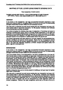
Praful M. Udani and Dhruvesh K. Mathur Adv. Appl. Sci. Res., 2016, 7(3):214-221 _____________________________________________________________________________ by Bhadar, Anas, Panam and the Meshri rivers. The Mahi River crosses boundary of three states Madhya Pradesh, Rajasthan; Gujarat. Present study only aims area of Mahi River after Vasad located at Anand District of Gujarat. It covers five taluka Anand, Anklav, Borsad, Khambhat (Cambay) and Petlad. Vadodara and Bharuch districts are on left bank while Anand district on right bank of Mahi River. The Mahi River forms the boundary between Vadodara and Anand districts. The area between Wanakbori to Gulf of Khambhat is gently sloping to almost flat near the Gulf and is a fully developed and fertile alluvial tract.[8] Anand is also popularly known as Charotar. Some of the villages of Borsad, Petalad and Anand taluka are located in this region. Known as "Golden Leaf", this region of Charotar has the highest production of tobacco in Gujarat. In Gujarati, the world "Charutar" literally means a pot full of gold coins. The entire region is very fertile and productive. Some of the villages of Khambhat and Tarapur taluka fall within the "Bhal" region. The region stretching form the bank of river Mahi near Vasad up to the bank of river Vatrak near Mahemdabad is popularly known as Charotar. It is very fertile and full of greenery. Figure 1 shows Taluka boundary of Anand taluka.
Figure 1 Taluka Boundary of Anand(source-BISAG)
4. Research Methodology The detailed methodology to be adopted for the study is given below (Fig.2 flow chart).The Topo sheets in a scale of 1:50,000 satellite image that cover the study area was collected. The base map of village boundary showing all the prominent geographic features of the basin was prepared by integrating topo sheets and satellite image. Field visits to different parts of the basin made to observe the landforms. Based on the observations made from the field base map was prepared. Depending on Elevation data, Population density, and resources available villages near by Mahi are identified. Also past history of flood during monsoon season is also considered for deciding vulnerable area.
215 Pelagia Research Library
Praful M. Udani and Dhruvesh K. Mathur Adv. Appl. Sci. Res., 2016, 7(3):214-221 _____________________________________________________________________________
Figure 2-Research Methodology
In figure 3 Mahi River basin areas is shown which clearly indicates river crosses three states and reach at Gulf of Khambhat. In figure 4 Satellite image of Anand Taluka is taken from Bhuvan portal.In figure 4 it is clear that river separates Anand & Vadodara districts. River passes from Anand taluka. In our study six villages which is Highly vulnerable for flood during monsoon season is studied.
216 Pelagia Research Library
Praful M. Udani and Dhruvesh K. Mathur Adv. Appl. Sci. Res., 2016, 7(3):214-221 _____________________________________________________________________________
Figure 3 –Mahi river basin area
Figure 4 –Satellite Image of Anand Taluka(source-Bhuvan)
217 Pelagia Research Library
Praful M. Udani and Dhruvesh K. Mathur Adv. Appl. Sci. Res., 2016, 7(3):214-221 _____________________________________________________________________________
Figure 5-Vulnerable area of Mahi river
Figure 6-Satellite Image of Mahi river Area
218 Pelagia Research Library
Praful M. Udani and Dhruvesh K. Mathur Adv. Appl. Sci. Res., 2016, 7(3):214-221 _____________________________________________________________________________
Figure 7-Resources identification during flood in selected vulnerable area
In figure 5 clearly indicates study area of Anand taluka. Six villages are selected for study. In figure 6 satellite image from Google earth is taken and path for Mahi River is shown in figure. After survey for available rescue sources in flood like schools, Health centers, anganwadi for selected villages their locations are identified using GPS and data base is prepared in QGIS which is shown in figure 7. RESULTS AND DISCUSSION
Figure 8-Risk zone villages
219 Pelagia Research Library
Praful M. Udani and Dhruvesh K. Mathur Adv. Appl. Sci. Res., 2016, 7(3):214-221 _____________________________________________________________________________
Figure 9-QGIS polygons for villages
Depending on census 2011 data, different satellite maps, QGIS analysis five villages near by Mahi river is identified .Vasad, Rajupura, anklawadi, Vaherakhadi, Kherda, Khanpur. From census data and available geographical area of these villages population density is calculated. Also elevation data is taking from Google maps. Resources like schools, anganwadis, and health centers are identified using ground observations. Depending on studies villages are classified in three zones like high risk zone, moderate risk zone, low risk zone. Past year flood records, SC/ST & child population, land available for farming is also consider for results. Results are summarized in figure 7 & 8. CONCLUSION Remote sensing and GIS inputs are used to save innocent lives and for impact assessment to infrastructure and properties. Remote sensing and GIS are used operationally for early warning and decision support systems for authorities during disaster. Monitoring of cyclones, tsunami, Heavy rain fall, storm surge are often results in flood which creates loss of property & human life. It is required to appropriately choose RS data with required spatial and temporal resolution for information extraction and integrating it with field survey data using GIS framework. This paper has provided insight about the possible applications of remote sensing and GIS in flood. REFERENCES [1]National Disaster management guidelines for Management of floods by Govt of India. [2]. IDRC (2009). “ICT, natural resource management and local development”, Background paper for the IDRC regional ICT and local development workshop, Working draft, Dakar, May 2009. Available at [http://web.idrc.ca/ritc/ev-139502-201-1-DO_TOPIC.html] [3]http://www.gsdma.org/ [4] http://www.crisp.nus.edu.sg/ [5]Gujarat state Disaster Management plan, June 2014 volume 1, 2. [6]Dhruvesh Mathur, Dr.P M Udani” APPLICATION OF GIS AND REMOTE SENSING TECHNOLOGIES IN DISASTER MANAGEMENT. “in ICGS 2015 conference at GTU-Chandkheda. [7] www.FloodSafety.noaa.gov [8] ]Dhruvesh Mathur,Dr.P M Udani” Characterization of Mahi river.”IJSTE journal December 2015 ISSN (online): 2349-784X. [9] www.sandrp.in
220 Pelagia Research Library
Praful M. Udani and Dhruvesh K. Mathur Adv. Appl. Sci. Res., 2016, 7(3):214-221 _____________________________________________________________________________ [10] www.googleearth.com [11] www.bhuvan.com [12] Ms. Ami Gor, Mr. Arvind Shah,2014, Water Quality Index of Mahi River, Vadodara, Gujarat, IJEDR ISSN: 2321-9939 [13] http://www.gsdma.org/ [14] http://www.crisp.nus.edu.sg/ [15] Gujarat state Disaster Management plan, June 2014 volume 1, 2
221 Pelagia Research Library