SS.Asadi, G.Rajani ,B.V.T.Vasantha Rao, S.K.Sekar/ International Journal of Engineering Research and Applications (IJERA) ISSN: 2248-9622 www.ijera.com
Vol. 1, Issue 3, pp.595-610 CREATION OF AN EXPORT VILLAGE LEVEL LAND USE/LAND COVER INFORMATION SYSTEM USING REMOTE SENSING, GIS AND VB.NET:ACASE STUDY FROM PRAKASAM DISRICT, A.P,INDIA SS.Asadi1, G.Rajani 2 ,B.V.T.Vasantha Rao 3and S.K.Sekar4 1
(Associate professor,Dept.of. Civil Engineering, KL University, Green fields, Vaddeswaram522502,Guntur(D.t),A.P,India)
2
(Senior Research Fellow, Centre for Environment, Institute of Science & Technology, Jawaharlal Nehru Technological University, Hyderabad-500085, A.P, India) 3
(Assistant professor, Dept. of .Civil Engineering, p.v.p.siddhardha Institute of Technology,Kanure, Vijayawada)
4
(Director, Centre for Disaster Mitigation & Management, VIT University,Vellore-632014,Tamilnadu)
ABSTRACT Most of the population in India live in villages and depend on agriculture alone and it is also said that the development of the country is centered around the agriculture. Though several developmental programmes have been initiated and executed on various scales, by both central and state government agencies in prakasam district, microlevel planning taking an individual village as a center has not yet been formulated with full thrust. It is therefore proposed to develop Village Information System (VIS) and model action plan for sustainable development of Vetaplem Mandal of Prakasam District in Andhra Pradesh Using Geospatial technologies. VIS for Village level planning with a scope to develop the villages by providing the information necessary about the village. This system is user friendly and many decisions can be taken for natural Resources management. 1. INTRODUCTION Village Information System has been defined as the “process of recording and disseminating information about the village resources such as census, utilities, land use and its associated resources”. A good administration system should permit the integration of village information and land use with sociological, economic and environmental data in support of physical planning. The availability of up-to-date large-scale spatial data provides the basic framework within which development schemes can be planned and gets implemented.
www.ijera.com
595 | P a g e
SS.Asadi, G.Rajani ,B.V.T.Vasantha Rao, S.K.Sekar/ International Journal of Engineering Research and Applications (IJERA) ISSN: 2248-9622 www.ijera.com
Vol. 1, Issue 3, pp.595-610 Village information system (VIS) would allow planners and citizens to quickly and efficiently create and test alternative development scenarios and determine their likely impacts on future land use patterns. In short, use of VIS in local government administration would increase efficacy, save time, improve accuracy, generate revenue, automate tasks, provide better decision support as well as being economical. To develop VIS and to understand the status and other aspects of spatial data, very large scale maps of natural resources, utilities, Land use / Land cover and other details are necessary. Hence this paper has considered the scale of 1:10,000 on which the entire data model is developed. 2. STUDY AREA The study area is part of Prakasam District of Andhra Pradesh in India. Prakasam is an administrative district in the state of Andhra Pradesh with the district headquarters located at Ongole. There are a total of 56 mandals in this district occupying an area of 17,626 km² with a population of 3,054,941 (as of 2001census). Some of the main towns in Prakasam district are Markapur, Chirala, Addanki, Kandukur, Giddalur, Podili, Dornala, Cumbum, Kanigiri and Chimakurthi. Prakasam district occupies an area of 17626 SqKm2 with various agricultural, mining and quarrying, manufacturing and other household industries. However, the study area Vetapalem mandal of prakasam district is located at Longitude of 800 .15’ 29’’ to 800. 24’ 30’’ and Latitude of 150 42’53’’ to 150 49’ 53’’. Vetapalem mandal has five Revenue villages and belong to Chirala constituency. (KothaPeta, NayaniPalli, PandillaPalle, PullariPalem and Vetapalem) 2.1 Village’s spatial extent: KOTHAPETA:
NAYANIPALLI:
PANDILLAPALLE:
PULLARIPALEM:
VETAPALEM:
Longitude
:
800 .20’ 18’’ to 800. 24’ 30’’
Latitude
:
150 45’51’’ to 150 49’ 53’’.
Longitude
:
800 .18’ 12’’ to 800. 21’ 57’’
Latitude
:
150 44’20’’ to 150 48’ 1.53’’.
Longitude
:
800 .15’ 29’’ to 800. 17’ 35’’
Latitude
:
150 44’20’’ to 150 46’ 53’’
Longitude
:
800 .16’ 51’’ to 800. 20’ 7.42’’
Latitude
:
150. 42’53’’ to 150. 46’9.93’’
Longitude
:
800 .16’ 39’’ to 800. 19’ 51’’
Latitude
:
150. 45’ 37’’ to 150. 48’40’’
www.ijera.com
596 | P a g e
SS.Asadi, G.Rajani ,B.V.T.Vasantha Rao, S.K.Sekar/ International Journal of Engineering Research and Applications (IJERA) ISSN: 2248-9622 www.ijera.com
Vol. 1, Issue 3, pp.595-610
The area of vetapalem mandal is 95.24 sq.kms .it has a total population of 67990 as per 2001 census, of which 28063 comprises rural and 39927 urban population. The mandal decadal growth rate is 7.40 in between1991-2001. Fig.1: Location map of the study area
Tab.1: Village wise area in ha & Sq.Km.
s.no 1 2 3 4 5
village name Pandillapalli Pullaripalem Kothapeta Nayanipalli Vetapalem
village area in ha. 873 1348 3031 2188 2084
village area in sq.kms. 8.73 13.48 30.31 21.88 20.84
3. VB .Net: Visual basic.net is an extension of the visual basic programming language combined with a graphical user interface used to create and modify programming code. Visual basic.Net and the GUI development environment were both developed by Microsoft Corporation. Visual basic.Net requires a different type of logic and order. For example, to create an interface in visual basic.net, you draw the objects and controls on a blank form. Compared to the programming effort required to produce graphical objects in most procedural languages, the actual coding needed to provide functionality in visual basic.Net is minimal. 3.1
Data Types: Boolean, String, Byte, Integer, Long, Single, Double, Currency, Data, Variant.
www.ijera.com
597 | P a g e
SS.Asadi, G.Rajani ,B.V.T.Vasantha Rao, S.K.Sekar/ International Journal of Engineering Research and Applications (IJERA) ISSN: 2248-9622 www.ijera.com
Vol. 1, Issue 3, pp.595-610
3.2
Controls In VB.net: Form, Text Box, Label, Frame, Command Button, Timer, box, Tab strip, Menu Editor, Data Reports Designer, Image.
3.3
Creating an application in visual basic.net involves eight basic steps: 1. Create a design plan 2. Create the user interfaces 3. Set the properties of interface objects. 4. Write code for events 5. 6. 7. 8.
Save the project Testing and debugging the application Make an executable file Create a setup application
4. OBJECTIVES To develop a standardized data model for Land use/Land cover on 1:10,000 Scale for object oriented mapping of Study area. To prepare the digital thematic map namely, land use/ land cover, using satellite imageries on Arc/GIS platform and to maintain a spatial digital database. To develop and maintain Village Information System (VIS) and its database of study area which can be used for micro level planning. To create a Village Information System using web services, which is user interactive for broad-based information retrieval and query on natural spatial and non-spatial database using VB.Net Software. 5. METHODOLOGY For analysis and interpretation, two types of data products are needed, namely that is basic data and ground data 5.1 Basic data: (a) (b) (c) (d) (e)
Satellite data Toposheets Local knowledge Area map on any scale to transfer details Reports and other literature of the study area
5.2 Ground data: Ground data is very much essential to verify and to improve the accuracy of the interpreted classes and also to minimize the field work. 5.3 Data Analysis: www.ijera.com
598 | P a g e
SS.Asadi, G.Rajani ,B.V.T.Vasantha Rao, S.K.Sekar/ International Journal of Engineering Research and Applications (IJERA) ISSN: 2248-9622 www.ijera.com
Vol. 1, Issue 3, pp.595-610 For analysis and interpretation of satellite data, the study can be divided into three parts: a. Preliminary work b. Field work c. Post field work a.) Preliminary work includes: i. ii. iii. iv. v. vi.
to see the limitation of satellite data to lay down the criteria for land use classification to be adopted to fix the size of mapping units, which depends upon the scale interpretation of different land use/land cover classes demarcation of doubtful areas preparation of field land use/land cover map
i.
Type of ground data to be collected
ii. iii. iv. v.
Selection of sample area for final classification Checking of doubtful areas Change in land use/ land cover due to wrong identification, fresh development, nomenclature. General verification
i. ii. iii. iv.
Reinterpretation and analysis or correction of doubtful areas Transfer of details on base map Marginal information Preparation of final land use/land cover map
b.) Field work:
c.) Post field work:
Creation of Village Information System (VIS) is structured by grouping all the activities into 7 groups, the seven group activities are
Development of data model for LU/LC on 1:10000 scale.
Scanning and Digitization of Maps.
Georeferencing and Registration.
Field Work, Field data collection and GPS survey for GCPs.
Generation of Thematic Maps.
Data base Design and Management
Home page Design for web-based VIS.
6. Data Model for Land use / Land cover (On 1: 10000 Scale) A modern nation must have adequate information on many complex interrelated aspects of its activities in order to make decisions. Land use / Land cover is only one such aspect, but www.ijera.com
599 | P a g e
SS.Asadi, G.Rajani ,B.V.T.Vasantha Rao, S.K.Sekar/ International Journal of Engineering Research and Applications (IJERA) ISSN: 2248-9622 www.ijera.com
Vol. 1, Issue 3, pp.595-610 knowledge about land use and land cover has become increasingly important as the Nation plans to overcome the problems of haphazard, uncontrolled development, deteriorating environmental quality, loss of prime agricultural lands, destruction of important wetlands, and loss of fish and wildlife habitat. Land use data are needed to study environmental processes and problems that must be understood if living conditions and standards are to be improved or maintained at current levels. The land use / land cover classification Model has been designed with four level hierarchy based configuration. This model is approved by the national level committee, on this data model LU / LC on 1:10,000 scales map has been superimposed.
PHASE - I Database Structure Data Model Development of a Reference Model
PHASE - II Data Collection, Georeferencing, Data interpretation & integration
PHASE – III Server + Database + Webpage + Broadband Connectivity + Security + Training + Capacity building Maintenance and updation of data
Transferring the information to Planning Department Flowchart 1: Methodology adopted for the present study
7. RESULTS AND DISCUSSION: 7.1 Base map Base Map is prepared by using Survey of India topographic maps on 1:25,000 scale. All the settlements, road network, water bodies and forest areas are taken into consideration. By www.ijera.com
600 | P a g e
SS.Asadi, G.Rajani ,B.V.T.Vasantha Rao, S.K.Sekar/ International Journal of Engineering Research and Applications (IJERA) ISSN: 2248-9622 www.ijera.com
Vol. 1, Issue 3, pp.595-610 comparing the Survey of India topographic maps with that of the satellite image the size of all the settlements are increased and updated. The aerial extent of the study area is 95.24 sq. km
7.2 Drainage All the water bodies are divided into dry and wet areas. These wet (water spread) areas changes from time to time and some new tanks are found in the satellite images. For this reason, the drainage map is updated from the satellite. Ramperu is the main drain flowing from North-West towards South-East of the mandal. Since the study area is a coastal region back waters predominate. The drainage system existing is rectangular type. 7.3 Transport map In the study area all the settlements are connected either by Metalled road or Un-Metalled road. Railway network (south central railway) passes through vetapalem village. The image shows the transport network map of the Vetapalem Mandal. 7.4 Land use/ Land Cover Land use/ Land cover map of the study area is integrated with village map and analyzed with the help of GIS to get the village wise findings of the present land use of the study area, which is given elaborately in the following pie chart:
Crops Cultivated in the study area: Food Crops Food grains Cereals Millets Pulses Condiments and Spices Non-food crops Oil seeds
: : : : : : : :
Paddy Ground nuts, Cashwenuts. Rice Jowar, Bajra, Maize and Ragi Redgram and Green gram Onions, Chillies and Tamarind Cotton,Tobacco,Casuraina Groundnut, Sunflower
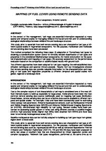
Fig.2: Vetapalem Mandal LU/LC findings
www.ijera.com
601 | P a g e
SS.Asadi, G.Rajani ,B.V.T.Vasantha Rao, S.K.Sekar/ International Journal of Engineering Research and Applications (IJERA) ISSN: 2248-9622 www.ijera.com
Vol. 1, Issue 3, pp.595-610
Fig 3: Village wise LU/LC findings of Vetapalem mandal.
www.ijera.com
602 | P a g e
SS.Asadi, G.Rajani ,B.V.T.Vasantha Rao, S.K.Sekar/ International Journal of Engineering Research and Applications (IJERA) ISSN: 2248-9622 www.ijera.com
Vol. 1, Issue 3, pp.595-610 8. Field work, Field data collection and GPS survey and GCPs The field sampling strategy is designed to describe the overall information of each village in vetapalem mandal. Collecting each independent house and utilities and other important features as a point and to identify doubtful areas occurred in preparing of LULC. Elements of the survey program includes: house point; utilities and other important features in villages. 9. Processing of VB.NET ( i ) Code For Verification: Private Sub SIGN_IN_Load(ByVal sender As System.Object, ByVal e As System.EventArgs) Handles MyBase.Load CON = New SqlConnection("Data Source=LOCALHOST;Initial Catalog=decision1;Integrated Security=True;Pooling=False") CON.Open() End Sub End Class Private Sub Button1_Click(ByVal sender As System.Object, ByVal e As System.EventArgs) Handles Button1.Click Dim q As String q = "select * from signin where username='" & UNAME.Text & "' and password='" & PWD.Text & "'" CMD = New SqlCommand(q, CON) DR = CMD.ExecuteReader() If (DR.Read) Then Dim c As New Form1 c.Show() Else MessageBox.Show("login failed") End If End Sub (ii) Code for Load Button: Private Sub DLOAD_Click(ByVal sender As System.Object, ByVal e As System.EventArgs) Handles DLOAD.Click If (selectvillage.SelectedIndex = -1) Then Dim s As String s = "select id from villageid" ' WHERE villageid ='" & selectvillage.SelectedItem.ToString() & "'" CMD = New SqlCommand(s, CON) CMD.ExecuteNonQuery() DR = CMD.ExecuteReader While (DR.Read()) VID.Items.Add(DR(0).ToString()) End While DR.Close() www.ijera.com
603 | P a g e
SS.Asadi, G.Rajani ,B.V.T.Vasantha Rao, S.K.Sekar/ International Journal of Engineering Research and Applications (IJERA) ISSN: 2248-9622 www.ijera.com
Vol. 1, Issue 3, pp.595-610 DDEL.Enabled = True Else Dim s As String s = "select id,villagename from villageid WHERE villagename ='" & selectvillage.SelectedItem.ToString() & "'" CMD = New SqlCommand(s, CON) CMD.ExecuteNonQuery() DR = CMD.ExecuteReader If (DR.Read()) Then VID.Text = DR(0).ToString() VN.Text = DR(1) End If DR.Close() s = "select * from demographic where id=" + VID.Text CMD = New SqlCommand(s, CON) DR = CMD.ExecuteReader If (DR.HasRows) Then If (DR.Read()) Then NHH.Text = DR(1) PM.Text = DR(2) PF.Text = DR(3) PT.Text = DR(4) PSC.Text = DR(5) PST.Text = DR(6) End If End If DR.Close() DDEL.Enabled = True DUP.Enabled = True End If (iii) Code For Image: Private Sub Button1_Click(ByVal sender As System.Object, ByVal e As System.EventArgs) Handles Button1.Click Dim q As String q = "insert into image values(@map,@img)" cmd = New SqlCommand(q, con) Dim p1 As New SqlParameter("@map", map.Text) Dim b() As Byte fs = New FileStream(img.Text, FileMode.Open) br = New BinaryReader(fs) b = br.ReadBytes(fs.Length) Dim p2 As New SqlParameter("@img", b) cmd.Parameters.Add(p1) cmd.Parameters.Add(p2) res = cmd.ExecuteNonQuery If (res > 0) Then www.ijera.com
604 | P a g e
SS.Asadi, G.Rajani ,B.V.T.Vasantha Rao, S.K.Sekar/ International Journal of Engineering Research and Applications (IJERA) ISSN: 2248-9622 www.ijera.com
Vol. 1, Issue 3, pp.595-610 MessageBox.Show("inserted") End If map.Clear() img.Clear() map.Focus() End Sub Private Sub Button2_Click(ByVal sender As System.Object, ByVal e As System.EventArgs) Handles Button2.Click Dim q As String q = "select * from image where mapname='" & map.Text & "'" cmd = New SqlCommand(q, con) dr = cmd.ExecuteReader() If (dr.Read()) Then fs = New FileStream("d:\temp.gif", FileMode.Create) bw = New BinaryWriter(fs) Dim b() As Byte b = dr(1) bw.Write(b) bw.Close() fs.Close() dr.Close() Dim f2 As New Form2 f2.str = "Transport" f2.str = "base map" f2.str = "PHYSIOGRAPHY MAP" f2.str = "DRAINAGE MAP" f2.str = "LANDUSE/LANDCOVER" f2.str = "village map" f2.str = "mandal MAP" f2.str = "geomorphology map" f2.Show() End If Fig 4: Toposheets and Satellite Imageries of the study area.
www.ijera.com
605 | P a g e
SS.Asadi, G.Rajani ,B.V.T.Vasantha Rao, S.K.Sekar/ International Journal of Engineering Research and Applications (IJERA) ISSN: 2248-9622 www.ijera.com
Vol. 1, Issue 3, pp.595-610
Fig 5: GPS Points of House and Utilities and Thematic maps of the study area
www.ijera.com
606 | P a g e
SS.Asadi, G.Rajani ,B.V.T.Vasantha Rao, S.K.Sekar/ International Journal of Engineering Research and Applications (IJERA) ISSN: 2248-9622 www.ijera.com
Vol. 1, Issue 3, pp.595-610 10. Development of VIS website: The main aim of the project on VIS is to develop web portal by incorporating all types of databases both spatial and non-spatial in GIS environment into a useful informatics tool for decentralized village level planning. A simple and robust tool, called VIS (Village Information System) will assist the decision makers to generate various socio-economic views /scenarios for identifying suitable villages to implement various developmental schemes. This web site Consists of all the information about the mandal at village level, the basic amenities like History of Village, Population details, Agriculture details, Socio economic data, Education details, Health & Safety, Employment details, Utilities, natural resources, developmental activities,(from Government and private), Transportation, Geological and Geographical conditions,
Village achievements, NRI’s information,
Mandal Head Quarter details, Historic places, Thematic information, and future plans etc..
10.1 Information from VIS includes: Areas under threat Population to be affected Densely populated villages Threat to Crops Damage to structures Rail and Road network in the affected areas Vulnerable points Cyclone shelters
The outputs of all the models analysed with the help of GIS database are linked for faster dissemination. By using this web site, the user can make the queries about the particular area by using the available query reporting module.
www.ijera.com
607 | P a g e
SS.Asadi, G.Rajani ,B.V.T.Vasantha Rao, S.K.Sekar/ International Journal of Engineering Research and Applications (IJERA) ISSN: 2248-9622 www.ijera.com
Vol. 1, Issue 3, pp.595-610 Fig 6: The model of VIS Web looks like the figure shows.
www.ijera.com
608 | P a g e
SS.Asadi, G.Rajani ,B.V.T.Vasantha Rao, S.K.Sekar/ International Journal of Engineering Research and Applications (IJERA) ISSN: 2248-9622 www.ijera.com
Vol. 1, Issue 3, pp.595-610 10. Conclusions Apart from loss of human lives, Natural Resources and Environmental Information like to ecology and economy of a region. Village Level Information System has made significant contribution in all the three phases, i.e. preparedness, prevention and relief of any natural resources With a constellation of IRS P6 LISS IV-MX (5.8) of satellite, To develop the areas like this, a flexible and user friendly information system was developed for one mandal (vetapalem) to assist planners for village level planning with reference to managing the resource of that mandal. The web designing and development is broad based suited to different users wherein the expert system approach provides all the information at a quick instance for the villages. The information can be used to assess the capability of the area for its shortcomings and hence to improve the productivity capacity and this will play an increasing role in the way future environmental proposals and decisions are made India has developed an operational mechanism for natural resources. Developments in space-based earth observation and weather watch capabilities in future may help refining existing models/approaches for prediction of such events and their management. 11. References 1. Lillesand M Thomas and Ralph w keiferi, Remote Sensing And Image Interpretation, John wiley and sons, Newyork, 2000. 2. Burrough PeterA and Rachael A Mc Donnell, Principles of GIS, Oxford University press, New York, 1998. 3. Geography, Rajivi Ahir, 3rd edition ,spectrum India, New Delhi,1999. 4. Hand book of getting started with map objects 2.2 5. Jensen john. R, remote sensing of the environment, a earth resources persceptive, Low price edition, keith c.clarke,serieseditor,pearson education. 6. Mather. M Paul, Computer Processing of Remotesensing images, an introduction Second edition, JOHN WILEY &SONS, newyork,1998. 7. Mishra H.C,”Introduction To Satellite Remote Sensing”, GIS India,1998. 8. Mishra H.C ,”GIS hand book”,GIS India;1998. 9. Nathanson Jerry. A, “Basic Environmental Technology” prentice hall of India; 2003 10. Panchayat level resource mapping by NRSA. 11. Principles and practice of highway engineering by Dr. kadiyali L.L
www.ijera.com
609 | P a g e