Western Water Assessment Building Climate Resilience by Design
2 015 - 2016 A N N UA L R E P O R T
2015-‐2016 Annual Report
Table of Contents Introduction ........................................................................................................................... 2 WWA Staff ....................................................................................................................................... 2 Research Team ................................................................................................................................ 3 New Areas of Focus ......................................................................................................................... 4 New Climate Services ....................................................................................................................... 4
Contributions to NIDIS Drought Early Warning Systems .......................................................... 5 WWA Evaluation and Impact .................................................................................................. 6 WWA 2015-‐2016 Program Highlights ...................................................................................... 7 Major Research Findings and Publications ....................................................................................... 7 External Products Resulting from WWA Work .................................................................................. 9 Selected Outreach Activities .......................................................................................................... 10 WWA 2015-‐2016 Project Reports .......................................................................................... 12 APPENDIX A: List of 2015-‐2016 WWA Publications ................................................................ 19 APPENDIX B: WWA Appearances in Media ........................................................................... 21 Principal Investigator Lisa Dilling, University of Colorado-‐Boulder
Co-‐Investigators Joseph Barsugli, University of Colorado-‐Boulder Elizabeth McNie, University of Colorado-‐Boulder Noah Molotch, University of Colorado-‐Boulder William Travis, University of Colorado-‐Boulder
Performance period covered in this report: June 1, 2015–May 30, 2016.
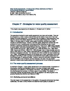
Cover photograph: Dead Horse State Park, Utah. Photo by John Berggren, Western Water Assessment
1
2015-‐2016 Annual Report
Introduction The mission of Western Water Assessment (WWA) is to conduct innovative research in partnership with decision makers in the Rocky Mountain West, helping them make the best use of science to manage for climate impacts. Using multidisciplinary teams of experts in climate, hydrology, ecology, law, and policy, WWA works with decision makers across our region to produce policy-‐relevant information about climate variability and change. By building relationships with and networks of decision makers, our team is able to develop practical research programs and useful information products. In 2015, WWA was renewed for another 5-‐year grant from the NOAA Climate Program Office and will focus its work on three overarching themes for the next several years. 1. Climate Vulnerability and Adaptive Capacity in the WWA Region 2. Extremes and Climate Risk Management 3. Designing Organizations and Networks for Usable Science WWA is formally part of the Cooperative Institute for Research in Environmental Sciences (CIRES) at the University of Colorado -‐ Boulder, and our researchers and partners come from universities and federal institutions across Colorado, Wyoming and Utah.
WWA Staff and Research Team WWA is comprised of a core staff of five (Table 1) who focus on program management, research development and synthesis, and coordination of stakeholder interactions. During this past year, WWA’s Program Manager and Utah Research Integration Specialist left for new jobs, and Ursula Rick, PhD and Seth Arens were hired to replace them. In addition to the core staff shown below, WWA’s graphic design/outreach specialist (Ami Nacu-‐Schmidt) is shared with the Center for Science and Technology Policy Research (CSTPR) at CU-‐Boulder in order to increase efficiency and leverage resources. Table 1. WWA Core Staff Staff
Title
Email Address
Expertise
Lisa Dilling
Director
[email protected]
Climate information, decision making
Ursula Rick
Program Manager
[email protected]
Science policy, glacial hydrology
Elizabeth McNie
Research Scientist
[email protected]
Science policy, program evaluation
Jeff Lukas
Research Integration Specialist, Colorado and Wyoming
[email protected]
Climate variability and climate change, paleoclimatology
Seth Arens
Research Integration Specialist, Utah
[email protected]
Eco-‐hydrology, air quality
WWA’s research team includes physical scientists and social scientists at the University of Colorado, NOAA and the National Center for Atmospheric Research (NCAR). A list of team members is provided in Table 2.
2
2015-‐2016 Annual Report
Table 2. Western Water Assessment Research Team Team Member
Title
Expertise
Averyt, Kristen
Associate Director for Science, CIRES, Univ. of Colorado
Climatology, energy-‐water, assessment processes
Lead Researcher, Western Water Assessment
Climate dynamics
Barsugli, Joseph
Research Scientist, CIRES, Univ. of Colorado Berggren, John
Graduate Research Assistant, Univ. of Colorado
Climate adaptation, water policy
Clifford, Katie
Graduate Research Assistant, Univ. of Colorado
Conservation decision making
Deems, Jeff
Research Scientist, CIRES, Univ. of Colorado
Climate and snow modeling
Jennings, Keith
Graduate Research Assistant, Univ. of Colorado
Snowpack remote sensing
Kaspryzk, Joseph
Assistant Professor, Civil Engineering, Univ. of Colorado
Multi-‐objective analysis for water management
Kenney, Douglas
Director, Western Water Policy Program, Univ. of Colorado School of Law
Western water policy and law
Klein, Roberta
Managing Director, Center for Science and Technology Policy Research, Univ. of Colorado
Environmental policy
Livneh, Ben
Assistant Professor, Civil Engineering, Univ. of Colorado
Hydrologic modeling
Mahoney, Kelly
Research Scientist, NOAA ESRL Physical Sciences Division
Hydrometeorology, extreme precipitation
McCurdy, Adam
Graduate Research Assistant, Univ. of Colorado
Climate risk assessment
Molotch, Noah
Lead Researcher, Western Water Assessment
Snow hydrology
Assistant Professor, Dept. of Geography, Univ. of Colorado Morss, Rebecca
Scientist III, National Center for Atmospheric Research
Socioeconomic and policy impacts of weather
Rangwala, Imtiaz
Research Scientist, CIRES, Univ. of Colorado and NOAA ESRL
Regional climate change, high elevation climate
Rajagopalan, Balaji
Professor, Civil Engineering, Univ. of Colorado
Water resources engineering
Ray, Andrea
Scientist, NOAA ESRL Physical Sciences Division
Climate-‐society interactions, water management
Schneider, Dominik
Graduate Research Assistant, Univ. of Colorado
Snow hydrology
Smith, Rebecca
Graduate Research Assistant, Univ. of Colorado
Multi-‐objective analysis for water management
Travis, William
Lead Researcher, Western Water Assessment
Natural hazards, climate impacts and adaptation
Associate Professor, Geography, Univ. of Colorado Wessman, Carol
Professor, Ecology and Evolutionary Biology, Univ. of Colorado
Landscape ecology, remote sensing
Wilhelmi, Olga
Project Scientist III, National Center for Atmospheric Research
Vulnerability and adaptation to weather and climate
Wolter, Klaus
Research Scientist, CIRES, Univ. of Colorado and NOAA ESRL
Climatology and meteorology
3
2015-‐2016 Annual Report
New Areas of Focus With the renewal of WWA, this year has been one of transition and transformation. Three new research themes (listed above and in Table 3) were added to our portfolio, and we began a major effort on decision tools for ranchers, which will strengthen our partnership with the USDA Northern Plains Regional Climate Hub (NPRCH) and lead to connections with new stakeholders. We are also working with the Wind River Indian Reservation and the National Drought Mitigation Center (NDMC) to evaluate their drought research. Finally, we are pursuing new partnerships with others in the RISA Network. Table 3. New partnerships and areas of focus developed in 2015-‐2016. New Area of Focus Designing Organizations for Usable Science Climate Vulnerability & Adaptive Capacity Extremes & Climate Risk Management New Partnership Wind River Reservation and National Drought Mitigation Center Alison Meadow (new cross-‐RISA partnership)
Relevant Projects (see pp. 12-‐17) • Metrics and Evaluation of WWA • Usability of Remotely Sensed Spatial Snowpack Data • Extreme Event Roster and Maps Relevant Projects (see pp. 12-‐17) • Evaluation of Drought Planning Research on the Wind River Reservation • Mapping Climate Services
New Climate Services Rocky Mountain-‐Great Plains Dashboard: In 2015, WWA implemented a prototype based on the Intermountain West Climate Dashboard tool for climate and drought monitoring that covers a broader 8-‐state region. This larger region coincides with the domains of the DOI North Central Climate Science Center (NC CSC) and the USDA NPRCH. These two entities spurred the creation of the Rocky Mountain-‐ High Plains Dashboard, which has additional content focusing on drought risk for agricultural producers and land managers. Analysis of website usage for the new dashboard over the past year indicates that users from all eight states are accessing it, but usage is dominated by Colorado, mainly in Fort Collins (home of the NC CSC, NPRCH, Colorado State University, and US Forest Service offices), Denver (State agencies) and Lakewood (USDA and DOI agency regional offices). Feedback from individual users indicates that value is being added by the new dashboard so the prototype will be supported for the longer term. Evaporative Demand Drought Index (EDDI): A new tool for drought early warning was developed by Imtiaz Rangwala, Candida Dewes and Joe Barsugli of WWA, along with partners at and NOAA PSD, National Integrated Drought Information System (NIDIS), NC CSC, Desert Research Institute, and the Western Regional Climate Center. EDDI can serve as an indicator of both rapidly evolving “flash” droughts (developing over a few weeks) and sustained droughts (developing over months but lasting up to years). Along with Jeff Lukas, the team created various products catering to different regions and stakeholders. There are two EDDI products on the WWA Intermountain West and Rocky Mountain-‐High Plains Dashboards. We also provide continental US-‐wide EDDI maps to the NDMC to inform the U.S. Drought Monitor. Finally, we have introduced EDDI to stakeholders at the Wind River Indian Reservation for their Drought Planning Project through workshops and a webinar. Stakeholder discussion at these workshops suggested that EDDI has been effective in capturing the rapidly changing conditions on the ground in 2015, which the U.S. Drought Monitor was not able to capture. In future, we are developing guidelines in the use of EDDI maps (and other datasets) for assessing current conditions and early warning, as requested by our partners at the USDA NPRCH.
4
2015-‐2016 Annual Report
Water Supply and Demand for Water Conservancy Districts: WWA’s Seth Arens is working with two organizations in Utah to provide climate information. The Jordan Valley Water Conservancy District is using downscaled global climate model data from the Multivariate Adaptive Constructed Analogs (MACA) data set to understand how future changes in climate will impact outdoor water demand. Projections of future climate from the MACA dataset are being used to project future potential evapotranspiration. The Weber Basin Water Conservancy District is working to incorporate information on paleo-‐drought provided by tree-‐ring records of Weber River stream flow into long-‐term planning. Weber Basin Water Conservancy District was first introduced to a 476-‐year record of Weber River stream flow in 2014. However, the information provided by the 476-‐year record of Weber River stream flow is not compatible with Weber Basin’s long-‐term planning structure; WWA is developing new ways to incorporate the record of paleo-‐drought into Weber Basin’s long-‐term planning.
WWA Contributions to NIDIS Drought Early Warning Systems During this reporting period, a major contribution to the National Integrated Drought Information System’s (NIDIS) Drought Early Warning Systems (DEWS) was a series of workshops intended to increase stakeholder awareness and knowledge of new approaches for snowpack monitoring, and the potential for integrating those approaches into streamflow forecasting. In August and September 2015, WWA conducted three one-‐day user workshops in each of the three WWA states (described under Select Outreach Activities). The post-‐workshop evaluations indicate that participants consistently reported gains in knowledge of snow hydrology and monitoring, and improved awareness of existing and emerging products. We have summarized the workshop content and findings in a report to NIDIS and our other partners. The report contains specific recommendations to NIDIS to enhance the snow-‐ monitoring elements of the DEWS in our region. WWA is also helping NIDIS to implement the recommendations from Elizabeth McNie’s evaluation of the Upper Colorado River Basin UCRB DEWS. In 2014, WWA completed an evaluation of the UCRB DEWS, which is part of NIDIS but is operated out of the Colorado Climate Center at Colorado State University. The UCRB DEWS is based around regular webinars and a website that communicate drought conditions to water managers, agricultural producers, and other decision-‐makers. WWA’s evaluation assessed whether the UCRB DEWS is meeting NIDIS’ goals for the DEWS and improving drought preparedness in the Upper Colorado River Basin. The evaluation report describes several areas where the UCRB DEWS is succeeding and recommends steps that could be taken to improve its effectiveness. WWA’s evaluation is currently being used to inform NIDIS strategic planning for the DEWS 2.0, and WWA’s McNie presented the evaluation to NIDIS and Colorado Climate Center staff. McNie has begun drafting a strategic plan for the Upper Colorado DEWS and will continue work in 2016 with NIDIS on this effort.
5
2015-‐2016 Annual Report
WWA Program Evaluation and Impact WWA is using a novel approach for conducting formative and summative evaluations by combining what it is calling the Meadow-‐Wall framework (Meadow and Wall, under review) and the WWA framework and metrics. The Meadow-‐Wall framework was designed specifically to evaluate projects that have been co-‐produced. It examines both internal and external contexts of the project, the process of co-‐ production and finally, the outputs, outcomes and impacts typical with more traditional evaluation frameworks. While not all WWA projects are co-‐produced, the framework nevertheless provides an effect approach to evaluating all WWA projects. During the first year of using the framework we will make necessary adjustments to it and conduct a cross-‐case comparison with others using the same framework in order to improve upon its utility. Much of WWA’s work, however, consists not of discrete projects, but of ongoing activities, relationship building, and maintenance, education and outreach. This work will be evaluated using the WWA framework and metrics. While focused on outputs and outcomes, this framework is also well-‐suited for evaluating building and maintaining social capital, the quality of stakeholder and researcher relationships, network participation, etc. One of the more difficult WWA functions to evaluate is what we call the WWA gestalt, what we do that represents the heart of RISA-‐like work yet is often impossible to quantify or effectively characterize using standard metrics. Our goal for the upcoming year is to experiment with different methodologies to identify ways to better capture the essence of WWA work with stakeholders and other researchers that cannot be captured through the two frameworks we have previously identified. Formative evaluations using the Meadow-‐ Wall and WWA framework and metrics will be conducted annually to be concluded in May while a programmatic evaluation is scheduled to begin at the end of 2017 to be concluded in spring of 2018. WWA has had a broad impact across Colorado, Wyoming and Utah through efforts such as workshops, webinars, training, decision tools and our climate dashboard. We convened snowpack workshops in each of our states, which drew over 180 attendees. We held a panel and webinar on the expected impacts from El Niño in our region which was attended by well over 100 people and drew local media coverage. Our researchers continue to interpret ongoing weather events and climate conditions for our stakeholders through our website and many individual requests. The City of Boulder requested our involvement with its climate training workshops for city staff, at which our team provided targeted technical assistance. Our Utah staff contributed to the Utah National Forests Vulnerability Assessment aimed at helping natural resource managers. Finally, we were asked to convene a special session at the Natural Hazards Workshop, a gathering of leading hazards and extremes researchers and practitioners in Colorado. These are just a small sampling of the work WWA has done this year to positively impact our stakeholders, and we are continually seeking new partnerships and projects as we begin our 5-‐year rebid. Over the past year, WWA has reoriented and strategized to successfully complete our goals for the next five-‐year rebid. We re-‐oriented our research portfolio around three new themes: Vulnerability and Adaptive Capacity, Extremes and Climate Risk Management, and Designing Organizations and Networks for Usable Science, with the goal of creating processes that can inform other entities that seek to engage in the delivery of climate services. Late in 2015, we hired two new people, a Program Manager and a Utah Research Integration Specialist, which represents a 40% turnover in our core staff. Our researchers leveraged the rebid funding to get several grants and fellowships, including from NASA, NOAA SARP and the University of Colorado – Boulder Vice Chancellor’s Office. This year, we have focused on setting ourselves up for success during the remaining years of this rebid project.
6
2015-‐2016 Annual Report
WWA 2015-‐2016 Program Highlights Major Research Findings and Publications Research Design and Implementation: Beyond “Basic” vs. “Applied” WWA’s Elizabeth McNie published a paper entitled “Improving the public value of science: A typology to inform discussion, design and implementation of research” with former RISA Program Manager Adam Parris and Dan Sarewitz (Arizona State University). In this paper, they describe a more complete view of research activities and expectations, and introduce a multi-‐dimensional typology of research activities. Attributes of research efforts can be evaluated on a spectrum from science-‐centric to user-‐oriented, and they include such concepts as disciplinary focus, knowledge exchange, social capital, flexibility and boundary management. Using the typology can inform science-‐policy planning and decisions, and WWA team members have begun the process of testing the typology by evaluating their research projects. • McNie, E.C., A. Parris and D. Sarewitz (2016) Improving the public value of science: A typology to inform discussion, design and implementation of research. Research Policy, 45(4) pp. 884-‐895, May 2016. Use of National Weather Service River Basin Forecast Center Forecasts and Information The National Weather Service (NOAA/NWS) operates a network of thirteen River Forecast Centers with the intended purpose of providing water management entities, emergency managers, and others with forecasts of streamflow and volumetric water supply. These predictions are designed to provide actionable information that will improve a host of decisions relating to issues such as reservoir management, drought restrictions, and flood preparations. However, potential users of forecasts do not always rely on available forecast information in decision making, and barriers can include political pressure, legal and policy constraints, issues with infrastructure, and natural and managed water supply, as well as a lack of scientific background or awareness of forecast availability. In an attempt to further understand this disconnect, WWA’s Bobbie Klein and Lisa Dilling developed a study, with input from the Colorado Basin River Forecast Center (CBRFC), to investigate characteristics of the users or potential users of CBRFC forecasts and their decision making contexts. The results show that the CBRFC forecasts are heavily relied up by a wide range of water managers, and they are the most cited mechanism among the stakeholders in this study for reducing the impacts from present and future weather and climate-‐ related events such as drought, floods, wildfire, unusually high temperatures and unusual changes in snowmelt timing. Future changes in climate will cause managers to seek even more information in addition to using the forecasts provided by CBRFC and other entities. They are most concerned in future about streamflow impacts from bark beetle infestations and dust-‐on-‐snow events, which may cause them to “use up” the adaptive capacity they will need for changes in future climate. • Klein, R. and L. Dilling (2015) The Colorado Basin River Forecast Center and the Decision Making Process. Western Water Assessment White Paper, October 2015.
7
2015-‐2016 Annual Report
Use of SNOTEL Data in Climate Impact Models Imtiaz Rangwala and Tim Bardsley, along with two others released a WWA Climate Research Briefing entitled “SNOTEL Sensor Upgrade Has Caused Temperature Record Inhomogeneities for the Intermountain West: Implications for Climate Change Impact Assessments.” The motivation for this study was to examine the large step shift in the observed temperature record at the USDA Natural Resources Conservation Service’s (NRCS) SNOw TELemetry (SNOTEL) stations in Colorado, Utah and Wyoming. This issue impacts the entire SNOTEL network across the 11 Western states, as demonstrated by Jared Oyler of the University of Montana and his colleagues. The climate research briefing builds on that work by performing finer-‐grained analyses and identifying the implications for climate studies that have incorporated SNOTEL temperature data. SNOTEL data are generally not used by climate scientists for analyses of temperature trends found in regional, national and international assessment reports such as the National Climate Assessment and the IPCC reports, but they are assimilated in the high-‐ resolution gridded products such as PRISM and DAYMET that are widely used by the climate impacts community to run their impact models. In releasing this briefing, the group aims to promote a broader awareness of this issue among the climate impacts assessment community. • Rangwala, I., Bardsley, T., Pescinski, M., and J. Miller (2015). SNOTEL sensor upgrade has caused temperature record inhomogeneities for the Intermountain West: Implications for climate change impact assessments. Western Water Assessment Climate Research Briefing.
Southwest Colorado Impacts and Adaptation A multi-‐year (2013-‐16) study of land managers’ perceptions and responses to climate variability and change in Colorado’s Gunnison Basin was led by WWA graduate student Katherine Clifford. Twenty-‐ eight detailed interviews assessed perceptions of climate and climate change among four stakeholder groups: ranchers, recreationalists, public land managers, and field scientists. Stakeholders have a keen sense of the area’s large spatial and temporal variability and perceived that climate was becoming more erratic and unpredictable, rather than changing in a linear fashion. Stakeholders interpret climate through landscape, social, and ecological benchmarks that are salient to their sector, each focusing on different indicators such as plant growth, stream temperatures, and elevational patterns, rather than traditional measures like average temperature or precipitation. Stakeholders also benchmarked their expectations of climate impacts against recent extreme periods. In the second phase, conducted under the NC CSC’s Southwest Colorado Social-‐Ecological Resilience Project, land managers were asked in interviews and focus groups to assess the effects of narrative climate scenarios on two ecosystems important to the basin: spruce-‐fir forests and sage shrublands. Land managers felt that the “Feast and Famine” scenario, conveying more variability and no general climate trend, presented the biggest adaptation challenge not just because of uncertainty and extreme events, but because futures without clear warming and drying trends would be harder for the public to recognize, thus undermining their adaptation efforts. Participants recognized that both target landscapes were undergoing change and they could not manage for current conditions, but Spruce fir was seen as already undergoing radical transformation with forest loss due to beetle infestations and fire regimes exacerbated by climate drivers. Sagebrush, in contrast, was described as more stable now but vulnerable to future climate changes, in particular drought, that would reduce ecological and economic values. Lack of information was not seen as the most critical barrier to implementing adaptation strategies, rather managers’ felt ill prepared to effectively engage the public in adapting to climate change.
8
2015-‐2016 Annual Report
Evaporative Demand Drought Index (EDDI) A new tool for drought early warning was developed by Imtiaz Rangwala, Candida Dewes and Joe Barsugli of WWA, along with partners at and NOAA PSD, NIDIS, North Central Climate Science Center, Desert Research Institute, and the Western Regional Climate Center. The Evaporative Demand Drought Index (EDDI) can serve as an indicator of both rapidly evolving “flash” droughts (developing over a few weeks) and sustained droughts (developing over months but lasting up to years). EDDI exploits the strong physical relationship between evaporative demand and actual loss of water from the land surface through evapotranspiration. Evaporative demand is the “thirst of the atmosphere,” estimated by the amount of water that would evaporate from the soil and be transpired by plants if the soil were well watered. A particular strength of EDDI is in capturing the precursor signals of water stress at weekly to monthly timescales, which makes EDDI a potent tool for drought preparedness at those timescales. Several updated EDDI data products can be found in the Drought Monitoring section of WWA’s Climate Dashboards. • Rangwala, I., M. Hobbins, J. Barsugli, and C. Dewes (2015). EDDI: A Powerful Tool For Early Drought Warning. WWA Briefing document, http://wwa.colorado.edu/publications/reports/EDDI_2-‐pager.pdf
External Products Resulting from WWA Work City of Boulder: Climate Initiatives The City of Boulder, Colorado, has embraced the challenges from climate change on two fronts: pursuing aggressive reductions of carbon emissions from within the City, and promoting adaptation and resilience to climate change impacts. Since the early 2000s, WWA has provided technical guidance to climate risk assessments for the City’s water utilities department; more recently, WWA has contributed to broader efforts cutting across the City’s departments and resources. The 2015 draft of “Boulder’s Climate Commitment” draws from multiple WWA technical inputs, including the 2014 Climate Change in Colorado report, to explain recent climate trends and future climate projections to Boulder’s citizens. In May 2016, WWA’s Jeff Lukas participated in a climate change training session for City of Boulder staff, summarizing key lessons from the 2014 report and related WWA research on climate adaptation planning. Colorado Water Conservation Board: Technical Input into the State Water Plan In December 2015, Colorado’s Water Plan was released—the first statewide plan for the management of Colorado’s water resources. The plan’s water supply analyses under future climate change relied heavily on a series of WWA engagements with the Colorado Water Conservation Board (CWCB), including the involvement since 2009 of WWA team members in CWCB’s Climate Change Technical Advisory Group, WWA’s technical input into the CWCB’s 2012 Colorado River Water Availability Study, and the 2014 Climate Change in Colorado report authored by Jeff Lukas and other WWA team members and co-‐ produced with CWCB. The Colorado Water Plan’s chapter on water supply reproduced a table on specific climate change vulnerabilities from that report, as well as a figure showing paleo-‐droughts in Colorado’s river basins.
9
2015-‐2016 Annual Report
Select Outreach Activities Snowpack Monitoring Workshops In August and September 2015, WWA’s Jeff Lukas, Elizabeth McNie, Tim Bardsley, Jeff Deems and Noah Molotch conducted three snow-‐monitoring workshops in Utah, Wyoming, and Colorado that introduced participants to spatial snow-‐monitoring products being developed by Deems and Molotch with their partners. The workshops helped participants better understand, access, and interpret operational snow-‐monitoring and runoff-‐ forecast products from the USDA Natural Resources Conservation Service and the NOAA River Forecast Centers. The workshops brought together a total of 180 participants, representing a core user community of local, state, tribal and federal water managers, along with other stakeholders, researchers, and operational information providers. Climate Change Roundtable with Secretary Moniz and Rep. Polis In August 2015, WWA’s Lisa Dilling, Jeff Lukas and Kristen Averyt briefed Secretary of Energy Ernest Moniz and Representative Jared Polis on WWA’s climate change assessment reports, as part of an roundtable hosted by Polis that showcased recent efforts in Colorado to understand and meet the challenges of climate change. Colleagues from the University of Colorado, Colorado State University, the National Renewable Energy Laboratory, and the US Forest Service also presented on their work in renewable energy and climate services. Manson Brown, Deputy Director of NOAA, and former Senator Tim Wirth were also in attendance.
10
2015-‐2016 Annual Report
Outreach to the DoI North Central Climate Science Center and USDA Northern Plains Climate Hub WWA participated in several activities for the members and stakeholders of the DOI North Central Climate Science Center (NC CSC) and the USDA Northern Plains Regional Climate Hub (NPRCH). In July, WWA’s Imtiaz Rangwala, Jeff Lukas, and Joe Barsugli presented a webinar for NC CSC staff and stakeholders on the anticipated impacts of the El Nino event for the CSC region for the coming fall, winter, and spring. They explained the basics of the El Nino phenomenon, summarized historical outcomes with previous El Nino events, and interpreted the official NOAA climate outlooks in the context of the El Nino. In October, WWA’s William Travis gave a webinar on quantitative risk and decision analysis applied to climate adaptation, which covered results from dryland agriculture and wastewater management on the Colorado Front Range, and discussed the ranching with drought project with the USDA NPRCH. El Nino Impacts in Colorado Panel In October 2015, as the 2015-‐2016 El Nino event was still building strength, WWA hosted a panel discussion with NOAA partners on the potential impacts of the El Nino event in Colorado and released a two-‐page El Niño briefing document. The archived webcast can be accessed here. WWA’s Jeff Lukas moderated the panel, which included WWA’s Klaus Wolter, Marty Hoerling of NOAA ESRL, and Nezette Rydell from the NOAA NWS Denver/Boulder Forecast Office. One hundred people watched the live webcast, and about 25 people attended in person, including members of the local and regional media. USDA-‐NOAA Agriculture Climate Tools Workshop In March 2016, Jeff Lukas participated in a joint USDA-‐NOAA Climate and Agriculture Tools Workshop in Casper, WY, convened by NOAA Central Region Climate Service, National Integrated Drought Information System and the High Plains RCC. Participants included the local National Weather Service Office; USDA NRCS, ARS, and USFS staff and researchers; state climatologists from Colorado, Kansas, and South Dakota; and tribal representatives from the Wind River Reservation. Lukas presented on the influence of the El Nino event in water year 2016 and the outlook for the coming spring and summer, and he demonstrated the WWA Climate Dashboards and the new EDDI (Evaporative Demand Drought Index) maps.
11
2015-‐2016 Annual Report
WWA 2015-‐2016 Project Reports Balancing Severe Decision Conflicts under Climate Extremes in Water Resource Management Primary Investigator(s): L. Dilling, J. Kasprzyk, L. Kaatz (Denver Water) Other Investigator(s): R. Smith, K. Averyt, I. Rangwala, L. Basdekas (Colorado Springs Utilities) Stakeholders: Denver Water, Colorado Springs Utilities, Northern Water Conservancy District, Aurora Water, City of Boulder Utilities, City of Fort Collins Utilities (collectively known as the Front Range Climate Change Group) Exploring the utility of multi-‐objective evolutionary algorithms (MOEAs) for improving the ability of water utilities to identify viable adaptation strategies under climate extremes. Over the past several years there have been increasing calls for decision support tools in the area of climate and acknowledgement that changing extremes add to an already challenging decision environment for water managers. Recurring droughts, flood events, and concerns over extreme events in the future have created a strong interest among water managers in the Front Range of Colorado in how to plan for these extremes. Traditional methods of identifying alternatives for water supply management may not fully capture the range of existing preferred alternatives, meaning that utilities may miss some of the solutions that appropriately balance among tradeoffs. In this project we have co-‐produced and are testing a newly developed multi-‐objective decision tool, balancing conflicting management objectives for water planning under climate extremes and determining how policy alternatives perform under severe climate uncertainty. In the past year, we have developed a complete model of the hypothetical Front Range water management context, developed and tested management/planning decision levers and encoded them in the model, and are performing preliminary optimizations runs. We are developing performance objectives for the model and have begun using CMIP3 and CMIP5 Bureau of Reclamation downscaled climate projections to develop climate scenarios to test the utility of the MOEA tool. Finally, we have continued community outreach to several utilities along the Front Range and are planning a second workshop. Deliverables: Initial workshop completed February 2015 with workshop report provided to participants April 2015. Additional workshop will be on June 30, 2016. There were 3 conference presentations and one publication so far (Smith et al. 2016). Leveraged Funding: $261,000 from NOAA SARP competitive grant (L. Dilling, PI) Regional Extremes Database and Event Maps Primary Investigator(s): W. Travis, J. Lukas, K. Wolter Other Investigators(s): A. McCurdy Stakeholders: Hazard mitigation planners, emergency managers, water resource managers Developing a database and visualizations of extreme events to assist hazard planners and emergency managers. Extreme events cause the majority of societal costs related to weather and climate and can provoke adaptive responses. WWA has begun a new focus that is designed to place extreme events in the context of historical climate variability and projected climate change, assess how risk varies over time and space, and examine how extreme events interact with place-‐based vulnerability. The first activity in this new research theme has been to build a database of historical extreme weather and climate events in the WWA three-‐state region (Colorado, Utah and Wyoming). This regional extremes database is intended to be useful to hazard planners and emergency managers trying to identify where and when the risk for different types of extreme events is greatest. It will also serve as a foundation for further research on what leads to the variation in risk over time and space. Two databases have been compiled: a selective roster of ~160 of the highest-‐impact weather and climate events in the three-‐state region back to the mid-‐1800s, and a more comprehensive dataset from culled from the NOAA NCEI Storm Events Database focused on the post-‐1950 period that includes over 20,000 weather events. The roster of high-‐impact events has been reviewed by all three of the state climate offices in our region, and as of spring 2016 is available on the WWA website. From the larger dataset of storm events, we generated a set of monthly occurrence maps, by county, for ten different event types, and these are also available on the WWA website. We are currently reaching out to stakeholders to solicit suggestions to refine these products and apply the data. Deliverables: Web-‐based searchable database of high-‐impact historical events; set of event maps for 10 different event types.
12
2015-‐2016 Annual Report
Informing the Integration of Climate Information into Water Supply Planning in Various Contexts in Utah Primary Investigator(s): S. Arens, T. Bardsley Other Investigators: J. Lukas Stakeholders: Utah Division of Water Resources, Weber Basin Water Conservancy District, Wasatch Area Dendroclimatology Research Group Partners: D. Rosenberg (Utah State University), S. McGettigan and A. Nay (Utah Division of Water Resources), J. DeRose (US Forest Service) Exploring climate change impacts and adaptation opportunities in various water management contexts in Utah. This project description encompasses a number of smaller efforts aimed at helping water managers in Utah understand the potential impacts of climate change to water resources and consider climate change impacts and adaptation when planning for the future. Building off of previous work with Salt Lake City Public Utilities, WWA began to work with other major water management groups in Utah. WWA engaged with the Weber Basin Water Conservancy District in partnership with Utah Division of Water Resources (UTDWR) on a project evaluating both the impacts of climate change on future water supply and paleohydrology scenarios for the reliability of water deliveries on the Weber Basin. Current work with Weber Basin focuses on incorporating information from a 500-‐year reconstruction and future projections of Weber River flow into water management and planning. Future work will include refining systems modeling analysis, in partnership with UTDWR, and developing realistic future scenarios for planning. Deliverables: Coordinated and facilitated a workshop (4/18/16) with water utilities from around the Wasatch Front to discuss the impact of drought, climate change and water conservation on water systems planning. The workshop was planned and carried out in collaboration with WADR and the Center for Water-‐Efficient Landscapes at Utah State University. Use of Potential Evapotranspiration to Predict Future Water Demand Primary Investigator: S. Arens Stakeholders: Jordan Valley Water Conservancy District (JVWCD) Partners: B. Forsythe, T. Schultz (JVWCD), C. Dewes Using downscaled projections of future potential evapotranspiration to predict future water demand This project will provide both projections of potential evapotranspiration (PET) and past trends in evapotranspiration (ET) and its components to help JVWCD understand how water demand may change in the future. The Multivariate Adaptive Constructive Analog (MACA) downscaled climate dataset will be used to calculate PET for three future time periods. An analysis of past trends in ET, evaporation and the physical drivers of both processes will be conducted. A key component of future water demand is also the length of the outdoor watering season; projections of future temperatures and the growing degree day index will be used to characterize future changes in the length of the outdoor watering season. This study aims to inform long-‐term planning for JVWCD by giving estimates of how much outdoor water demand may change due to changes in PET. Deliverables: A presentation will be given to the JVWCD Board of Directors in early July on preliminary results from the project. The final product of the study will include a written report and presentation to the appropriate JVWCD staff by the end of 2016. Usability of Remotely Sensed Snowpack Data for Streamflow Forecasting and Water System Management Primary Investigator(s): J. Lukas, N. Molotch, J. Deems Other Investigator(s): B. Livneh, M. Raleigh, J. Berggren, K. Jennings Stakeholders: National Integrated Drought Information System (NIDIS), Uncompahgre Basin water managers, Rio Grande Basin water managers, Colorado Basin River Forecast Center Using remotely sensed snowpack data to reduce negative impacts in water management A key indicator of water availability, and the primary input to streamflow models, is April 1 snow water equivalent (SWE) in watersheds. April 1 SWE has historically been calculated from a network of in-‐situ SNOTEL observing sites across the West, but two remote-‐sensing-‐based approaches have recently been developed to complement and extend the SNOTEL network. In the first approach, used by Molotch and group, MODIS satellite snow-‐cover measurements along with a regression from historic SNOTEL data are combined to reconstruct SWE. In the second, used by Deems and group, airborne LIDAR measurements of snow depth are used to estimate SWE. This project aims to understand the usability of these spatial SWE products by water managers, and their potential to improve runoff forecasts. We will interview water managers in the Uncompahgre and Rio Grande River Basins in summer 2016 to better understand their needs and concerns with respect to snow data and runoff forecasting. Focusing on recent stressful events as identified by the water managers, we will use the spatial SWE products and hydrologic models to simulate how the new SWE products could have provided better information to prepare for those events. PI Molotch and K. Jennings have prepared MODIS data for the two basins to be used in hydrologic models. PI Deems has prepared ASO data from the Uncompahgre Basin for use in the models. Investigator Raleigh will use the SNOW-‐17 model, which is currently used by the Colorado Basin River Forecast Center, while Livneh will use the DHSVM model to explore the impact of various snow regimes on streamflow. Deliverables: Report on the impact of snowpack data on the stressful events and decisions related to those events. Leveraged funding: $60,000, NASA Graduate Student Fellowship for K. Jennings
13
2015-‐2016 Annual Report
Snowpack monitoring workshops for streamflow forecasting and drought planning in the Rocky Mountain West Primary Investigator(s): J. Lukas, N. Molotch, J. Deems Other Investigator(s): T. Bardsley, E. McNie, D. Schneider, L. Lestak Stakeholders: National Integrated Drought Information System (NIDIS), Wyoming State Engineer’s Office, Natural Resources Conservation Service (NRCS) Snow Survey, various water managers across WWA region Partners: A. Marrs and C. McNutt (NIDIS), M. Hoobler (Wyoming State Engineer’s Office), M. Stokes and S. Bender (Colorado River Basin Forecast Center), B. Domonkos and R. Julander (NRCS Snow Survey) Workshops aimed at introducing stakeholders to newer techniques of snowpack monitoring. Real-‐time monitoring of the snowpack is essential to forecasting runoff amount and timing and preparing for both drought and flooding. New spatially-‐explicit snowpack monitoring data products based on remote sensing are being developed by WWA researchers and others. These products could usefully complement the NRCS SNOTEL network and facilitate new streamflow forecasting approaches, but it is not yet clear how best to deploy these products to enhance the overall utility from snowpack information. We developed and conducted three one-‐day user workshops in late summer 2015 in Colorado, Utah, and Wyoming. The workshops brought together a total of 180 participants, mainly representing a core user community of local, state, and federal water managers, along with other stakeholders, researchers, and operational information providers. We and our partners provided participants with a brief overview of snow hydrology informed by the latest science on snowpack processes, described the current status of snowpack monitoring capacity and products, and solicited feedback on how participants are using them. We then introduced the spatially-‐explicit snowpack monitoring products and solicited feedback on their present utility and potential future utility. The post-‐workshop evaluations indicate that participants consistently reported gains in knowledge of snow hydrology and monitoring, and improved awareness of existing and emerging products. We have summarized the workshop content and findings in a report to NIDIS and our other partners. The workshops have also helped Molotch and Deems refine and deploy their respective snowpack-‐ monitoring products, by informing them about user needs and capacities, and by connecting them with users and collaborators. Deliverables: Full-‐day workshops, in West Jordan, UT (August 11, 2015), Lander, WY (August 26, 2015), and Broomfield, CO (September 9, 2015); workshop report (review draft completed). Mapping Climate Services Primary Investigator(s): E. McNie, A. Meadow (CLIMAS, University of Arizona) Stakeholders: NOAA Western Regional Collboration Team Toward closing the gap between climate service providers and users. Adapting to climate change requires decision makers to have information in hand that is relevant to solve their problems, information that is salient, credible and legitimate. Decision makers, however, do not often have the information they need; perhaps they are unaware of existing useful information, get too much of the wrong kind of information, or have information needs that go unmet, leaving them to muddle through important decisions that could help people adapt to climate variability and change. Hundreds of organizations have been created or evolved to help create, translate and disseminate potentially useful climate information. Such “climate service organizations” exist in both public and private domains, at research universities and private organizations, and represent a wide variety of sectors. Unfortunately, potential users of climate information often do not know where to look for relevant information, nor are producers of climate information well-‐connected to potential users, resulting in a gap that separates the supply and demand of climate information. This project represents a first attempt to reduce this gap by creating a comprehensive database of climate service providers in the western United States. Organizations were assigned attributes based on the sector in which they work, the types of information they provide, the service area covered, the type of sponsoring organization, and many others. The finished product is a searchable database that is open and usable by the public. Deliverables: Searchable database, report, peer-‐reviewed publication (in progress) Evaluation of Drought Planning Research on the Wind River Reservation Primary Investigator(s): E. McNie Stakeholders: S. McNeeley (North Central Climate Science Center), C. Knutson (National Drought Mitigation Center), Wind River Reservation Providing support for tribal drought planning efforts on the Wind River Reservation. In collaboration with the Eastern Shoshone and Northern Arapahoe tribes, WWA partners at the DoI NC CSC and the NDMC are developing a comprehensive drought plan for the Wind River Indian Reservation in Wyoming. The research team is developing analytical tools and provides analysis to inform the drought plan. WWA investigator McNie’s role is providing evaluation support and helping to inform the research design. She will use a typology of research approaches to guide the design and analysis of research goals, objectives and processes in order to ensure that the project meets its goals of producing useful drought information to inform future policy decisions. Deliverables: Typology survey results, evaluation of drought planning research
14
2015-‐2016 Annual Report
Climate Change Vulnerability Assessment for the Uinta-‐Wasatch-‐Cache and Ashley National Forests Primary Investigator(s): J. Rice (Janine Rice Consulting), T. Bardsley, L. Joyce (USFS Rocky Mountain Research Station) Stakeholders: Uintah-‐Wasatch-‐Cache National Forest, Ashley National Forest Partners: P. Gomben (Uintah-‐Wasatch-‐Cache National Forest), D. Bambrough (Ashley National Forest) Developing vulnerability assessments for National Forests in Utah. The Uinta-‐Wasatch-‐Cache and Ashley National Forests in Utah are faced with the challenge of incorporating climate change into their land management planning. To meet this challenge, the US Forest Service has commissioned the vulnerability assessments about how climate change may affect resources. These vulnerability assessments provide information to help guide climate adaptation planning and are a key element of the US Forest Service’s Climate Change Scorecard. The assessments were developed by former WWA postdoctoral researcher J. Rice along with T. Bardsley and L. Joyce (USFS RMRS and USDA NPRCH), providing information to help land managers integrate climate change information into their planning, identifying information gaps, and setting a foundation for future assessments. First, a series of vulnerability workshops were held in 2014 and 2015 to introduce climate change science and impacts information to forest staff and seek input from the forests. Two complementary vulnerability assessments were drafted, and reviewed by Forest Service and outside experts: a Watershed Vulnerability Assessment, and an Aspen Ecosystem Vulnerability Assessment. Publication of both assessments as Forest Service General Technical Reports is expected later in 2016. Deliverables: Vulnerability workshops, two USFS General Technical Reports on climate change vulnerability (expected late 2016) Leveraged Funding: $6,500 from US Forest Service to T. Bardsley Building Climate Science into Land and Water Conservation Planning and Decisionmaking in the American Southwest Primary Investigator(s): W. Travis, I. Rangwala, J. Barsugli, G. Garfin and J. Brugger (CLIMAS), E. Gordon Stakeholders: The Nature Conservancy, agencies participating in conservation and climate adaptation efforts in southwestern Colorado Partners: The Nature Conservancy, DOI/USGS North Central Climate Science Center (NC CSC), CLIMAS RISA, Mountain Studies Institute, National Center for Atmospheric Research (NCAR), Colorado Natural Heritage Program, Univ. of Montana Continuing efforts to integrate climate science into conservation and adaptation efforts The project, formally completed last year with results and deliverables covered in the previous annual report, ended in a no-‐cost extension period of effort through June, 2016. However, our climate science outreach effort, with the project partners and others as described in earlier reports, has continued through early 2016. WWA’s Imtiaz Rangwala continues to make major contributions to the Conservancy’s key climate change projects and planning efforts, i.e., the Gunnison Wetland and Riparian Restoration and Resilience-‐Building Project, and the Southwest Colorado Social-‐Ecological Climate Resilience (SECR) Project, and our internal statewide strategic plan. He developed three climate scenarios for climate adaptation planning that were used to develop ecological response models and narrative scenarios for use in social science focus groups in SW Colorado. As a key member/PI on the Southwest SECR Project – he continues to provide climate science to planners, agency land managers and partners on conference calls, webinars and in-‐person climate adaptation strategy workshops on sagebrush and spruce-‐fir landscapes in the Upper Gunnison Basin. He also assisted with recent workshops held in November 2015 and February 2016 in Gunnison. He also has provided extensive climate expertise for our wetland/riparian site selection analysis for the restoration-‐resilience-‐building project. Deliverables: Evaluation conducted by collaborators at CLIMAS published in the March 2016 issue of the BAMS, workshops
15
2015-‐2016 Annual Report
Evaporation, Drought, and the Water Cycle Across Timescales: Climate Foundational Sciences for the North Central Climate Science Center Primary Investigator(s): I. Rangwala, J. Barsugli, B. Livneh, M. Hobbins (NIDIS) Other Investigator(s): J. Lukas, A. Ray Stakeholders: The Nature Conservancy, US Forest Service, other conservation agencies Partners: J. Morisette, D. Ojima, and S. McNeeley (NCCSC); R. Rondeau, CO Natural Heritage Program; J. Rice (Southern Rockies LCC); L. Joyce (USFS Rocky Mountain Research Station); D. Llewellyn (Bureau of Reclamation); M. Friggens (US Forest Service) Providing climate science support for the DOI North Central Climate Science Center, particularly for water cycle issues. The goals of this project are twofold: First, we aim to co-‐produce relevant climate information and integrate that into the socio-‐ecological decision making context. This includes helping with the development of future climate scenarios for specific projects, application of existing and emerging climate products and tools, interpretation of emerging and relevant physical science research, and continuous engagement with stakeholders and boundary organizations in exploring appropriate tools and datasets. Second, we are conducting primary research into drivers of hydro-‐climatic trends and extremes in the North Central Great Plains and Intermountain West Regions (Missouri River Basin and Upper Colorado River Basin) across multiple timescales. These include understanding drivers of droughts and developing better indicators for short and long term drought. We organized a 2-‐day workshop, September 24-‐25, 2015 on the application of high-‐resolution climate models (HRCMs) for socio-‐ecological adaptation in the NC CSC regions at the NOAA Earth Systems Research Laboratory in Boulder. The motivation was to explore recent advances in HRCMs and discuss how can they better inform ecological impacts modeling and adaptation projects in the US Northern Great Plains and Mountains. The workshop, attended by climate modelers and expert users of climate information for socio-‐ ecological impacts assessment, was structured around three major themes: (a) convective precipitation, (b) land-‐surface feedbacks, and (c) usability of HRCM output. Deliverables: Workshop, briefing report in AGU EOS: https://ciresevents.colorado.edu/hrcm/. Leveraged Funding: $450,777 from the NCCSC. Climate Adaptation Guidance for Salt Lake City Public Utilities Primary Investigator(s): T. Bardsley, S. Burian (Univ. of Utah), C. Strong (Univ. of Utah) Stakeholder: Salt Lake City Department of Public Utilities Partners: A. Wood (NCAR); L. Briefer, J. Niermeyer, and T. Kirkham (SLCPUD); M. Hobbins (NOAA ESRL PSD); E. Goharian (University of Utah); J. Lhotak (NOAA CBRFC) Continued work with the Salt Lake City Department of Public Utilities (SLCPUD) to help them assess and adapt to the challenges that climate change presents to their water supply system. This project, with SLCDPU senior staff, is aimed at understanding the potential impacts of climate change to their water supply system and to explore adaptation options to help the utility maintain a reliable system under a variety of potential future conditions. Since the inception of this effort, WWA has established a collaborative team including experts from the University of Utah, the Colorado Basin River Forecast Center, NOAA and the National Center for Atmospheric Research. Regular meetings with SLCDPU helped focus research efforts to best address their challenges and information needs. Since publication of an article in Earth Interactions in 2013, T. Bardsley has presented at several conferences as well as to boards of local water districts, and the project has raised awareness and interest in understanding the impacts of climate change to water resources and acted as a catalyst for discussions of adaptation planning among a variety of water managers in northern Utah (see “Informing the Integration of Climate Information into Water Supply Planning in Various Contexts in Utah” project description above.) Future work with SLCPU will focus on incorporating climate change scenarios into long-‐term planning efforts. SLCPU has asked for guidance on how to develop resilient and adaptive planning strategies; WWA staff will begin to help SLCPU by conducting a review of strategies that other water utilities have employed to incorporate climate change into long-‐term planning. Deliverables: Journal of Water Resources Planning and Management peer reviewed paper, in press; multiple stakeholder presentations; information directly transferred to SLCPUD Leveraged Funding: In-‐kind staff efforts from NOAA Colorado Basin River Forecast Center, University of Utah, National Center for Atmospheric Research, and NOAA Earth Systems Research Laboratory Physical Sciences Division
16
2015-‐2016 Annual Report
Decision Analysis for Climate Adaptation Primary Investigator(s): W. Travis Other Investigator(s): A. McCurdy Development of simulation models and decision tools for drought and hydro-‐climatic uncertainty in climate adaptation The adaptation decision analysis project seeks to analyze decision processes in climate-‐sensitive sectors and to build decision models that act as both research tools and decision aids. In this year we focused on two sectors: dryland agriculture and ranching. The goal is to provide decision aids to those sectors while also conducting research to better understand the processes underlying people’s adaptation decisions. Underlying this work is a basic question: When is it time to change strategies and practices in a changing climate? We developed and submitted for publication the “Crop Switch” model (available on the WWA website) that assesses the benefits of changing crops in the Northern Great Plains as the climate warms and winter wheat becomes less susceptible to winter kill. This includes calculation of the role of crop insurance in making the switch. A new effort is underway to model rancher adaptation to drought in collaboration with the USDA NPRCH and the DoI NC CSC. The prototype “Ranch Drought” model is built on an Extension Service ranch decision tool coupled with an Agricultural Research Service drought calculator, and a module that calculates range insurance payouts according to the USDA Risk Management Agency’s new forage, range and pasture index insurance program. The model was demonstrated to the collaborating institutions at a November, 2015 retreat and in a December, 2015 webinar with the RMA, organized by Doug Kluck to bring together climate science and agricultural insurance. Deliverables: Paper in revise-‐and-‐resubmit: W.R. Travis and A. McCurdy: “Decision Analysis Applied to Climate Adaptation: A Simulation Approach to Crop Switching in a Changing Climate.”; Prototype Ranch Drought Model to be tested by regional range stakeholders. Climate Dashboards Primary Investigator(s): J. Lukas, T. Bardsley, K. Wolter, A. Nacu-‐Schmidt Partners: DOI North Central Climate Science Center, USDA Northern Plains Regional Climate Hub Stakeholders: Water resources managers; anyone needing to monitor evolving weather, climate, and hydrologic conditions Enhancements to the widely used climate information web resource and production of monthly text briefings. The Intermountain West Climate Dashboard, which debuted in October 2012, is a web resource with a grid of 30 weather, climate and water information graphics that are automatically updated on the Dashboard as their providers update them. Feedback from WWA stakeholders has indicated that this Dashboard is a very useful ‘one-‐stop shop’ for up-‐to-‐date climate and water information for WWA’s three-‐state region. The creation of similar dashboards by other climate-‐service entities (e.g., Great Basin Climate Dashboard by WRCC and DRI/CNAP) is further confirmation of the effectiveness of this format. During the past year, we built on this success by implementing a second, similar, dashboard covering the combined eight-‐state region of WWA, the DoI NC CSC and the USDA NPRCH, in collaboration with those two entities. This Rocky Mountains and High Plains Climate Dashboard is also proving to be useful to stakeholders of the NC CSC and the NPRCH. We also added new drought-‐monitoring graphics to the Dashboards: a seasonal cumulative actual evapotranspiration (ETa) map produced by USGS/ NC CSC, and multiple maps showing the new EDDI (Evaporative Demand Drought Index) product developed by NOAA PSD, WWA, NC CSC and DRI. In addition to these enhancements, we have continued producing monthly text briefings (~1500 words) that summarize and interpret current conditions, and performed website maintenance to ensure consistent loading of all graphics. Deliverables: The Intermountain West Climate Dashboard web resource, Rocky Mountains and High Plains Climate Dashboard web resource
17
2015-‐2016 Annual Report
Extremes: Adapting stormwater infrastructure to extreme precipitation Primary Investigator(s): W. Travis, A. McCurdy, I. Rangwala Stakeholders: Stormwater managers. This new effort links WWA’s decision modeling work with our extreme events theme. Increases in precipitation intensity raise the question of how to adapt stormwater infrastructure. We developed a model to simulate the effects of increasing flows on roadway culverts, which are typically constructed to convey certain flow volumes. Key model inputs include when and how to modify stormwater infrastructure as climate changes and culvert failures become more likely. By the end of this reporting period WWA Graduate Student Adam McCurdy successfully produced several adaptation simulations using the model for a testbed of selected Colorado culvert emplacements. McCurdy presented on the results at the Adaptation Futures conference in May, 2016 in Rotterdam, Netherlands. That presentation and two articles prepared for submission, available as working papers in the WWA website, convey the key findings related to different rates of climate change and four different adaptation strategies: Nominal, Anticipatory, Reactive, and Concurrent. The Nominal Strategy assumes no change in culvert replacement strategy over the entire simulation; in the event that a crossing’s lifespan is reached, or the crossing is destroyed by a runoff event, it is replaced with a crossing of the same capacity. Under the Anticipatory Strategy, all crossings are replaced with higher capacity crossings prior to the end of their normal lifespans. Under the Concurrent Strategy the capacity of each crossing is increased at the time of normal replacement. The Reactive Strategy begins with the Nominal Strategy and switches to the Concurrent Strategy when a crossing is replaced following damage by an extreme event. Results indicate that aggressive anticipatory replacement of culverts is economically inefficient even under rather large climate change scenarios. This is due to the sunk investment of culverts and the traffic disruption caused by construction. The most efficient adaptation pathway under climate uncertainty appears to be to invest more effort to evaluate the vulnerability of each culvert no matter what its life-‐cycle status, and adapt only those likely to failure in the near term. Deliverables: Master Thesis: McCurdy, A. (2016) Simulated climate adaptation in stormwater conveyance structures, paper presentation at the Adaptation Futures 2016 (Rotterdam, May 2016): A. McCurdy and W. Travis, “Simulated Climate Adaptation in Stormwater Conveyance Structures”
The Role of States in Enabling Adaptive Capacity for Water Governance Primary Investigator(s): L. Dilling, C. Kirchhoff (U. of Conn.) Stakeholders: State governments, water management agencies Worldwide water governance failures undermine effective water management under uncertainty and change. Overcoming these failures requires employing more adaptive, resilient water management approaches; yet, while scholars have advance theory of what adaptive, resilient approaches should be, there is little empirical evidence to support those normative propositions. To fill this gap, we reviewed the literature to derive theorized characteristics of adaptive, resilient water governance including knowledge generation and use, participation, clear rules for water use, and incorporating nonstationarity. Then, using interviews and documentary analysis focused on five U.S. states’ allocation and planning approaches, we examined empirically if embodying these characteristics made states more (or less) adaptive and resilient in practice. We found that adaptive, resilient water governance requires not just possessing these characteristics but combining and building on them. That is, adaptive, resilient water governance requires well-‐funded, transparent knowledge systems combined with broad, multilevel participatory processes that support learning, strong institutional arrangements that establish authorities and rules and that allow flexibility as conditions change, and resources for integrated planning and allocation. We also found that difficulty incorporating climate change or altering existing water governance paradigms and inadequate funding of water programs undermine adaptive, resilient governance. Deliverables: Kirchhoff, C. J., & Dilling, L. (2016). The role of US states in facilitating effective water governance under stress and change. Water Resources Research, n/a–n/a. http://doi.org/10.1002/2015WR018431. Leveraged Funding: NSF Decision Making Under Uncertainty Program
18
2015-‐2016 Annual Report
APPENDIX A: List of 2015-‐2016 WWA Publications Averyt, K. (2016) Energy-‐Water Nexus: Head-‐on Collision or Near-‐Miss?. American Scientist, May/June, pp. 158–165. Brugger, J., A. Meadow, A. Horangic (2016) Lessons from First-‐Generation Climate Science Integrators. Bulletin of the American Meteorological Society 97, pp. 355-‐365, doi:10.1175/BAMS-‐D-‐14-‐00289.1 Dickerson-‐Lange, S.E., J. A. Lutz., K. A. Martin, M. S. Raleigh, R. Gersonde and J.D. Lundquist (2015) Evaluating observational methods to quantify snow duration under diverse forest canopies. Water Resources Research, 51, doi: 10.1002/2014WR01574. Dilling, L. (2015) Adaptation. Research Handbook on Climate Governance, Ed. K. Bäckstrand and E. Lövbrand, 470-‐479, Edward Elgar Publishing. Dilling, L. and J. Berggren (2015) What do stakeholders need to manage for climate change and variability? A document-‐based analysis from three mountain states in the Western U.S. Regional Environmental Change, 15(4), pp. 657-‐667. Goharian, E., S. J. Burian, T. Bardsley and C. Strong (2015) Incorporating Potential Severity into Vulnerability Assessment of Water Supply Systems under Climate Change Conditions. Journal of Water Resources Planning and Management, doi: 10.1061/(ASCE)WR.1943-‐5452.0000579. Gordon, E., L. Dilling, E. McNie, A.J. Ray (2016) Navigating Scales of Knowledge and Decision Making in the Intermountain West: Implications for Science Policy. In: Climate in Context: Lessons learned from the RISA Program, Parris, A, et al, eds. Wiley & Sons. Kasprzyk, J., P. Reed, D. Hadka (2016) Battling Arrow’s Paradox for Discovering Robust Water Management Alternatives. Journal of Water Resources Planning and Management, 142(2), 04015053. Kirchhoff, C. and L. Dilling (2016) The role of U.S. states in facilitating effective water governance under stress and change. Water Resources Research, doi: 10.1002/2015WR018431, April 17. Klein, R. and L. Dilling (2015). The Colorado Basin River Forecast Center and the Decision Making Process. Western Water Assessment White Paper, October, 2015. Lapo, K., L. Hinkelman, M. S. Raleigh and J.D. Lundquist (2015) Impact of errors in the surface radiation balance on simulations of snow water equivalent and snow surface temperature. Water Resources Research, 51, doi: 10.1002/2014WR016259. Mahoney, K., F.M. Ralph, K. Wolter, N. Doesken, M. Dettinger, D. Gottas, T. Coleman, and A. White, (2015) Climatology of extreme daily precipitation in Colorado and its diverse spatial and seasonal variability. Journal of Hydrometeorology,16, pp. 781-‐792.
19
2015-‐2016 Annual Report
McNie, E.C., A. Parris and D. Sarewitz (2016) Improving the public value of science: A typology to inform discussion, design and implementation of research. Research Policy, 45(4) pp. 884-‐895, May. Mountain Research Initiative Working Group* (2015). Elevation-‐Dependent Warming in Mountain Regions of the World. Nature Climate Change, 5: 424-‐430, doi: 10.1038/nclimate2563. * http://mri.scnatweb.ch/en/projects/global-‐campaign-‐to-‐understanding-‐elevation-‐dependent-‐warming Raleigh, M.S., J. D. Lundquist and M.P. Clark (2015) Exploring the impact of forcing error characteristics on physically based snow simulations within a global sensitivity analysis framework. Hydrology and Earth Systems Sciences, 19, pp. 3153-‐3179, doi:10.5194/hess-‐19-‐3153-‐2015. Raleigh, M.S., B. Livneh, K. Lapo and J.D. Lundquist (2016) How does availability of meteorological forcing data impact physically-‐based snowpack simulations? Journal of Hydrometeorology, 17, pp. 99-‐ 120, doi: 10.1175/JHM-‐D-‐14-‐0235.1. Rangwala, I., Bardsley, T., Pescinski, M., and J. Miller (2015). SNOTEL sensor upgrade has caused temperature record inhomogeneities for the Intermountain West: Implications for climate change impact assessments. Western Water Assessment Climate Research Briefing. Rangwala I., N. Pepin, M. Vuille and J. Miller, (2015). Influence of Climate Variability and Large-‐Scale Circulation on Mountain Cryosphere. In The High-‐Mountain Cryosphere: Environmental Changes and Human Risks, edited by C. Huggel, J Clague, A. Kääb and M. Carey. Chapter 2. Cambridge University Press. Rangwala, I., M. Hobbins, J. Barsugli, and C. Dewes (2015) EDDI: A Powerful Tool For Early Drought Warning. WWA 2-‐pager document: http://wwa.colorado.edu/publications/reports/EDDI_2-‐pager.pdf Rangwala, I., C. Dewes and J. Barsugli (2016) High Resolution Climate Modeling for Regional Adaptation. EOS, 97, doi: 10.1029/2016EO048615, March 25. Ray, A.J. (2016) Providing climate science to real-‐world policy decisions: a scientist's view from the trenches. pp.141-‐160 in: Water Policy and Planning in a Variable and Changing Climate. Eds: Kathleen Miller, Alan Hamlet, Douglas Kenney, Kelly T. Redmond, CRC Press. Smith, R., J. Kasprzyk and E. Zagona (2016) Many-‐Objective Analysis to Optimize Pumping and Releases in Multireservoir Supply Network. Journal of Water Resources Planning and Management, 142(2), 04015049.
20
2015-‐2016 Annual Report
APPENDIX B: WWA Appearances in Media 2016 April 28, 2016 "Boulder releases draft on 'resiliency' plan to bolster preparedness" Daily Camera April 18, 2016 "Are U.S. States Prepared to Manage Water in a Changing Climate?" EOS March 5, 2016 "Orange County faces more competition for drought-‐strangled Colorado River" Orange County Register January 14, 2016 "Where Colorado Meets the Arctic: Science and Global Climate Change" Medium 2015 December 8, 2015 "Beyond Cop21 Paris: Climate Science & Policy" KGNU Science Show November 16, 2015 "Meltdown: The Skiing Industry and Climate Change" 5280 Magazine November 11, 2015 "How Water Is Reshaping the West" PBS's Nova Next November 6, 2015 "What does super El Niño mean for the American West?" High Country News October 24, 2015 "Record moisture in Colorado...Thanks El Niño?" Denver 7News October 23, 2015 "Coverage of Local and Regional Public Affairs and News" KGNU Morning Magazine
21
2015-‐2016 Annual Report
October 23, 2015 "El Nino expert analyzes Colorado impacts" Denver 9News October 8, 2015 "NOAA extends CU’s Western Water Assessment funding with $4M commitment" BizWest October 8, 2015 "NOAA funds CU-‐Boulder-‐based Western Water Assessment for another five years" CU News Center September 24, 2015 "Climate change in Colorado" Boulder Weekly September 21, 2015 "What will 'Godzilla' El Niño Mean for the Southwest?" Tahoe Daily Tribune September 4, 2015 "Energy Secretary Moniz celebrates climate research in Boulder" The Colorado Statesman August 28, 2015 "Rep. Jared Polis hosting climate change roundtable at CU-‐Boulder" Daily Camera August 1, 2015 "El Niño impacts predicted to influence warm, dry winter in West" Wyoming Livestock Roundup July 14, 2015 "Making Use-‐Oriented Research More Useful" AAAS News
22