UNIT 2: Chapter 5 Glaciated Landscapes Worksheets • Glaciated landforms • Glacial deposition features • Glaciation OS map • Human uses of glaciated landscapes • Tourism in a glaciated landscape • Generating hydro electricity • The Galtür avalanche • Glaciation – Test yourself
Tomorrow's Geography for Edexcel GCSE Specification A Dynamic Learning Network Edition © Hodder Education 2009
1
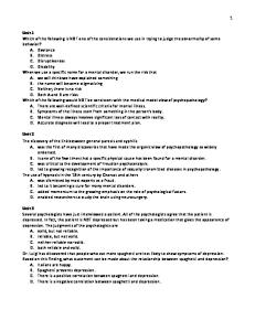
Chapter 5 Glaciated Landscapes Glaciated landforms
5a Higher tier Use pages 84–86 of the textbook to help you. A
B
Hodder: Tomorrow's Geography A/W10 Mac/eps/Illustrator B/W s/s C Trade Gothic 8/9 Text: HODDER & STOUGHTON EDUCATIONAL Studio: Peters & Zabransky
Start of glaciation
During glaciation
Hodder: Tomorrow's Geography A/W11 Mac/eps/Illustrator B/W s/s Text: Trade Gothic 8/9 HODDER & STOUGHTON EDUCATIONAL Studio: Peters & Zabransky
After glaciation
Hodder: Tomorrow's Geography A/W12 Mac/eps/Illustrator B/W s/s 1 Text:Annotate Trade Gothicthe 8/9 diagrams above to explain the formation HODDER & STOUGHTON EDUCATIONAL 2 Name physical feature found between two corries. Studio: Petersthe & Zabransky
of a corrie.
3 After glaciation the mountain has a jagged top. What is this known as? 4 What is a hanging valley? 5 Explain the formation of hanging valleys. Now use page 40 of the textbook to help you answer the following question: 6 What features of glaciation can be found at the following grid references? a 455 100 b 418 100 c
450 126 – 460 126
d 431 123 e 398 146 – 405 146
2
Tomorrow's Geography for Edexcel GCSE Specification A Dynamic Learning Network Edition © Hodder Education 2009
Chapter 5 Glaciated Landscapes Glaciated landforms
5b Foundation tier Use pages 84–86 of the textbook to help you with this worksheet. A
B
Start of glaciation
During glaciation
Hodder: Tomorrow's Geography A/W10 C Mac/eps/Illustrator B/W s/s Text: Trade Gothic 8/9 HODDER & STOUGHTON EDUCATIONAL Studio: Peters & Zabransky
Hodder: Tomorrow's Geography A/W11 Mac/eps/Illustrator B/W s/s Text: Trade Gothic 8/9 HODDER & STOUGHTON EDUCATIONAL Studio: Peters & Zabransky
After glaciation
Hodder: Tomorrow's Geography A/W12 B/W s/s 1Mac/eps/Illustrator Label the diagrams above using Text: Trade Gothic 8/9 HODDER & STOUGHTON EDUCATIONAL Studio: Peters & Zabransky
the words in the box below to describe the formation of corries.
corrie lake snow builds up rotational slipping abrasion small hollow steep back wall plucking rock lip weathering round-topped mountain crevasses jagged-topped mountain
2 Name the physical feature found between two corries. 3 The mountain after glaciation has a jagged top. What is this known as? Now use page 40 in the textbook to help you answer the following questions: 4 What features of glaciation can be found at the following grid references? Choose from the following list: arête, U-shaped valley, pyramidal peak, ribbon lake, corrie a 455100
b 418100
d 431123
e 398146 – 405146
c
450126 – 460126
Tomorrow's Geography for Edexcel GCSE Specification A Dynamic Learning Network Edition © Hodder Education 2009
3
Chapter 5 Glaciated Landscapes Glacial deposition features
5c Higher tier C
A
B
1 Name the landform shown above. 2 Complete the labels A and B with the correct terms. 3 Put an arrow head on line C to show the direction of ice movement. 4 What is an erratic? 5 What is the material deposited by a glacier called? Study the glaciated landscape below.
A
B
C
6 Name the types of moraine at A, B, and C. 7 What type of moraine is not shown on the diagram? 8 Lateral moraine is shown on the diagram. Explain the formation of lateral moraine. 9 How does the process of lodgement form ground moraine?
4
Tomorrow's Geography for Edexcel GCSE Specification A Dynamic Learning Network Edition © Hodder Education 2009
Chapter 5 Glaciated Landscapes Glacial deposition features
5d Foundation tier C
A
B
1 The landform above is a Drumlin. Name the slopes. 2 Complete the following sentences about the landforms created by glacial deposition. Use the words in the box. lowland
highland
moraine
glacier
water
erratic
arête
corrie
Drumlins can be found in ............... glaciated areas. They are small hills made from ................. They are formed when the ............... slows down. Another depositional landform found in lowland glaciated areas is an .......................
Tomorrow's Geography for Edexcel GCSE Specification A Dynamic Learning Network Edition © Hodder Education 2009
5
Chapter 5 Glaciated Landscapes Study the glaciated landscape below.
A
B
C
3 Name the types of moraine at A, B, and C. Choose from the following: lateral ground terminal recessional medial 4 Lateral moraine is shown on the diagram. Explain the formation of lateral moraine by rearranging the statements below.
6
G
One of the processes used to deposit material is ablation.
G
Material is eroded from the valley sides by the process of plucking.
G
Ablation occurs when material is deposited as the ice melts.
G
The glacier deposits material on the valley sides.
G
The material is transported down the valley by the glacier.
Tomorrow's Geography for Edexcel GCSE Specification A Dynamic Learning Network Edition © Hodder Education 2009
Chapter 5 Glaciated Landscapes Glaciation OS map
5e Higher tier To answer these questions you need to use the OS map of the Lake District found on page 40 of the textbook. 1 a Describe the shape of Haweswater Reservoir. b Describe the shape of Blea Water. 2 Which side of the mountain are the corrie lakes on? 3 Why is the valley floor so wide in grid square 4317? 4 Describe the route of the A592 shown on the map extract. Use map evidence in your answer. 5 Draw a cross section from 440100 to 500140. On your cross section mark: a Blea Water, steep back wall, lip b An arête c
Riggindale Beck
d Haweswater Reservoir e Guerness Gill
Tomorrow's Geography for Edexcel GCSE Specification A Dynamic Learning Network Edition © Hodder Education 2009
7
Chapter 5 Glaciated Landscapes Glaciation OS map
5f Foundation tier To answer these questions you need to use the OS map of the Lake District found on page 40 of the textbook. 1 a b
Describe the shape of Haweswater Reservoir. Describe the shape of Blea Water.
2 Which side of the mountain are most of the corries: south
north
west
south and west
3 What has caused the valley floor to be so wide in grid square 4317? 4 Describe the route of the A592 shown on the map extract.
8
Tomorrow's Geography for Edexcel GCSE Specification A Dynamic Learning Network Edition © Hodder Education 2009
Chapter 5 Glaciated Landscapes Human uses of glaciated landscapes
5g Higher and foundation tier 1 Ten statements are given below about the effects of glaciation on our lives. Glacial ice contains information about past climates Glacial gravel is very important in the construction industry Glacial scenery attracts tourists Glacial valleys can be used for reservoirs Glaciated areas are habitats for rare flowers and animals Glaciated valleys are perfect for HEP production Glaciated regions provide leisure activities like skiing and climbing Glacial meltwater provides drinking water to mountain communities Glaciers deposit soils which are fertile Glacial valleys provide communication routes through the mountains
a Rank these statements in what you consider to be the order of importance. Rank
Statement
b Compare your ranking with your partner. c
Discuss the differences.
d Feed your results back to the class. e Add all the class results together to arrive at a class rank order.
Tomorrow's Geography for Edexcel GCSE Specification A Dynamic Learning Network Edition © Hodder Education 2009
9
Chapter 5 Glaciated Landscapes f
Complete the table below with the class results. Rank
Statement
g How do your results differ from the class results?
10
Tomorrow's Geography for Edexcel GCSE Specification A Dynamic Learning Network Edition © Hodder Education 2009
Chapter 5 Glaciated Landscapes Tourism in a glaciated landscape
5h Higher tier Tourism in the Lake District Without the effects of glaciation, the landscape in the Lake District would be far less attractive to tourists. Glaciation has altered the shape of the land by changing the rounded hills into sharp peaks with knife-edged ridges. There are small bowl-shaped mountain lakes and deep valleys, many of them filled with long, shallow and narrow lakes. This has made the scenery far more spectacular with many waterfalls and fast-running rivers. The landscape is particularly attractive for hikers, ramblers, mountaineers and rock climbers. The lakes themselves attract tourists for a wide range of water-based activities such as boat trips, sailing, water skiing and windsurfing. 1 What is the geographical name given to small bowl-shaped mountain lakes found in glaciated areas? 2 What is the geographical name given to long, narrow lakes found in glaciated areas? 3 What is the geographical name given to sharp knife-edged ridges found in glaciated areas? 4 Why are the long, narrow lakes particularly good for water sports?
A593
i
N
Ambleside A592 A591 0
5 Kilometres A591
i
i
Windermere Boating facilities and sailing club Water-skiing Ferry route
A590
Camping and caravan sites Outdoor pursuit centres
A592
Hotels i i
Newby Bridge
Information centre Woodland Settlement
Tourist map of Windermere
5 Explain how Windermere was formed. 6 Describe the variety of tourist uses of Lake Windermere. 7 Explain why there are so many visitors to the Lake District every year.
Tomorrow's Geography for Edexcel GCSE Specification A Dynamic Learning Network Edition © Hodder Education 2009
11
Chapter 5 Glaciated Landscapes Tourism in a glaciated landscape
5i Foundation tier Tourism in the Lake District Without the effects of glaciation, the landscape in the Lake District would be far less attractive to tourists. Glaciation has altered the shape of the land by changing the rounded hills into sharp peaks with knife-edged ridges. There are small bowl-shaped mountain lakes and deep valleys, many of them filled with long, shallow and narrow lakes. This has made the scenery far more spectacular with many waterfalls and fast-running rivers. The landscape is particularly attractive for hikers, ramblers, mountaineers and rock climbers. The lakes themselves attract tourists for a wide range of water-based activities such as boat trips, sailing, water skiing and windsurfing. 1 What is the geographical name given to small mountain lakes found in glaciated areas? Choose from the list below: corrie lake
ribbon lake
basin lake
bowl lake
2 What is the geographical name given to long, narrow lakes found in glaciated areas? Choose from the list below: corrie lake
ribbon lake
basin lake
bowl lake
3 What is the geographical name given to sharp knife-edged ridges found in glaciated areas? Choose from the list below: needle
arête
corrie
peak
4 Suggest two reasons why the long, narrow lakes are good for water sports
A593
i
N
Ambleside A592 A591 0
5 Kilometres A591
i
i
Windermere Boating facilities and sailing club Water-skiing Ferry route
A590
Camping and caravan sites Outdoor pursuit centres
A592
Hotels i i
Newby Bridge
Information centre Woodland Settlement
Tourist map of Windermere
12
Tomorrow's Geography for Edexcel GCSE Specification A Dynamic Learning Network Edition © Hodder Education 2009
Chapter 5 Glaciated Landscapes 5 Copy out the following paragraph, choosing the correct alternatives, to explain how Lake Windermere was formed. Windermere was formed when a valley glacier reached alternate areas of soft and hard rock. It eroded the soft / hard rock more easily than the soft / hard rock. This left a hollow / ridge in the valley bottom which, after the ice froze / melted, became filled with water. 6 Complete the table to describe the variety of tourist uses of Lake Windermere. Water-based activities
Land-based activities
7 Explain why so many tourists go to the Lake District.
Tomorrow's Geography for Edexcel GCSE Specification A Dynamic Learning Network Edition © Hodder Education 2009
13
Chapter 5 Glaciated Landscapes Generating hydro electricity
5j Higher and foundation tier Hydro electricity is one way that people can use glaciated landscapes. The diagram shows how a hydro electric power station works.
Power transmission cables Dam Power house Transformer
Sluice gates
Generator
Storage reservoir Turbine Downstream outlet Dam Silt
1 Complete the table by placing the correct term from the diagram beside the matching description. Description
Term
These are like big propellers. The rushing water spins the propellers. Water in the reservoir is regulated by sluice gates which allow water into the dam. This is connected to the turbine by a drive shaft and produces electricity. The water returns to the river and flows downstream. Water flows down under pressure at high speed.
2 Why are glaciated landscapes good for producing hydro electric power? 3 Hydro electricity schemes can impact negatively on the environment. Suggest two ways that it can impact negatively on the environment. 4 What part does the transformer play in the production of electricity?
14
Tomorrow's Geography for Edexcel GCSE Specification A Dynamic Learning Network Edition © Hodder Education 2009
Chapter 5 Glaciated Landscapes The Galtür avalanche
5k Higher and foundation tier What happened at Galtür and why? In February 1999 heavy cloud and low temperatures meant that exceptionally large amounts of snow were deposited without breaking free. The build-up of snow continued for a week until record levels had been deposited. When the mass gave way, a giant 50-metre wall of snow travelled with great force and at a speed of up to 200 kilometres an hour into the small town. It overturned cars, damaged buildings and 31 people were killed. Too much snow had accumulated very quickly and enormous quantities fell on the valley sides. Once the avalanche began, it collected more and more snow that ran far out into the valley floor and engulfed the settlement that was built there. The steep, sharp Alpine landscape intensified the effect of the avalanche.
1 Galtür is situated in the Paznau valley in the Tyrol region of Austria. Find the Tyrol region in an atlas. It is a classical glaciated highland area. Describe and explain why the landscape features in this area are ideal for skiing and attractive for tourists. 2 What caused the Galtür avalanche? 3 You are a journalist and have been asked to write an article about the avalanche in Galtür. Write your article as if you were interviewing several people – a local resident living in Galtür; a visitor on a skiing holiday; an environmental campaigner and the mayor of Galtür. What can be done to reduce the danger of avalanches in Galtür? Austria has tried to categorise areas that are in danger from avalanches by creating red zones and yellow zones. In red zones, construction of any kind is prohibited. In yellow zones, certain safety measures apply and strict building codes are enforced. Although the threat of avalanches is present, the buildings are constructed in such a way that people should not be harmed. Galtür is built in a yellow zone. At the time the avalanche struck, at 4 pm, many people were returning from the ski slopes and were caught out on the streets rather than in the relative safety of the buildings. Austria has spent a great deal of money to try to reduce the risks from avalanches – constructing strong, resistant buildings; creating avalanche barriers on the mountain slopes; planting trees which in themselves break the flow of an avalanche. However, pressure for further development on mountainsides to meet the increased demand from tourists creates tensions between planners, environmentalists and the authorities. If further development continues to take place then the risks from avalanches also increase.
4 The continuing growth of skiing in Alpine areas is unsustainable. Discuss.
Tomorrow's Geography for Edexcel GCSE Specification A Dynamic Learning Network Edition © Hodder Education 2009
15
Chapter 5 Glaciated Landscapes Glaciation – Test-yourself
5l Higher and foundation tier 1 Complete the spidergram below. The first letter of each word has been done for you. U-s_______________ v_______________
a_______________
p_______________ p_______________
c_______________
Features of glaciated uplands
t_________________ s________________
h________________ v________________
r_________________ l_________________
2 On the diagram below there are a number of descriptive comments. Put the correct word in the space provided. A jagged mountain top ___________
Type of weathering _____________
The back wall is _____________ and _____________
Type of lake _____________
A knife-edge ridge _____________
16
Type of erosion when ice is present _____________
It dams the entrance _____________ _____________
Hodder: Tomorrow's Geography A/W20 Mac/eps/Illustrator B/W s/s Text: Trade Gothic 8/9 HODDER & STOUGHTON EDUCATIONAL Studio: Peters & Zabransky Tomorrow's Geography for Edexcel GCSE Specification A Dynamic Learning Network Edition © Hodder Education 2009
Chapter 5 Glaciated Landscapes 3 Explain how a glacier forms a U-shaped valley.
4 Put the following statements in order to explain the formation of hanging valleys: Streams meet main river by waterfalls down the valley sides Ice melts Smaller valleys of tributary streams contain glaciers Main valley glacier has more power Tributary valleys contain less ice Tributary valley glaciers have less power Tributary valleys are left higher up Main valley glacier is lower than tributary valley
5 The statements below are about moraine and ribbon lakes. For each statement tick if it is true or false. Statement
True
False
Moraine is rock which is eroded by a glacier Lateral moraine is found on the sides of valleys Ground moraine is found where two glaciers meet Ribbon lakes are long and thin Ribbon lakes are formed by deposition
Tomorrow's Geography for Edexcel GCSE Specification A Dynamic Learning Network Edition © Hodder Education 2009
17