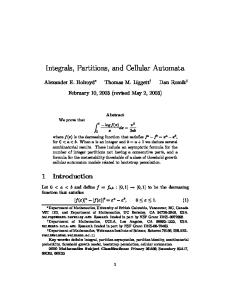
SIMULASI GEOSPASIAL BERBASIS CELLULAR AUTOMATA UNTUK EKSTRAPOLASI PERUBAHAN PENGGUNAAN LAHAN
GEOSPATIAL SIMULATION BASED ON CELLULAR AUTOMATA IN EXTRAPOLATING LAND-USE CHANGES Paharuddin 1), Andi Mappadjantji Amien1), D.A Suriamihardja1), Ahmad Munir2) 1)
Faculty of Mathematics and Natural Sciences, Hasanuddin University, 2) Faculty of Agriculture, Hasanuddin University.
Correspondence: Paharuddin Faculty of Mathematics and Natural Sciences, Hasanuddin University Makassar, 90245 Mobile: 0811462400 Email :
[email protected]
Abstrak Dinamika perubahan penggunaan lahan beserta dampak yang ditimbulkannya merupakan respon alam terhadap perilaku manusia. Penelitian ini bertujuan menyusun aturan-aturan yang diperlukan dalam membangun model Cellular Automata (CA) sehingga simulasi data geospasial mampu menghasilkan peta ekstrapolasi perubahan penggunaan tahun 2012 hingga 2037. Metode penelitian yang digunakan adalah simualsi dan pemodelan berbasis CA dengan input data spasial penggunaan lahan existing multi waktu menurut kondisi pada tahun 2000 sampai dengan tahun 2012 dan faktor fisik lahan yang direpresentasikan oleh multi layer seperti: Curah hujan, lereng, elevasi, jenis tanah, regulasi zona penyangga, dan aksesibilitas jalan. Seluruh data sapsial ini diubah dalam format ASCII dan merupakan data kondisi Sub-Das Jeneberang yang diolah dan dianalisis dengan Sistem Informasi Geografis (SIG). Simulasi dilakukan mulai pada kondisi tahun 2000 hingga 2012 dengan durasi waktu tiap 3 tahun, selanjutnya divalidasi dengan algoritma Kappa dan Fuzzy Kappa. Hasil yang diperoleh menunjukkan bahwa aturan-aturan yang dirumuskan telah berhasil menyusun model CA untuk ekstrapolasi peta perubahan penggunaan lahan tahun 2012 hingga tahun 2037. Demikian pula validasi simulasi geospasial menunjukkan tingkat ketelitian sangat baik dengan nilai di atas 90 %. Disimpulkan bahwa hasil validasi sangat baik.
Kata kunci : Sistem Informasi Geografis, Cellular Automata, Geospasial, Multi layer, Fuzzy Kappa.
Abstract The dynamics changes of land-use and their impact are a natural responses to human activities. These responses need to be understood in order to determine a proper management in the future. The aim of this research is to formulate the rules required for developing a Cellular Automata (CA) model so that the simulation of geospatial data are able to produce an extrapolation map of land-use changes from 2012 until 2037. This research employed CA-simulation and modeling. The input was in the form of spatial data of the multi-time use of existing land according to the condition in 2000 until 2012, and land physical factors in multi layer representation consisting of rainfall, slope, elevation, soil types, buffer zone regulation, and road accessibility. These spatial data were converted into ASCII format as Jeneberang sub-basin condition. The data were processed and analyzed by using Geographic Information System (GIS). The simulation was conducted in the condition of 2000 until 2012 with a time duration of every 3 years. Furthermore, the validation was conducted by using Kappa and Fuzzy Kappa algorithm. The results revealed that the formulated rules were able to develop a CA model to extrapolate the map of land-use change from 2012 until 2037. The validation of geospatial simulation revealed a very good accuracy level of more than 90%, it can be concluded as an excellent result.
Keywords: Geographic Information Systems, Cellular automata, Geospatial, multi layers, Fuzzy Kappa.
2 INTRODUCTION The phenomenon of land-use change and their impacts are nature responses to human behavior. These responses need to be understood in order to determine the proper action for future management. One of the consequences of land use is its impact on the sustainability of natural resources. This impacts should be minimized for sustainable use (Munir et al., 1997; Munir et al., 2000). According to Karsidi (2004), the use of GIS is very useful in relation to the dynamic of land use, especially with the availability of applicable models that are able to describe aspects of spatial dynamic. Further, Karsidi argued that the principle of the Game of Life (Gardner, 1970) refers to a spatial cell-based model where changes depend on the surrounding cells or nearby parcels. The principle became the underlying basis for the model named Cellular Automata (CA). Wolfram (2002) and Weisstein (2002) described a collection of cells that stained on a plot (grid) with a special form that evolved through a number of discrete time steps by a set of rules based on the state of its neighbour cells. A two-dimensional CA describes cells that change their color according to the color of the adjacent surrounding cells based on certain rules (Amien, 2005). One simple rule to time change of the values of a state was formulated by Wolfram (1984) with the following factors: An arbitrary function that determines the rules of CA and a set of rules that indicates the value of the ith state for onedimensional CA at time step t. The values of a state will change after an iteration in the next period in accordance with the rules given. CA application for land-use change and urban development have been implemented by various researchers. Dubos-Paillard et al (2003) conducted a simulation of urban growth based on empirical knowledge with the idea that such simulation will follow a simple spatial rule. Verburg et al (2004) introduced a method to analyze neighborhood characteristics of land use. Hegde et al (2008) applied the Neural Network and the CA to describe the settlement growth. Jenerette and Wu (2001) simulated a land-use change by developing a model of Markov-Cellular Automata. Ahmed Bayes and Ahmed Raquib (2012) predicted the urban growth using Landsat satellite imagery based on comparison of three
3 models: the St. Markov, CA Markov, and Markov MLP. Okwuashi et al (2012) introduced the SVC (Support Vector Machine) which was based on the GIS cellular automata for land-use change. Dynamic of land-use change may always take place at any time and location; due to driving forces factors such as population growth, economic growth, as well as influenced by physical factors such as topography, soil type, and climate (Skole et al., 1993). Therefore, this research was designed
to
construct rules that may affect changes in land-use using CA model to extrapolate land-use changes by taking into account the physical factors of land that are represented by multi layers such as rainfall, elevation, slope, soil type, road accessibility, and buffer zone regulations. MATERIALS AND METHODS Location and Database The research was carried out in Jeneberang sub-basin, a part of the Jeneberang Watershed. Type of this research is simulation and modeling research. Materials and tools used include: multi-temporal Landsat TM image Jeneberang catchment area (2000 – 2012), the SRTM data, data and supporting maps: Rainfall (Yachiyo Engineering, 2009), RBI maps, map of land system by RePPProT. Software includes: ArcGIS 9.3 and Arcview version 3.3 with necessary extensions, SpaCelle for CA simulation (Dubos-Paillard et al., 2003; Langlois, 2008; Langlois, 2009; Langlois., 2011), ILWIS Open Source (Steinigera et al., 2009 ) for image processing, and Map Comparison Kit (MCK) version 3.2.2 for map validation (Hagen et al, 2005; Visser et al., 2006). Methods This research employed CA-simulation and modeling of spatial data in the range of year 2000 to 2012. The physical factors of rainfall, slope, elevation, soil types, buffer zones regulation and road accessibility are represented in multilayers as spatial data. The first stage of this research was started with the generation of maps of land physical factors, namely rainfall isohyet that was analyzed using Geographic Information Systems (Aronoff., 1989; Burrough et al.,
4 1998) based on rainfall data documented by several stations around the Jeneberang sub-basin, road accessibility and the criteria of protected areas were based on Decree of President No.32/1990 to produce the map of buffer zone regulation, slope and elevation maps were generated by SRTM data, soil types were obtained using land system maps and field surveys, land-use interpretation from Landsat TM image from the year of 2000 to 2012 (Lillesand et al., 1994; Schowengerdt, 2007). The output was maps in from of grids with cell size of 30 m2. The generated maps were then used as multi layers in the simulation (McHaney, 2009) and converted to ASCII format. The simulation results were validated using the MCK program (Hagen et al., 2005; Visser et al., 2006) with Kappa algorithm (Carletta, 1996; Pontius, 2000) and Fuzzy Kappa (Hagen, 2003; Hagen-Zanker et al., 2005; Hagen-Zanker, 2009). The results should be under categorized of good, very good or perfect to validated according to the level of accuracy of Kappa values proposed by Monserud and Leemans (1992). RESULT The Rule of Simulation on Land-use Change Figure 1a shows zonation of information of land-use changes that is used as a barrier layer; whereas Figure 1b to Figure 1h are multi layer of physical factors of land. This Layers are used as a reference for formulating the rules of change in the simulation program by considering the physical factors of land (Amien, 2001; Baja, 2012; Paharuddin, 1999), regulatory factors of buffer zone, and road accessibility based on the conditions in the year of 2000 to 2012. Using multi layers maps into the simulation program, the transition rules of land use change were formulated as: (1) First line: Sb>Kc = PV(Kc;8;0.01;1) * EV(Ch0;2) * ZV(Ch1;1) * ZV(SbT;1)*ZV(Lsr;10), and (2) Second line: Sb>Kc = PV(Kc;6;0.05;1) * EV(SbU;1) * EV(Elv1+Elv2;5) * EV(jt0+jt5;3) * ZV(jt1;2) * ZV(SbT;1) * ZV(jt6;10) * ZV(Lsr;20)
5 The symbols of *, +, and > used in formulating the transition rules are interpreted based on Langlois (2011) which is defined as follows: symbol * refers to AND, symbol + means OR, and symbol > describes the change on type of the current spatial data to other spatial data, respectivelly (Langlois., 2011). Simulation of Land-use Change Referring to Table 1, the period of 2000 to 2003 presents a difference of 6.03 ha for shrubs and -6.03 ha for mixed agriculture. Similarly, in the period of 2009 to 2012 shows unsignificant differences for every type of land use. Validation Simulation of Land Use Change Table 2 describes the employed program that contain aggregate count on the nine categories of land-use. However, the program may also generate statistical values for each category. Fuzzy Kappa, as listed in Table 2, with a value of 1, is a type of land use that has not changed and, thus, the result of maps comparison came up with a perfect level. Whereas, the open land (Lt) was ended up with 0 in the comparison between reference map and simulation results for the year of 2006. Extrapolating the Land-use Change In Table 3 and as spatially shown in Figure 2, it may note that each 5-year period, the type of land-use that decreased is the mixed agriculture, whereas the residential and horticulture are increase; other types of land-use remain unchange. DISCUSSION This research result that formulated rules were able to developed the CA model for extrapolating the map of land-use change in year 2012-2027. The validation of geospatial simulation shows an accuracy more than 90%. Based on the rule of simulation on land-use chage, the first line refers to the current spatial data in the form of shrubs (Sb) that can be transformed into a mixed agriculture (Kc), when the proportion of existing Kc is at the distance of 8 km circle around a cell with a radius of 0.01 - 1 km, AND as far as 2 km from Ch0, AND there are no changes occured in radius of 1 km around Ch1, AND
6 there are no changes in radius of 1 km around the SbT, AND also no changes in radius of 10 km around the Lsr (Langlois, 2008; Langlois., 2011). The second line describes the spatial data which is currently in the form of shrubs (Sb) can be transformed into a mixed agriculture (Kc) when the proportion of existing Kc is at the distance of 6 km circle around a cell with a radius of 0.05 1 km, AND as far as 1 km from SBU, AND as far as 5 km from Elv1 OR Elv2, AND as far as 3 km from jt0 OR jt5 AND no changes in radius of 2 km around jt1, AND there are no changes in radius of 1 km around the SBT, AND there are no changes in radius of 10 km around jt6, AND also no changes in radius of 20 km around the LSR (Langlois, 2008; Langlois., 2011). Resuls showed in part of simulation of lad-use change, implies that the simulation results were not far from the real condition of the existing land-use. Contradictive result was obtained for the period of 2003 to 2006, in which, during this period, a big difference was observed between the simulation and the existing land-use; this may be due to the incindence of landslide in 2004 which strongly affected the application of the rules of land-use change in the simulation program. Normally, a syntax may be inserted into the simulation program when formulating the rules of land-use change; however, due to the fact that the landslide is a natural occurrence and it is impossible to predict the occurence of similar incident, the factor can not be inserted. Validation results indicates that there are no open land available in the comparison between reference map of 2006 and the simulation map of 2006 which based on the reference map of 2000. Other land-use type which based on accuracy level of Kappa values classified by Monserud and Leemans (1992), was categorized at the very good level with value above 80%. These results are not much different from those obtained in the case of different (Dubos-Paillard et al., 2003; Langlois, 2008; Langlois, 2009; Langlois., 2011). Therefore, the simulation process was followed by a 5-year period, assuming a medium-term development is conducted every 5 years starting from 2012 to 2037.
7 As for the extrapolation of land-use change, the increase phenomena of the residential areas is associated with the growth of structures and infrastructures, including better road accessibility. In addition, population growth also plays a significant contribution in accelerating the residential development (Baja, et al., 2005). This is confirmed by cencus result of Gowa Regency (2010) which states that the rate of population growth in Gowa per year over the last ten years, i.e. from the year of 2000to 2010 reach 2.10% (Center Agency of Statistics Gowa Regency, 2010). Development of horticulture was found at the upstream areas of Jeneberang river, Bulutana village, Tinggimoncong subdistrict, a village near to Malino city and located on a plateau with an altitude of 2000-2500 meters above sea level. This is in line with the statement of the Head of Agriculture Department of Gowa Regency (Harahap, 2012), that in the recent year production of vegetables from Gowa highlands reached 109,970 tons which harvested from nearly 5,000 hectares of planting area. A total of 18 kinds of horticultural commodities are grown in the highlands. Eight of these commodities are categorized as high commercial commodities, i.e. potato, fruit tomato, carrot, cabbage, green onions, green beans, tomatoes, and red pepper. Development of vegetable production in 2010 for each commodity was also varies. Increasing commodities include onion (from 72 tons to 78 tons), beans (from 2,948 tons to 3,055 tons), tomatoes (from 1,669.6 tons to 8,616.8 tons). Other commodities such as potatoes, cabbage, mustard greens, carrots, peppers, eggplant, beans, cucumbers, kale, spinach, also increased production. While declining commodities include onion leaf (from 4,437 tons to 3,552 tons), squash (14,941 tons to 1,860.7 tons) (Center Agency of Statistics Gowa Regency, 2011). CONCLUSION AND SUGGESTION The formulated rules have been proven to be successfully simulate the land-use change with results that approaching the initial conditions; this is supported by validation test that gives Kappa and Fuzzy Kappa values above 90%
8 indicating a very good accuracy. Thus, it can be concluded that the model of CA is applicable to extrapolate land use changes from the year of 2012 to 2037. To get a higher level of confidence towards the results of the formulation of land-use change simulation by CA model, the model needs to be tested for other sub-basins; in addition, the simulation process may also include social and economic factors and, thus, the making of change rules, with the presence of both factors, will provide more optimal results.
ACKNOWLEDGEMENTS My gratitude to the DIKTI for financial support through the scholarship program of BPPS and the opportunity to widen my horizon through “Program Sandwich” in Bremen, Germany.
9 REFERENCE Ahmed B., & Ahmed R. (2012). Modeling Urban Land Cover Growth Dynamics Using Multi-Temporal Satellite Images: A Case Study of Dhaka, Bangladesh. ISPRS Int. Journal of Geo-Information. 1: 3-31 Amien,A.M. (2005). Local Self-Reliance. Conceptions of Development, Organization, and Education of a New Science Perspective, Jakarta: PT Gramedia Pustaka Utama. Amien,A.M. (2001). Spatial Planning of Coastal Region, Bandung: Pustaka Ramadhan. Aronoff, S. (1989). Geographic Information Systems: A Management Perspective, Ottawa, Canada: WDL Publications. Baja, S. (2012). Land Use Planning in Regional Development, Spatial Approach and Its Application, Yogyakarta: Cv. Andi Offset. Baja S., Ramli M. & Jayadi M. (2005). Spatial matching between land use and land quality in the Jeneberang valley:An analysis within a spatial planning perspective. In: Proc.2nd ASEAN Subcommittee on Space Technology and Appli-cations Conferenceon Space Application Technology towards Competitive ASEAN, 5–11 August 2005. Burrough, P. A., & McDonell, R. A. (1998). Principles of Geographical Information Systems. New York: Oxford University Press. Center Agency of Statistics, Gowa Regency. (2011). Gowa in Figure 2011. Province of South Sulawesi. Center Agency of Statistics, Gowa Regency. (2010). Census Result Gowa Regency 2010. Agregat Data Sub-District. Province of South Sulawesi. Carletta, J. (1996). Assessing agreement on classification tasks: the kappa statistic. Computational linguistics, 22(2). Dubos-Paillard E., Guermond Y, & Langlois P. (2003). Analyse de l’évolution urbaine par automate cellulaire. Le modèle SpaCelle, L’espace géographique, 32 (4) : 357-380. Gardner, M. (1970). Mathematical games: The fantastic combinations of John Conway's new solitaire game life. Scientific American 223 : 120 – 123. Hagen-Zanker, A. (2009) An improved Fuzzy Kappa statistic that accounts for spatial autocorrelation. International Journal of Geographic Information Science 23 (1) : 61-73. Hagen-Zanker, A., Straatman, B., & Uljee, I. (2005). Further developments of a fuzzy set map comparison approach, International Journal of Geographical Information Science, 19 : 769–785. Hagen, A . (2003). Fuzzy set approach to assessing similarity of categorical maps. International Journal of Geographical Information Science , 17 : 235–249.
10 Harahap. A.R, (2012), Gowa vegetables Provincial Crosses. Available from: http://travel.kompas.com/read/2012/05/28/02541138/Sayur-ayur.Gowa.Melintas.Provinsi Hegde N.P, Muralikrishna I.V., & Chalapatirao K.V. (2008). Settlement Growth Prediction Using Neural Network And Cellular Automata. Journal of Theoretical and Applied Information Technology (JATIT), 4 (5) : 419-428. Jenerette, G. D., & Wu Jianguo. (2001). Analysis and simulation of land-use change in the central Arizona - Phoenix region, USA. Landscape Ecology, 16 : 611-626. Karsidi, A. (2004). Analysis of Dynamic Land Use Changes in Geographic Information Systems Based on Markov Cellular Automata. In Rais Jacob et al,. Integrated Coastal Zone in Spatial Palnning, First edition, Jakarta: Pradnya Paramita. Langlois P. (2011)., Simulation of Complex System in GIS. USA: First Published, ISTE, Ltd. UK and John Wiley & Sons, Inc. Langlois P. (2009). De Fonctionnement De L'automate Cellulairesimulation, Automate Cellulaire SpaCelle version 5.18. Laboratoire MTG, Universite de Rouen. Langlois P. 2008. Cellular Automata for Modeling Spatial Systems, in: Yves Guermond editor. The Modeling Process in Geography From Determinism to Complexity. USA : ISTE Ltd and John Wiley & Sons, Inc. Lillesand, T.M., & R.W. Kiefer. (1994). Remote Sensing and Image Interpretation, Third Edition. New York : John Wiley and Sons Inc. McHaney, R. (2009). Understanding Computer Simulation, Roger McHaney & Ventus Publishing ApS. Monserud, R. A., & Leemans, R. (1992). Comparing global vegetation maps with the Kappa statistic. Ecological Modelling, 62: 275-293. Munir, A., N. Abdullah., & T. Martuni. (2000). Application of Geographic Information System (GIS) for assessment of land use risk on sediment yield. Journal of Agriculture, Kyushu Univ. Japan, ed no. 44 (3-4) 2000: 463-471. Munir, A., & Suripin. (1997). Study of landuse risks to sediment yields at the Wonogiri Catchment Area, Indonesia from 1980 until 1994. International Workshop "Experience with Soil Erosion Models", 1997 October 6-8, Prague, Czech Republic. Okwuashi O, McConchie J, Nwilo P, Isong M, Eyoh A, Nwanekezie O, Eyo E., & Ekpo A.D. (2012). Predicting Future Land Use Change Using Support Vector Machine Based GIS Cellular Automata: A Case of Lagos, Nigeria, Journal of Sustainable Development, 5 (5): 132-139. Paharuddin, (1999). Remote sensing and geographical information system for spatial planning-Case study in mamuju coastal areas south sulawesi province. (Thesis). Yogyakarta: Universitas Gadjah Mada.
11 Pontius, Jr, R. G., (2000). Quantification error versus location error in comparison of categorical maps. Photogrammetric Engineering & Remote Sensing, 66: 1011-1016. Pontius Jr., R.G., Huffaker, D., & Denman, K. (2004). Useful techniques of validation for spatially explicit land-change models. Ecological Modelling, 179 (4): 445-461. Schowengerdt R.A. (2007). Remote Sensing: Models and Methods for Image Processing. Third Edition. USA: Academic Press is an imprint of Elsevier. Skole, D., & Tucker, C. (1993). Tropical deforestation and Habitat Fragmentation in the Amazon: Sattelite Data from 1978 to 1998. Science, 260: 1905-1910. Steinigera S., & Hay G.J. (2009). Free and Open Source Geographic Information Tools for Landscape Ecology. Ecological Informatics. Version 4th July 2009. Verburg, Pete H, de Nijs, Ton C.M, van Eck, J.R, Visser, H., & de Jong K. (2004). A method to analyse neighbourhood characteristics of land use patterns, ELSEVIER, Computer, Environ. and Urban Systems 28 : 667-690. Visser, H., & de Nijs, T. (2006) The Map Comparison Kit. Environmental Modelling & Software 21 : 346-358. Weisstein, Eric W. (2002). CRC Concise Encyclopedia of Mathematics. Chapman & Hall/CRC, 2nd edition. Wolfram, S. (2002). A New Kind of Science. Champaign, Illinois: Wolfram Media, Inc. Wolfram, S. (1984). Cellular automata as models of complexity. Nature, 311 : 419-424. Yachiyo Engineering Co. Ltd. And Associate. (2009). Necessity of Comprehensive Sediment Control In Jeneberang River Basin. Workshop Natural Disaster of Caldera Wall Collapse of Mt. Bawakaraeng in South Sulawesi, January 29, 2009. In Jakarta. .
12 Table 1. Difference between Simulation Result and Existing Land-use Change Year, area and percentage of land-use Land-use
2000 Area (ha]
2003 %
Area (ha]
2006 %
Area (ha]
2009 %
Area (ha]
2012 %
Area (ha]
%
Forest
0.00
0.00
0.00
0.00
0.18
0.00
0.00
0.00
0.00
0.00
Shrub
0.00
0.00
-6.03
-0.02
509.67
1.35
-24.75
-0.07
-24.75
-0.07
Horticulture garden
0.00
0.00
0.00
0.00
0.00
0.00
0.00
0.00
-80.01
-0.21
Meadow
0.00
0.00
0.00
0.00
0.00
0.00
0.00
0.00
0.00
0.00
Mix garden
0.00
0.00
6.03
0.02
-167.31
-0.44
-106.74
-0.28
-91.35
-0.24
Rice field
0.00
0.00
0.00
0.00
50.94
0.13
-67.59
-0.18
-81.99
-0.22
Residential
0.00
0.00
0.00
0.00
110.07
0.29
199.08
0.53
278.10
0.74
Bili-Bili dam
0.00
0.00
0.00
0.00
0.00
0.00
0.00
0.00
0.00
0.00
Open land
0.00
0.00
0.00
0.00
-503.55
-1.33
0.00
0.00
0.00
0.00
Table 2. Values of Kappa and Fuzzy Kappa, Simulation of Land-use Change based on the Category Year - Fuzzy Kappa per Category of Land-use 2003 2006 2009 2012
Statistics & Land-use Kappa KLocation KHisto Fraction correct Forest (Ht) Horticulture garden (Kb) Mix garden (Kc) Open land (Lt) Residential (Pm) Meadow (Pr) Shrub (Sb) Rice field (Sw) Dam (Wd)
0.99902 0.99924 0.99978 0.99928 1 1 0.99646 1 1 1 0.99362 1 1
0.97147 0.99533 0.97602 0.97888 0.99999 1 0.98463 0 0.81145 1 0.85774 0.99148 1
0.99026 0.99761 0.99263 0.99303 1 1 0.98645 1 0.90879 1 0.98264 0.99449 1
0.98467 0.99476 0.98986 0.98888 1 0.92853 0.97132 1 0.8781 1 0.98264 0.99318 1
Tabel 3. Area and Percentage of Simulation of Land-use Change in 2012 - 2037 Area and Percentage of Simulation of Land-use Change
Code Ht Sb Kb Pr Kc Sw Pm Wd Lt Jumlah Note: Ht : Forest Sb: Shrub
2012 ha 8.011,5 3.282,6 638,1 183,7 16.318,0 6.811,2 589,0 1.452,2 503,6 37.789,8
2017 % 21,2 8,7 1,7 0,5 43,2 18,0 1,6 3,8 1,3 100
ha 8.011,5 3.270,0 708,8 183,7 16.208,4 6.878,3 573,4 1.452,2 503,6 37.789,8
2022 % 21,2 8,7 1,9 0,5 42,9 18,2 1,5 3,8 1,3 100
Kb : Horticulture garden Pr : Meadow
ha 8.011,5 3.240,3 797,3 183,7 16.135,3 6.793,4 672,6 1.452,2 503,6 37.789,8
2027 % 21,2 8,6 2,1 0,5 42,7 18,0 1,8 3,8 1,3 100
ha 8.011,5 3.240,3 831,5 183,7 16.101,1 6.793,4 672,6 1.452,2 503,6 37.789,8
Kc: Mix garden Sw :Rice field
2032 % 21,2 8,6 2,2 0,5 42,6 18,0 1,8 3,8 1,3 100
ha 8.011,5 3.240,3 841,8 183,7 16.090,8 6.793,4 672,6 1.452,2 503,6 37.789,8
2037 % 21,2 8,6 2,2 0,5 42,6 18,0 1,8 3,8 1,3 100
Pm : Residential Wd: Bili-Bili dam Lt: Open land
ha 8.011,5 3.240,3 849,4 183,7 16.083,2 6.793,4 672,6 1.452,2 503,6 37.789,8
% 21,2 8,6 2,2 0,5 42,6 18,0 1,8 3,8 1,3 100
13
c)
b)
a)
f)
e)
d)
h)
g)
Figure 1. Multi layers of Land Physical Factors a) Barrier of land-use cahnge c) Elevation b) Rainfall d) Slope
e) Soil type f) River Buffer
g) Road Buffer h) Accessibility and drainage
a)
b)
c)
d)
e)
f)
Figure 2. Extrapolation of Land-use for 2012 – 2037 a) Land-use cahnges in 2012 c) Land-use cahnges in 2022 b) Land-use cahnges in 2017 d) Land-use cahnges in 2027
e) Land-use cahnges in 2032 f) Land-use cahnges in 2037