28
Universities Council on Water Resources
Journal of Contemporary Water Research & Education Issue 136, Pages 28-36, June 2007
Towards Integrated Regional Models of Transboundary River Basins in Southeast Asia: Lessons Launched from Water and Watersheds Jeffrey E. Richey1 and Erick C.M. Fernandes2 1
2
O
School of Oceanography, University of Washington, Seattle; Agriculture and Rural Development,The World Bank, Washington, DC
ne of the most salient of contemporary issues in Global Change is the dynamics of water movement across large river basins to the sea. Understanding the subtle relations between the forcing provided by seasonal and interannual variability in climate expressed across an evolving landscape provides important insight into the processes controlling the intrinsic dynamics of meso-scale river basins, while providing important information for basin managers. Increases in resource demand rise directly with increases in population and the generation of wealth. Significant medium to longterm climate change and altered frequency and severity of extreme events will likely complicate the priority setting and decision-making processes. Conflicts arising from regional inequities in access to and capture of water will be exacerbated in the years ahead, with a growing human population and with the stresses that global changes will impose on water quality and availability. A robust ability to examine simultaneously such a complex suite of forces and events is key in adaptations for the future. In our original Water and Watersheds proposal of 1995, “Toward an Integrated Regional Model of River Basins of the Pacific Rim,” we stated that “our ultimate goal is to combine basic research with assessment modeling in order to better understand, predict and constrain the effects of an altering landscape on Earth system health.” To address these issues, we proposed “to conduct a multi-national, multi-disciplinary, large-scale investigation into the processes that control and UCOWR
alter the health and activity of river systems within the Pacific Rim.” We were awarded essentially a pilot grant, which allowed us to begin developing a longer-term work plan (with funding from national and international sources), and ultimately a vision of how to determine what information is necessary for not only the basic science of large river basins, but how to bring that knowledge to bear on capacity development and decision makers in the developing world. As described below, implicit in our approach was that: 1. A key scale to work at was that of the regional/large river basin. While much work in flowing waters has been done at the streams level, impacts of land-use change on an entire river basin cannot be defined by simply “summing up” the impacts observed on individual streams; models that explicitly recognize the changes in spatial and temporal dynamics with which river systems function must become a standard in large-scale river basin management. Conversely, global-scale analyses are too coarse to provide useful information to managers. A midrange approach and challenge is to anchor individual or related watersheds that are managed by communities and delineated by socio-political boundaries within the context of larger river basins. 2. Problem-focused or applied science is not always considered to have the stature that basic science does. But it was our challenge that the work that needs to be done to provide
Journal of Contemporary Water Research & Education
Towards Integrated Regional Models of Transboundary River Basins in Southeast Asia insightful and useful information for decision makers actually pushes the frontier of the basic science. 3. The transition of science into policy is always problematic, but is perhaps more challenging in the less developed regions of the world. An outcome is that patience and focus are required.
The Region and Our Research Strategy Our strategy was to build off the classic “paired watershed” paradigm of river basin research, but with a twist. Our control watershed was the Amazon basin of South America. The Amazon can be considered as a test case for developing a model of the dynamics of large-scale drainage basins. Its major tributaries represent different climate, soil, and topographic regimes. It is large scale (6 million km2) and represents a series of hydrological and chemical regimes that are not atypical of world rivers. As much of the Amazon is relatively undisturbed by anthropogenic activity compared to other large rivers, it provides one of the few opportunities left to develop models of how basins should function. It is also relatively well-characterized (by our group alone, over 130 publications). The disturbed watersheds were river basins of Southeast Asia, an area roughly comparable in size and latitude to the Amazon. The climate in the region ranges from tropical lowland and arid grassland to snow-capped mountains. At the other end of the development spectrum from the Amazon, the extraordinary pace of development and population growth in much of Asia has placed dramatically increasing pressure on river basins and their downstream coastal ecosystems. Impacts occur through erosion of the land surface, changes in the nature of the sediment and its associated organic matter, and nutrient content from agricultural and urban sources. Changes in hydrology are an immediate consequence of dam construction and large-scale water diversion for irrigation. Longerterm changes in regional weather patterns and climate would result in altered flow regimes in both regions. These changes have major consequences for water resources. As such, landscape and water resource management are major challenges for the socio-economic development of upland and Journal of Contemporary Water Research & Education
29
lowland watersheds in Southeast Asia due to their association with downstream environmental impacts and water supply. During recent decades, concerns about the impacts of changing patterns of land use associated with deforestation and agricultural transformation on water resources have created social and political tensions from local to national levels. Major concerns focus on consequences of land use change for water supply and demand, for local and downstream hydrological hazards, and for biodiversity conservation. Our long-term objective is to assess the vulnerability of specific sectors (agriculture, forestry, fisheries, water supply and quality) of a large river basin to potential drought, flooding, landslides, infrastructure, and re-forestation schemes, under both current and possible future conditions. With this information, the next objective is to evaluate the trade-offs between sectors as a basis for future policy interventions and financial investments. As such, these objectives represent a very complex set of intersecting issues, typically beyond the scope of most traditional analysis frameworks. A template where decision-makers can consider rigorous scenarios of alternative futures could play an important role in making complex environmental and economic decisions. This requires an accurate understanding of linkages between water resources and its controlling factors, and the ability to quantitatively forecast individual and combined impacts of demand. Contemporary geospatially-explicit, processbased hydrology models (including dams and irrigation schemes) provide a robust basis for analysis of changes in the water flow and landscape dynamics of river basins as a function of changes in land use and land cover and regional climatology. While they address the detailed movement of water across the landscape, such models are “more” than just hydrology models. The model can be seen as a multi-layered representation of characteristics and processes in a drainage basin that allows us to examine intersections of the data required for describing a basin’s topographic and landscape features and its climatology patterns. In considering large drainage basins, it is important that processes are represented with sufficient resolution to be meaningful at local to regional scales, even in datasparse regions. With contemporary capabilities in remote sensing, evolution of computers, and UCOWR
30
Richey and Fernandes
developing databases, this is now possible. Such models can be considered as interpolation schemes. Overall, the resulting modeling environment can be developed as a “Dynamic (Landscape-Water Resources) Information Framework (DIF).” Because of the fundamental processes and detailed information represented in a functional DIF, a series of critical problems can be examined that may result from climate variability and land use / land cover change. Our “Broader Impacts” challenge (sensu National Science Foundation standards for engagement beyond strictly intellectual content) was to take our analytical engine, represented as the DIF, engage multiple regional stakeholders in the application, and learn from and adapt to the regional challenges. In the following sections, we summarize these actions.
Engagement with the Regional Academic and Government Communities: The Sea Basins Program We judged early in the process that is was critical to form the basic platform that would provide not only the immediate research basis, but also the training and subsequent government sector involvement. Among the multiple stakeholders of the Southeast Asia region, we proceeded in a sequential fashion, from immediate academic colleagues and the core scientific work, to then beginning the process of translating the work to regional, international, and transboundary organizations. Accordingly, the partnership SeaBasins (Southeast Asia Integrated Regional Model: River Basin Inputs to the Coastal Zones), was initiated as a joint venture of the University of Washington (UW) and the Southeast Asia START Regional Center (SEA START RC, Chulalongkorn University, Bangkok). SeaBasins was set up to serve as a multi-scaled, nested regional synthesis and training engine to address the questions, 1. What are the physical and ultimately economic consequences of changing land-use and climate on the mobilization of water and its chemical load from the land surface into the coastal zone? 2. What is a functional strategy for taking basic science information and translating it into water resource information and management
UCOWR
at regional scales? The targets for the project were to develop: 1. Tools for systematic synthesis of diverse information, leading to a coherent information base that can be applied to regional evaluation, 2. Predicative capability and scenarios generation across multiple time and space scales, and 3. A process for proactive, interdisciplinary, communication amongst regional scientists, and between the scientists and decision makers. The process for executing SeaBasins was to engage partners via workshops and networking. Following the initiation of the Water and Watersheds project, additional support from the U.S. Agency for International Development (USAID), the Asia-Pacific Network (APN), World Resources Institute (WRI), and START (Global Change System for Analysis, Research and Training) over the next several years allowed SeaBasins to “get up and going.” Two workshops, in Thailand in 1998, brought the initial partners together, leading to concept and initial model development (Fig. 1). These and related efforts subsequently led to the development of several larger projects, which allowed more progress on our initial agenda. The Dynamics of Carbon Export to the Atmosphere and Oceans from Fluvial Systems of the Humid Tropics: Southeast Asia project was funded by the NSF EAR/Carbon program in 2002. This project has been conducting extensive field measurements and modeling, on the Chao Phrya and Mekong basins. The Vulnerability of Water Resources to Extreme Hydrological events in Southeast Asia due to Climate Change project was initiated in 2001, as part of the Assessments of Impacts and Adaptations to Climate Change in Multiple Regions and Sectors (AIACC), of the Global Environment Facility (GEF). The formation of SeaBasins partnership should be considered as the primary outcome of the initial Water and Watersheds funding. An important outcome from this work is that seed funding for pilot projects can be nurtured into larger efforts with greater impact.
Journal of Contemporary Water Research & Education
Towards Integrated Regional Models of Transboundary River Basins in Southeast Asia
31
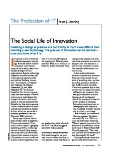
Figure 1. Initial SeaBasins Partners Workshop, representing Australia (CSIRO Division of Atmospheric Research), Cambodia (Min.of Public Work and Transport, Working Group Basin Modeling & Knowledge Base in Cambodia Nat’l Mekong Committee , MRC), China (Yangtze River Water Resources Comm., Nanjing Inst.of Hydrology and Water Resources, Min. of Water Resources State Oceanic Administration), Indonesia (Dept. of Mining, Institut Teknologi Bandung, R&D Centre for Geotechnology – LIPI), Laos (River Works Management Unit, Min.of Communication Transport Post and Construction), Malaysia (Dept. of Irrigation and Drainage, Borneo Marine Research Institute Universiti, Regional Humid Tropics Hydrology and Water Resources Centre for Southeast Asia and the Pacific Dept.of Irrigation and Drainage, University of Science Malaysia. Penang ,Dept.of Civil and Structural Engineering, University Kebangsaan), Myanmar (Directorate of Water Resources and Improvement of River Systems), Philippines (National Inst. of Geological Sciences, University of the Philippines-Diliman), Thailand (Royal Irrigation Dept., Chulalongkorn University, Southeast Asia START Regional Center, IOC-WESTPAC), USA (University of Washington), Vietnam (Vietnam National Institute of Water Resources Planning , Inst. of Geography, National Center for Natural Science and Technology, Institute of Applied Mechanics). Center for Hydro-Meteorological Forecasting, Inst. of Mechanics, Hydrological Division).
Engagement with International Organizations: Collaboration with the Alternatives to Slash – and – Burn Programme There is a broad array of international agencies concerned with the sustainable development of developing nations, primarily in the tropics. Among the principal such organizations is the Alternatives to Slash-and-Burn (ASB) Programme, a systemwide programme of the Consultative Group on International Agricultural Research (CGIAR) that is convened by the World Agroforestry Centre (ICRAF) and governed by a Global Steering
Journal of Contemporary Water Research & Education
Group of 11 institutions, balanced between South and North. ASB is a global partnership of over 50 institutions around the world with a shared interest in conserving forests and reducing poverty in the humid tropics. ASB applies an integrated natural resource management approach to analysis and action regarding trade-offs between global environmental concerns and local rural development opportunities in the forest margins of the humid tropics. ASB and similar organizations represent funding by donor organizations, including international development banks (e.g., the World Bank) and national development agencies (e.g., U.S. AID). As such, a partnership with a quantitative, UCOWR
32
Richey and Fernandes
synthetic perspective such as ours would help ASB achieve its goals. Accordingly, we engaged with ASB in the Functional Value of Biodiversity program (supported in part by the World Bank-Netherlands Pilot Program). The goal of the project was to better inform policy makers about the nature, magnitude, and geographic location of hydrologybiodiversity-forest relationships. Efforts to ‘mainstream’ biodiversity have been frustrated by lack of scientifically based, comprehensive assessments of the functional contribution of biodiversity conservation to rural livelihoods and economic development. While there are many such functional contributions, one of the most frequently discussed is the contribution of conservation to maintenance of key hydrological processes. It is supposed – plausibly but without much evidence – that changes in upland land use practices could help poor hill-dwellers conserve biodiversity and provide “bankable” benefits for downslope urbandwellers. In particular, there is considerable policy interest in the argument that maintenance of biodiverse forests in upper watersheds can mitigate flooding in densely populated urban or agricultural lowlands. If so, large economic value attaches to maintenance of those upland forests. Policies that mobilize this value could simultaneously promote development and conservation. To contribute to this dialogue, we applied the DIF concept at two scales, in our “paired watershed” metaphor. For the small scale, we analyzed the 4,000 km2 Mae Chaem (Chaem River) watershed located in the Chiang Mai province of northern Thailand (Thanapakpawin et al. in press). It is a major upper tributary subbasin of the Ping River, which in turn, is the largest tributary of central Thailand’s Chao Phraya River. The climate of this mountainous basin is defined by large variations in seasonal and annual rainfall that are influenced by Pacificborn typhoons, superimposed on the south-west monsoon. Steep hillsides with slopes exceeding 25 percent are a common landscape element, resulting in rates of soil erosion that prevent advanced soil development. Dominant vegetation goes from dry dipterocarp and mixed deciduous forests at low elevations to tropical mixed pine forest alternating with hill evergreen forest, up to tropical montane cloud forest. The Mae Chaem was selected as an example of UCOWR
serious policy issues involving primarily ethnic minorities in the uplands relative to lowland agriculturists. In northern Thailand, the prevalent views are that logging, shifting cultivation by mountain ethnic minorities, and commercial agriculture in highland watersheds cause severe dry-season water supply shortages. Water demand is the other side of the equation, as it also places constraints on water availability. Dynamics of water use relate to land use change, especially through expansion of lowland cultivation, irrigated upland fields, urban areas, and industrialization. To evaluate these trade-offs, we evaluated the hydrologic regimes of the Mae Chaem River with land use change, using the Distributed HydrologySoil Vegetation Model (DHSVM) (Wigmosta et al. 1994) as the hydrology component of the DIF. Because DHSVM is a spatially-explicit, fully-distributed landscape hydrology model that recognizes the spatial heterogeneity of the watershed, we could evaluate the spatial variation of hydrologic attributes inside the basin, and adjust calculations based on the availability of data and level of complexity. Our focus was to assess effects of land use conversion between forest and croplands on the basin hydrology and on water availability in terms of annual and seasonal water yields. Specifically, we assessed the influence of elevation bands of agricultural fields (highlands versus lowlands) and irrigation diversion. Scenario analysis eliminates interpretation problems associated with direct comparison of stream flow in paired watershed analyses where basins have different underlying geological settings (Bruijnzeel 2004). In the process of conducting these analyses, we were able to assess the applicability of this class of physical model for use as a water resource tool in basins where data are relatively sparse. Three plausible future forest-to-crop expansion scenarios and a scenario of crop-to-forest reversal were developed based on the land cover transition from 1989 to 2000, with emphasis on influences of elevation bands and irrigation diversion (Thanapakpawin et al. in press). As would be expected in such a steep basin, topography is the primary factor controlling climatic, vegetation, and, consequently, spatial variation of Mae Chaem’s hydrologic components. Saturated overland flow was the predominant flow path for water into streams. Irrigation diversion is the most Journal of Contemporary Water Research & Education
Towards Integrated Regional Models of Transboundary River Basins in Southeast Asia direct influence on discharge magnitude, with water yields varying significantly under different scenarios Discharge magnitude is sensitive to assumptions on the percentage of area irrigated, crop types, and crop water needs. The basin hydrology is sensitive to changes in land cover attributes, with a general pattern of increasing unregulated runoff with migration from trees to crops due to decreasing evapotranspiration. Rainfed upland agriculture, especially in the midland zone, does not appear to result in lower water availabilities downstream. The net effect depends on whether the benefit of reduced evapotranspiration outweighs the cost of reduced infiltration. Under current irrigation schemes, highland crop expansion may lead to slightly higher seasonal and annual yields than lowland-midland crop expansion. Results from this work are being made available to local agencies, primarily through the efforts of a co-author from the region. An important lesson from this work is that it was possible to derive significant information in a very data-sparse region. Contemporary “earth-system” models are a means of assimilating information from multiple studies, and advancing that information to new regions.
Engagement with Transboundary Organizations: Collaboration with the Mekong River Commission Transboundary river basins, where a river passes through multiple countries, pose particularly vexing problems in water resource allocation, including not only water, but fisheries production, sediment transport, and navigation. The 6-country Mekong River basin is a very important example of this class of issues. The Mekong itself is a large, diverse transboundary river basin, with the world’s 8th largest discharge (ca. 0.47 km 3/yr), 12th largest length (ca. 4,800 km), and 21st largest drainage area (ca. 795,000 km2). The portion of the basin lying within China, Burma, and the northern part of Laos consists of mountainous terrain between 400 and 5,000 m elevation and is referred to as the Upper Mekong Basin (189,000 km2), while 606,000 km2 of its drainage area is referred to as the Lower Mekong Basin. Next to western Cambodia, which often receives over 3,000 mm of rainfall annually, the Northern and Eastern Highlands, with elevations of up to about 2,800 m, are the wettest regions in the Journal of Contemporary Water Research & Education
33
basin. In contrast, the Khorat Plateau, composing the northeastern region of Thailand, is a dry region, with annual rainfall between about 1,000 and 1,600 mm and intense evapotranspiration. The lower Mekong is characterized by the Tonle Sap “Great Lake,” a complex and important ecosystem driven by an annual flood pulse. During the dry season, water flows from the lake into the Tonle Sap River, a major tributary that joins the Mekong River at Phnom Penh. But when the southwestern monsoon begins each May, heavy rains overflow the Mekong and send sediment-laden water rushing back up the river into the lake. The lake and its environs go through a complex cycle of primary production, decomposition, and oxygen depletion, with important implications for biodiversity. Specific concerns for the Mekong include: Water: •
•
• •
Water resources: dams (small and large, withdrawals for irrigation, hydroelectric), floods (detection, control), droughts, navigation, timber floating; all potentially affected by climate change, Sediment generation (increased erosion, landslides) and subsequent transport (perceived loss of territory, as well as filling of reservoir), Fisheries production (including changes in floodplain habitat), Water quality (including salinization, especially in the Delta).
Land use / Land cover • • • • • •
Effects of land cover change on downstream water allocation (and sediment generation), Conversion of land for agriculture and other land uses (small holders, use of chemicals), Land cover change consequences for carbon and carbon trading, Implications of land use change on settlement patterns, rate of expansion of frontiers, Provision of ecosystem goods and services, Sustainability of major infrastructure.
Biodiversity • Assessment of biodiversity and underlying causes for change, • How biodiversity plays out into international UCOWR
34
Richey and Fernandes conventions
Cumulative “Far-Field” Effects •
A significant issue in large basins is how an impact at a site upstream will propagate, with what consequences, downstream,
•
How multiple upstream impacts propagate downstream
Transnational agencies play important roles in mediating between competing interests. A key player in the Mekong basin is the Mekong River Commission (MRC), now based in Vientiane, Laos. The mandate of the MRC includes current and future water resource management of the riparian counties (Laos, Thailand, Cambodia, and Vietnam) of the lower Mekong, according to the terms of the Agreement on the Cooperation for the Sustainable Development of the Mekong River Basin. 5 April 1995 (coincident with the initiation of Water and Watersheds). Following several initial meetings, SeaBasins participation in the MRC-sponsored Workshop on Hydrologic and Environmental Modelling in the Mekong Basin, in 2000, opened collaboration with the MRC. At roughly the same time, the Water Utilization Plan (WUP) project of the MRC launched a major modeling effort, through a competitive-bidding process (open only to World Bank-approved consulting institutions). This project was based on more classic hydrology models and programming approaches, and was intended to engage water resource agencies of the MRC countries. As a consequence of these issues and opportunities, we expanded our research plan for the Mekong to extend the ASB cooperation and engage with the MRC on synthesis and modelingfocused issues. The SeaBasins modeling efforts proceeded essentially in parallel with the WUP program, with the inclusion of MRC staff. As documented in Costa-Cabral et al. (in press), we developed the detailed geospatial databases of topography, soils, and vegetation for the DIF. In our initial work, we found that a series of MODIS land cover data didn’t accurately represent the heterogeneity of the landscape, so we worked with the MRC to derive LANDSAT-based products. MODIS LAI, used in the hydrology modeling, was reasonable during dry seasons, but not during periods of heavy cloud cover. We developed a
UCOWR
surface climatology, using station observations of daily precipitation and temperature obtained from the NOAA Climate Prediction Center Summary of the Day data archived at NCAR for the period January 1979 through December 2000. To examine regional dynamics of moisture distributions, and then in examining how land use practices would affect those dynamics, we used the spatial model and climatology with the VIC (Variable Infiltration Capacity) distributed, macro-scale hydrologic model, at a 10-km, daily resolution. VIC has been widely used to simulate the hydrology of large river basins, and land-atmosphere moisture and energy exchanges (Liang et al. 1994; Nijssen et al. 1997; and Nijssen et al. 2001, among many others). Very briefly, we found that while much of the runoff variability is explained by the monsoonal regime and terrain topography, a significant portion of this variability is explained by the (simulated) spatial patterns of soil moisture, which often do not follow precipitation patterns – especially for the lowest moisture soil zone. Three sub-regions of contrasting geophysical and climatic characteristics, ranging from mountainous areas with steep slopes and thin soils, to flat agricultural areas with deep soils – were examined to investigate the relative influence of soil moisture and current precipitation on runoff generation. Soil moisture shows a strong relationship to vegetation type; in general it was highest for agricultural areas and lowest for grassland and woodland areas – except when antecedent precipitation was high (as is the case immediately following the rainy season), when soil moisture was the lowest for forested areas. With the basic processes established, we then examined the relative consequences of human impact by using the VIC to examine scenarios of the expansion of sedentary agriculture relative to swidden agriculture, expansion of irrigated lands, and streamflow regulation. While results are too detailed to summarize here, counter-intuitive trends were observed. The vast land cover and land use changes that took place in the Mekong river basin over the second half of the 20th century did not result in statistically significant trends in streamflows over the entire basin, yet, smaller sub-basins or subregions did exhibit trends in monthly streamflows and in minimum annual flows. An expected increase in discharge with Northeast Thailand’s dramatic degree of deforestation and agricultural expansion was not Journal of Contemporary Water Research & Education
Towards Integrated Regional Models of Transboundary River Basins in Southeast Asia observed. Apparently, the use of “bunded” (leveed) paddies (in which collected rainwater, added irrigation water, or both, is prevented from running off the paddy and eventually infiltrate or evaporate) returns an amount of water to the atmosphere that surpasses the large evapotranspiration losses from the original forest. Hence, a decline in the region’s runoff ratio has accompanied the expansion of agriculture. In an apparent paradox, its crop yield now has heightened vulnerability to precipitation shortages. Hence, “drought” has become a major issue in this region. While the individual dams that are currently in place have little impact, a full cascade of dams would be expected to have a significant impact. At the time of the writing of this article (March 2007), the MRC is engaged in significant planning for its next generation of MRB analysis and modeling. The geospatial, process-driven contemporary approach represented by our efforts will be incorporated in the resulting future activities.
Future Perspectives The research and perspective initiated by our initial Water and Watersheds program has grown substantially. The utility of integrated basin models, developed in concert with stakeholders, is beginning to emerge. The challenge is how best to incorporate such technologies in the upcoming challenges of transnational river basin management. Market-based incentive systems that can provide rewards in the hope of promoting sustainable land and water stewardship in catchments and basins generally work on the concept that enhanced resources management in upper catchments results in both productivity and ecosystem services that can benefit stakeholders in the lower catchments. In most incentive-based systems, the beneficiaries are charged an appropriate amount that is then equitably shared among the land users in the upper catchment. To be successful, the volume and quality of water flows and associated benefits (for example, vegetation biomass and soil cover, reduced erosion, and added food and fiber production) provided by good land and natural resources stewardship must be identified and reliably quantified. Creating an appropriate decision-making framework and institutional support structure that can be accessed by all stakeholders is a critical step in the process. Journal of Contemporary Water Research & Education
35
Acknowledgments Camrex contribution number #136. Supported in part by NSF Water & Watersheds DEB-9613370, EAR0223521 and DEB-0213585, and the Bank-Netherlands Pilot Program.
Author Bios and Contact Information Jeffrey Richey, Ph.D. is a Professor in the School of Oceanography and Adjunct Professor in the College of Forest Resources, Department of Civil and Environmental Engineering, and the Quaternary Research Center, University of Washington. His research involves the biogeochemistry and hydrology of large-scale river basins, and how to implement the geo-information systems (http://www.riversystems.washington.edu). The long-term multi-national study of the Amazon (CAMREX) serves the dual purposes of gaining a broad mechanistic understanding and of establishing data baselines needed to assess anthropogenic perturbations. This perspective was then extended to Southeast Asia, and more recently to Africa. Dr. Richey can be contacted at the School of Oceanography, Box 355351, University of Washington, Seattle WA 98195, Phone: 206.543.7339, E-mail:
[email protected]. Erick Fernandes is the Land Management Adviser in Agriculture and Rural Development (ARD) at the World Bank. He was an International Professor of Crop and Soil Science at Cornell University and PI of the NASAfunded Large-Scale Biosphere Atmosphere (LBA-Eco) program focusing on carbon and nutrient dynamics in the Brazilian Amazon. He coordinated the Alternatives to Slash and Burn Agriculture (ASB) of the Consultative Group of International Agricultural Research Centers (CGIAR) funded by the Global Environment Facility (GEF). Dr. Fernandes can be contacted at The World Bank, 1818 H. St., NW, Washington DC 20433, Phone: 202.473.1292, E-mail:
[email protected].
References Bruijnzeel, L. A., 2004. Hydrological functions of tropical forests: Not seeing the soil for the trees? Agriculture Ecosystems and Environment 104(1): 185-228. Costa-Cabral, M. C., J. E. Richey, G. Goteti, D. P. Lettenmaier, C. Feldkötter, and A. Snidvongs. (in press). Landscape structure and use, climate, and water movement in the Mekong River Basin. Hydrological Processes. UCOWR
36
Richey and Fernandes
Liang, X., D. P. Lettenmaier, E. F. Wood, and S. J. Burges. 1994. A simple hydrologically based model of land-surface water and energy fluxes for generalcirculation models. Journal of Geophysical ResearchAtmospheres 99 (D7), 14415-14428. Nijssen, B., D. P. Lettenmaier, X. Liang, S. W. Wetzel, and E. F. Wood. 1997. Streamflow simulation for continental-scale river basins. Water Resources Research 33: 711-724. Nijssen, B., R. Schnur, and D. P. Lettenmaier. 2001. Global retrospective estimation of soil moisture using the Variable Infiltration Capacity land surface model, 1980-93. J. Climate 14 : 1790-1808. Thanapakpawin, P., J. E. Richey, D. Thomas, S. Rodda, B. Campbell, and M. Logsdon. (in press). Effects of landuse change on the hydrologic regime of the Mae Chaem river basin, NW Thailand. J. of Hydrology. Wigmosta, M. S., L. W. Vail, and D. P. Lettenmaier, 1994. A distributed hydrology-vegetation model for complex terrain. Water Resources Research 30 (6): 1665-1679.
UCOWR
Journal of Contemporary Water Research & Education