Killorglin Town Heritage Trail
1
Festivals in Killorglin KFEST arts festival, June, www.kfest.com Puck Fair, 10,11,12 August, www.puckfair.com Flavour of Killorglin, food festival, Sept, www.flavourofkillorglin.com
Killorglin T o w n H i s t o ry Trail
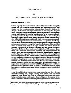
Swans Crossing! The Square, Killorglin 1950s
This brochure was designed and produced by
Walk around the town of Killorglin as we try to cover with you its history and folklore. The distance, including a tour of Dromavalla graveyard, could be 3 miles/5 km. Allow yourself 1.5 to 2 hours, with stops at points of interest.
16
Killorglin Town History Trail
FURTHER READING/SOURCES:
Follow numbers on map on pages 8 & 9 Tom Doyle, The Civil War in Kerry (2008)
1 Let’s begin our tour on the main bridge, the Laune Bridge, where we get a sense of the town’s pre-history. A crossing-point on a salmon-rich river in a fertile valley must have attracted early man. The earliest reference in the Annals records the defeat of a Viking force on the banks of the River Laune in 915AD.
Tom Doyle, The Growth and Development of Killorglin town in the 19th Century (publication pending) Kieran Foley, History of Killorglin (1988) Michael Houlihan, Puck Fair History and Traditions (1999) Patrick Houlihan, Cast a Laune Shadow – Reminiscences (1997)
From your position on the bridge however, you can see some evidence of the early dwellers. Looking upriver (south), behind the cream/yellow house on the left, the grove of trees on the skyline almost hides a ring fort which the maps show under the name Foilnagower (Faill na nGabhar, the cliff of the goats). The cliff must have extended to the river before the present road to Killarney was built. The Killorglin area, on both sides of the river, has a concentration of earthen ring forts, fortified dwelling places that are up to 2,000 years old. Many, including Foilnagower, have souterrains, underground passages and chambers, now closed to avoid danger to animal and human. We can discount the old belief that the passages connected under-river.
Terence Houlihan & Billy Browne, Saint James and Father Tom (2004) Killorglin History & Folklore Society, Cois Leamhna – Monuments, Milestones and Memories (1984) Pat O’Shea, Trail Blazers – A Century of Laune Rangers 1888:1988 (1988)
Any of these books out of print (a number are) can be read at Killorglin Library.
Other Heritage Trails around the town of Killorglin: The Laune River (leamhain, elm) drains the Lakes of Killarney and it is tidal to a point well above this bridge. All this stretch of water and adjoining land, west through Castlemaine Harbour to Inch Point, is an SAC (Special Area of Conservation). On the right bank of the river upstream is the marsh, a wildlife area. The resident swans no more than hint at the amount of birdlife that exists out the harbour. Otters sometimes are seen playing in the river.
The marsh also holds the Ardmoneel Stone, a cross-inscribed boulder (main inscription: a triple-armed cross contained within a rectangular frame) which is not
Astellas Riverside Trail Railway Bridge Trail Ballykissane Pier Trail These leaflets can be downloaded from www.killorglintidytowns.com It is also possible to take a short stroll along the banks of the Laune via the Mill car park on Annadale Road. For other walks see walk leaflet left - available from the Library, Tourist Office and County Kerry Local Area Offices in Library Place.
2
15
(30ft) high stand to preside over the fair where "humans act the goat and the goat acts the king". The three days, marking the fact that people traditionally assembled from all over the south-west of Ireland, are named The Gathering Day (a horse fair), The Fair Day (a cattle fair) and The Scattering Day. Traditionally, the public houses remained open throughout the nights but, in recent years, opening times have been restricted. There are still enough hours to provide the necessary lubrication for what remains a lively carnival where ‘people meet people’.
easily accessed. The belief is that this is not the original site but that the stone was being transported on the river, perhaps from/to the monastic site of Innisfallen on Killarney’s Lower Lake. The Laune River featured in Killarney history later; it is claimed that in 1652 Cromwellian troops brought boats upriver, leading to the surrender of Ross Castle.
In 1756, Dr Charles Smith visited and noted that crossing of the river was at low tide only. A bridge erected shortly afterwards, a wooden structure resting on 14 stone piers, was in such a bad state by 1881 that a watchman was on duty to warn the public. As you can see on the memorial tablet, the present bridge was opened in 1885.
Nobody can be sure when the annual event began. There is the story that a fleeing herd of goats, led by a magnificent puck, warned the townspeople of approaching Cromwellian soldiers. It is much more likely that the origins lie in pagan fertility celebrations. The earliest written record is the patent of 1613 when Jenkin Conway was given permission to hold a fair "on every Lammas day and two days later". The belief is that this was to continue a fair already in existence. It's a pity but we are out of time/space for further comment and we must end our tour together here. You can of course decide to explore parts of the town not covered already.
© Seán Ó Súilleabháin 2012 ——————————————————————————————
Photos: Ann O’Sullivan & Rosie Magee Cover - Dromavalla Grave Yard Page 2 - County Bridge, Killorglin Page 4 - detail, Blennerhasset Tomb, Dromavalla Page 6 - detail, Mill Building, Annadale Road
The ancient tradition of commercial salmon fishing continues, although obviously fish numbers are much lower in recent years. The Fishery buildings seen from the bridge are owned by KRD Fisheries, successor to a partnership formed in 1849 by Keyes, Ronayne and Dodd to continue the Dodd interest in the fishery dating from the 18th century. The best of smoked wild Atlantic salmon, exported throughout the world, can be purchased there.
Still looking upriver (south), the hills that dominate the skyline are Na Cruacha Dubha (the black pinnacles) or the MacGillycuddy’s Reeks, Ireland’s highest mountains. From this point, what appears to be the highest summit is Beenkeragh (beann caorach, peak of the sheep), 1,010m/3,314ft high. It hides the true summit, Carrauntoohil (Corrán Tuathail, inverted sickle or serrated peak) which stands at 1,039m/3,414ft.
North, your view is of the ‘metal bridge’, almost all that remains of the railway line between Farranfore and Killorglin, also opened in 1885. The improvement in the infrastructure did much to boost the commercial life of Killorglin. Weekly markets and monthly fairs remained important into the 1960s. Behind the bridge can be seen the Slieve Mish mountains, a line of hills that runs west along the Dingle Peninsula. The Laune Bridge acts as gateway to the Ring of Kerry, the world-renowned scenic motoring route that encircles the coastline of the Iveragh Peninsula.
Page 11 - Niamh by Pauline Bewick Page 14 - King Puck
Before you leave the bridge, you will have to inspect the riverside seating area, Faiche Rí an Phoic (Green/Lawn of King of Puck) and the 12 plaques honouring ‘The
Page 16 - Swans on Market Square, 1950s
14
3
Puck Poets’, 11 plaques containing the words of poems and songs. Dominating all is the King Puck statue with 3 plaques that give information on the annual festival.
capture the barracks then occupied by the Free State troops. The plan backfired literally, when the mine placed against the barrack wall blew back, setting fire to the house occupied.
2 Look east now through the lines of houses with three names [Laune View; St. Mary’s Terrace; and the townland name, Dromavalla (drom a’ bhaile, (hog’s) back of the town)] to see the ivy-clad ruins of a ruined church. Access can be through the Terrace (an awkward climb over the graveyard wall) but it’s best to walk to the main entrance (beside the former creamery, now an agricultural supply store) off the Tralee Road.
The church ruin has not been dated but it obviously is old and your inspection will confirm that sections were built at different times. The church may have been a parish church erected by the Augustine Friars from Killagha Abbey in nearby Milltown. There is a tradition that the friars had a hospital or refuge for lepers in Killorglin.
That church may have given the town its name. Cill is church. Old manuscripts refer to the place as Cill Forglonn (1215) and Kell Orglann (1261) but the second element of the names is meaningless to us now. Prof. Donnchadh Ó Corráin of Killorglin and University College Cork suggests that (on the basis of older residents’ pronunciation) the original may have been cill thar gleann, the church across the glen.
If you have detoured to visit Dromavalla graveyard at this stage, you can take extra time to inspect the Blennerhassett family tomb (obvious at the west end, surrounded by a wrought iron railing) and the republican monument (a Celtic cross, with the legend in Gaelic at the southern side of the graveyard) which marks the grave of two of those drowned at Ballykissane in the first deaths linked with the Easter Rising of 1916 (Charlie Monahan, Belfast and Donal Sheehan, Newcastlewest; Con Keating was buried in his native Cahersiveen).
4
10 Rounding the corner into The Square and Main Street, we first can look up/travel onto Langford Street, once the main line into town from the south/east. It was named after landlord William Langford-Rae. There were no houses on it in 1812, the core streets then being Main Street/The Square and Upper Bridge Street. By 1841 there were 25 buildings in Langford Street.
On the site (left) now occupied by O’Neills public house stood the Killorglin Constabulary Barracks, ‘the Wooden Hut’, built 1836-’37. The barracks was transferred to the site (in the Square), now the Employment/Social Protection building, earlier O’Donovan’s public house, later again the Oisín Cinema. In the 1890s, it was transferred to the current Barracks site, one that gave the RIC (Royal Irish Constabulary) a commanding view of a number of streets. Langford Street had two houses for married quarters for the RIC and in the late 1890s, Tom Barry (freedom fighter and author of Guerrilla Days in Ireland) lived as a boy in one of them.
A short distance up, on the left, is what was originally the Butter Market building, later O’Sheas Wool Stores. It was used as a temporary chapel while the RC church was being built (1888-’91).
Further up Langford Street, on the left, is a housing development named The Paddocks, marking the fact that the lower side of the street was the site of the fair/ market green until moved to Mill Road/Market Street. Further on, on the left, is the FEXCO IT and Teleservices Centre and beyond it the community Sports Centre followed by the Killorglin Community College.
The Square itself (you can see that it's a triangle!) links all ages as Puck Fair, centred there, continues a tradition with origins lost in history. However deserted or busy it seems when you arrive, this area really comes to life on August 10, 11 and 12 each year when the Fair is held. A puck goat is crowned and placed on a 10m
13
9 What was the goods store is now the headquarters of FEXCO, the computerbased international financial services company. A plaque noting the connection stands in front of FEXCO Centre and there is a video presentation in the FEXCO Reception area recording the extension of the railway to Valentia Harbour 1890’93. The full branch line (Farranfore-Valentia Harbour) was closed in January 1960.
The solicitor’s office, further on, on the right, was the Stationmaster's residence. The Manor Inn, opposite, was built as the Railway Hotel (1886-’87).
Still further on, the new Church of St. Michael occupies the site of the passenger building and platform. When built (1997) it was the first new Church of Ireland church built in an existing parish since the foundation of the State. If you travel further west, you can just make out the line of the railway (in the field on the left behind Melrose Grove) as it continued west towards Cahersiveen. Opposite on the hill is "The Academy", the Intermediate School which until recent years occupied the Carnegie building seen earlier.
The Laune Rangers GAA (Gaelic football) pitch is some distance on. It is named the J P O’Sullivan Memorial Park in honour of a noted Killorglin Gaelic footballer. It was formerly a greyhound racing track and still called ‘The Track’ by some.
Turning around to retrace your steps, you will note on the right the fire station. Behind it used to stand the first purpose-built mountain rescue station erected in the Republic. Kerry Mountain Rescue Team was formed in 1966 and in the early days was largely manned by members of the local mountaineering club. The hills of Kerry, in particular the Reeks seen from all parts of the town, act as a magnet to those without experience of high ground. Sadly, this has resulted in many deaths and injuries. Be warned, if today's expedition gives you an appetite for more ambitious walking!
As we leave the Bridge, at the start of Lower Bridge Street, you can see on the right the premises inscribed ‘J M Coffey’s Bar’, no longer a licensed public house. The second inscription, ‘Laune Rangers founded here in 1888’, commemorates this as the site where a group of Killorglin sportsmen met to transfer allegiance from the game of rugby to the newly-formed Gaelic Athletic Association (GAA).
3 We now move to the junction at the bottom of the hill where development took place in medieval times. Local folklore suggests that a cluster of fishermen’s huts first occupied Cnocán na gCeap (the hillock of the lasts or perhaps of the tree stumps), the hill that now has become part of the main street.
Behind the red brick and white building (what used to be Bank premises, still sporting the legend ‘Established 1825’) you can see the ivy-clad ruins of Castle Conway. The manuscript of 1215 refers to a Norman castle in Cill Forglonn. The records show that it was destroyed by McCarthy following the Battle of Callan (1261). The first stone castle on this actual site may have been built shortly after Jenkin Conway was made custodian of Killorglin castle by Queen Elizabeth 1 in 1587, the grant of ‘the castle and lands of Killorgan’ being confirmed in 1592. By 1600, it had been burned evidently in the course of the Nine Years War. The fortified tower house, now in ruins, was built by Capt. John B Conway in the late 1690s/early 1700s. It was an admired feature of Killorglin in the 18 th century, as were its terraced gardens running down to the river. Griffiths Valuation noted it to be in ruins in 1853.
Back at 'Tobins’ Corner', we go right into Upper Bridge Street. This was one of the sites of the civil war Battle for Killorglin (September 1922) when members of the Republican forces burrowed through houses on the right in an attempt to
Aside from Father James Luony, P.P. who occupied the habitable section of the then deteriorated building up to his death in 1844, the last permanent occupant of Castle Conway was Harman Blennerhassett, a descendant of the Conways (following a 17th century marriage to a Cromwellian, Robert Blennerhassett). Having gone against his own class by becoming a United Irishman while at Trinity College Dublin, Blennerhassett decided to sell the Killorglin estate and depart for the land of liberty, the developing United States of America. There, he gained prominence by opening stores in the outback, the then frontier states of Virginia and Ohio. He also had a fleet of ships trading on the Ohio River and in 1800, he and his wife Avice built a magnificent mansion on an island on the river. Blennerhassett’s contribution to USA history came to prominence in research some years ago into the Burr Conspiracy which was hatched in his mansion. As a result of his
12
5
participation, he lost what remained of his fortune. Nonetheless, the claim can be made that Killorglin money helped to open some of the frontier states of America!
Standing on the opposite (SW) corner is the Bianconi Inn. What was Timothy Curran’s public house in the early 19th century and known as the Laune House up to the late 1900s now is renamed to commemorate the use of the premises for an overnight stop (and change of horses) for the Bianconi Transport Company that opened service between Killarney and Cahersiveen in 1836, a 5 hour journey by two -wheeled jaunting car allowing for the change of horses at Mountain Stage.
Annadale Road leads (south) from the junction to Beaufort and Glencar. Just a short distance up on the left is the Old Mill, built by Arthur de Moleyns in the late 1860s as a sawmill. The pillar on the right (opposite) supported the viaduct that carried water many miles from the upper Cottoners River. It is recorded that on opening day when all the dignitaries were assembled, the water released by floodgates at Farrantoreen was insufficient to drive the machinery. Power then was by steam engine.
4 You will find behind the Bianconi Inn and Nick’s Restaurant (on the hill) the former Anglican/Episcopalian church of St. James, erected in 1816 and virtually rebuilt in 1868. It now is a tapas bar, Sol y Sombre. When still in use as a church, it had a tablet to Rev. William de Moleyns, vicar of the church during The Great Famine which affected Ireland between 1845 and 1850. The effect on Killorglin and area was far less than it might have been, due to the co-operation between Rev. de Moleyns and the Catholic priest, Rev. Eugene (Owen) O’Sullivan in organising the people and advocating their case with the authorities. Rev. de Moleyns dedication to relief work extended to proposing increases in property rates, despite the fact that he himself was a landowner.
6
there at any time for sale. Currently, Kerry Co Council is extinguishing some rights and designating a trading area. However, the right to the traditional quarterly fairs is being preserved, mainly for the sale of horses. The traditional use for amusements during Puck Fair also is being preserved.
The KCYMS (Killorglin Catholic Young Men’s Society) building on the left replaced a building where electricity was generated for Killorglin from the early 1900s until the national network reached the town.
8 We continue now to the top of the Mill Road and through ‘Tobins’ Corner’. The building occupied as ‘The Crystal Cave & Bookshop’ once belonged to the Tobin family and the name has stuck, at least for the older generation. On the right is School Road leading to Sunhill, with the old National Schools on the left some distance up and the new school on the right on a site communicating with St James RC Church. What once was a hump-backed bridge that took the road over the railway line now is almost levelled.
Straight on is the street with two names – Iveragh Road, known to locals as the Bog Road. This arises from the perception of the quality of land in the parish. ‘Over the Laune’, where you started in Dromavalla, is better limestone land. That to the south and west of the town is acid, boggy soil, from which a living was and is wrung with much effort. Of course, there is also much bogland (blanket bog) where turf (peat) is still cut for use as domestic fuel, not yet subject to the ban on cutting on raised bogs.
As you go west on the Bog Road on your theoretical journey through history, you meet the technology of modern times. All the ground on the right hand side was occupied by the railway, opened 15 January 1885, Killorglin then being the terminus. Library Place, the new complex which holds the local authority offices and public library, sits on the site of the water tower and turning-table. As you can see, the Bewick Art Collection is on display, well worth a visit. The open space is a pleasant assembly, seating and concert area. 11
6
5
We turn left now onto Mill Road and the Roman Catholic church of St. James the Great. The site originally had a poor thatch-roofed one on an east west axis, extended with two new wings (1837) as well as two schools (1839) by the renowned Fr James Luony. The foundation stone for the present church, cruciform -shape on a north south axis, was laid in 1888. Two years later, the builder became bankrupt and a new builder had to be found. In May 1891, the church was dedicated and came into use. However, work was still in progress in 1909. Admiring the inside will help you to understand the achievement of what must have been an extremely pauperised congregation directed by the indefatigable pastor, Rev Thomas Lawlor (‘Fr Tom’). While the original design allowed for a spire, funds did not extend to fitting it and the church still lacks this focal feature.
Returning to the crossroads, you now can walk up the New Line, built in the 1830s to give access to the RC Church. Locals still know it as Crows’ Road but the risk of bombardment is less now that the elm trees have disappeared. On the left above the road stand the Carnegie Building (originally a Carnegie funded library; later the Intermediate School; now a community Day Care Centre) and the terrace of houses named Árd na Leamhna (Laune Height). While work was in progress on these houses, skeletons and bones were discovered. This substantiates the theory that the medieval Protestant church and burial ground serving Castle Conway was in this area.
7 You can read the tablet on the monument opposite the church. This was erected by the Kerry Militia to commemorate one of its officers Townsend Blennerhassett, credited with sacrificing his life in a boating accident in an attempt to save that of a tenant. This may not be the full story. Folklore suggests that two boatmen were on a joint smuggling expedition.
Along Market Street, which connects back with Main Street, can be seen the courthouse (recessed, completed 1869), the front side of the Carnegie building noted already and the former Wesleyan Church, also completed in 1869, now an arts centre, the Chapel on the Hill.
Mill Road where you stand had buildings on both sides when the Ordnance Survey map of 1854 was produced but only on West side in the 1894 version. The explanation is that the Fair Grounds were relocated here by landlord Lord Ventry on the coming of the railway and in turn a terrace of 25 houses was built in Langford Street. The 1894 map confirmed the open area on the left as Cattle Market and showed the Toll House that stood there until the 1950s. It is still called The Fair Field, known also to some as The Old Orchard. Tradition is that apple trees stood there but there also is the possibility that the name came from an archery that served Castle Conway. Street fairs have largely died out but (according to a legal opinion obtained by the Killorglin Community Council some years ago when acting to preserve the open space) a person has the right to stand an animal
10
The sculpture piece on the right was erected as the art element of the contract for the water purification plant below. I thought originally that the design was a goat’s hoof, paying homage to Puck Fair but have been told that the circle represents the Ring of Kerry while the centre-piece represents the encircled mountains. No doubt that was obvious to you at first glance.
As mentioned already, the first deaths of the Easter 1916 Rising that led to the War of Independence occurred in Killorglin. Four men were travelling on that Good Friday towards Cahersiveen with orders to destroy or secure radio equipment. Having driven up the New Line, instead of going left into Mill Road, the car went straight on as far as, and over, Ballykissane Pier. Three were drowned, the only survivor being the driver who was pulled from the car.
Ballykissane Pier is worth a visit, now or later, to view the monument there. Killorglin Port, through the Ballykissane and satellite piers, functioned up to 1854 when the railway, then terminating in Killarney, supplanted it. Nevertheless, coal boats continued to come into Ballykissane up to the 1950s.
If you like to gather trivia, you can note that the place name Ballykissane gained an extra syllable to produce the name for the TV series Ballykissangel. The author, Kieran Prendiville, with strong family connections with this area, spins stories coloured by his childhood experience of Killorglin and Glenbeigh nearby. It is said that Kieran wished filming to take place in Glenbeigh but a location on the east coast of Ireland was chosen for logistical reasons. Look at what we lost in terms of publicity!
7
Killorglin Town History Trail Map
8
9