Available online at www.sciencedirect.com
Procedia Computer Science 00 (2013) 000–000 www.elsevier.com/locate/procedia
2013 International Conference on Virtual and Augmented Reality in Education
3D Outdoor Augmented Reality for Architecture and Urban Planning Arnis Cirulisa*, Kristaps Brigis Brigmanisb Virtual and Augmented Reality Laboratory, Sociotechnical Systems Engineering Institute of the Vidzeme University of Applied Sciences, Cesu str. 4, Valmiera, Latvia, LV-4200
T
a,b
AF
Abstract
R
The aim of this paper is directed in field of architecture and urban planning process improvement, by allowing more precise evaluation of new constructions and objects look and visual influence on environmental surrounding. Nowadays there are several solutions for city visualization in virtual reality which provide wide functionality, including spatial visualization. Despite all modern technologies, which provide photorealistic models on stereoscopic monitors and screens, it is still noticeable barrier among virtual buildings and buildings in real environment. To enhance the immersion level of urban planning solution, main task is to find a way how to use augmented reality to allow urban planning experts move around the city streets and project virtual three dimensional buildings, allowing to see real city and virtual buildings at the same time. © 2013 The Authors. Published by Elsevier B.V. Selection and/or peer-review under responsibility of the programme committee of the 2013 International Conference on Virtual and Augmented Reality in Education.
D
Keywoards: Virtual reality (VR); augmented reality (AR); markerless tracking; urban planning.
1. Introduction
Due to rapid development of virtual and augmented reality technologies, due to improvements of performance parameters and increase of technologies availability, it is important to discover new innovative approaches of technologies usage in different branches. Architecture and urban planning has an essential role in our lives and fundamental contribution can be delivered to this field of specialization by modern technologies like augmented reality (AR). It is important to provide wider use of qualitative AR technologies solutions, to come out of narrow scope of usages, mostly based on two dimensional data depiction or marker based systems.
* Corresponding author. Tel.: +371 28301333 E-mail address:
[email protected]
Arnis Cirulis, Kristaps Brigis Brigmanis / Procedia Computer Science 00 (2013) 000–000
Depiction of three dimensional (3D) data is crucial for urban planning stages and using AR technologies it is possible to achieve more precise evaluation of new constructions and objects look and visual influence on environmental surrounding.
R
AF
T
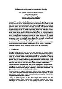
There are already available solutions for city visualization in virtual reality, but to achieve better results and improve immersion level of planning process, AR technologies are a key, providing endless possibilities, however not all ideas can be reached immediately, and still lot of work and research should be done for AR logical and physical structure. Although Furht [1] bring forward four types of applications that are most often used for AR research and these applications are advertising and commercial, entertainment and education, medical, and mobile applications for smartphones. For all that Furht [1] also encourage new directions, because there are many possibilities for using AR in an innovative way and also new challenges AR is facing to go from the laboratories to the industry. In this paper the innovation is based on development of application City 3D-AR for urban planning, allowing to merge real city with virtual three dimensional (3D) buildings (Fig. 1).
D
Fig. 1. Bus station augmented with new building for urban planning and public discussions
To enhance the immersion level of urban planning solution, main task is to find a way how to use augmented reality to allow urban planning experts move around the city streets and project virtual 3D buildings, allowing to see real city and virtual buildings at the same time. Beneficiaries are architecture centres, local authorities, companies of architects, art institutions, municipal archives, museums, and market parties. But not only, as Allen et al. [2] proved, such interactive solutions are great way to increase public participation in urban planning processes, only functionality of the system should be limited, so the users be able to view the available 3D models and vote for the models according to personal preference. The idea is to keep the functionality to a minimum in order to limit any confounding factors in the user experience of the system. As such, the graphical user interface (GUI) had to accommodate these functions in the most direct, user friendly way possible. Additionally, the physical structure and immersion level also plays a role, professionals could have expensive head mounted displays (HMD) with AR support and wearable computer, common users can use tablets for more reasonable prices (Fig. 1.), however latest achievements in HMD development from Vuzix [3] offer light way and high performances HMD sets, which have tendency to decrease price year by year. And
Arnis Cirulis, Kristaps Brigis Brigmanis / Procedia Computer Science 00 (2013) 000–000
good evolution direction, is that HMDs with AR functionality for mobile devices appears, meaning comfortable replacement for wearable notebook solutions. The main challenges of this paper and the project City 3D-AR are depiction of bulky three dimensional objects in outdoor environment, buildings position detection that depends on participant's distance and viewing angle. Traditional approach with fiducial markers cannot be used; it is suitable for indoor solutions in short distances. Project Work Executed at Sociotechnical Systems Engineering Institute of the Vidzeme University of Applied Sciences, Virtual and Augmented Reality Laboratory. Two basic sets of hardware and software were used. The first set consists of tablet PC (Asus Transformer Pad TF300TG) with Android operating system, integrated position sensors, and visualization software libraries (more detailed in last section). The second set contains notebook (Asus G71Vseries), head mounted display with functionality of augmented reality (Vuzix Wrap 920AR), USB positions sensors (OceanServer evalution kit OS5000, Phidgets GPS and Spatial 3/3/3), gyroscopic mouse (Logitech MX Air Mouse) and VR/AR authoring platform (3DVIA Virtools) with building blocks for AR support.
T
2. Merging real and virtual environments on mobile devices
D
R
AF
The history of necessity to merge real and virtual environment is longstanding, however definitions are formulated just in last decades. If the first approaches of mixing real and virtual appeared in cinematography in 1950s, then definition appeared only in 1997 by Azuma [4]. History facts are summarized by Kent [5], and the first entry devoted to cinematographer Morton Heiling, who created Sensorama simulator in 1957, this simulator was patented and provided visuals, sound, vibrations and smell. The AR term appeared only in 1990 by Tom Caudell whose work was related to aircraft maintenance works. Azuma's definition [4] in 1997 prescribed AR as combination of real and virtual worlds in 3D with real-time interaction capabilities. Despite this definition, most of nowadays AR applications still offer real worlds augmentation with two dimensional data. Most of applications from Google Play and Apple's App Store for Android and iPhoneOS based smartphones and tablets provide two dimensional information. For example, text or image based descriptions or instructions, navigation arrows and instructions, or poorly interactive marker solutions with 3D object integration. Rapid growth of mobile devices usage and also technological leap of supported features makes professionals to think over new solutions in different economic sectors. Modern mobile and entertainment AR systems use one or more of the following tracking technologies: digital cameras and/or optical sensors (Nintendo Wii, Sony PlayStation Move, Microsoft Kinect), accelerometers, GPS, gyroscopes, solid state compasses, RFID and wireless sensors. These technologies offer varying levels of accuracy and precision. By Kent's literature analysis [5] most important is the position and orientation of the user's head. Tracking the user's hand(s) or handheld input device can provide 6DoF interaction technique. In Furht's turn [1] performance is relevant consideration. In spite of rapid advances in industry of mobile devices, their computing platform for real time imaging applications is still rather limited if done using cell phone's platform. As a result, many applications send data to a remote computer that does the computation and sends the result back to the mobile device, but this approach is not well adapted to AR due to limited bandwidth. Nevertheless, considering the rapid development in mobile devices computing power, it can be considered feasible to develop real-time AR applications locally processed. This Furht's conclusion [1] confirmed a choice for City 3D-AR pilot product use the tablet PC with camera and already integrated sensors. More immersive solution with Vuzix AR HMD will be developed after development of theoretical model and working portable tablet solution. The usefulness of mobile devices use is also affirmed by Lee [6]. Mobile computing devices have been widely deployed to customers; the interest in mobile AR is increasing. As the need for mobility is growing, computing devices shrink in size and gain acceptance beyond an audience of tech-savvy specialists. With the help of enhanced
Arnis Cirulis, Kristaps Brigis Brigmanis / Procedia Computer Science 00 (2013) 000–000
computing power, small devices have sufficient computational capability to process complex visual computations. For example, a cell phone with a camera and wide screen can serve as an inexpensive AR device for the general public. Emerging wearable computers are also excellent platforms for enabling AR anywhere users may go. 3. Technologies and approaches of augmented reality (AR)
T
Today, image processing and computer vision technologies have been progressed to a stage that allows us to infer the 3D information of the world directly from the images. Because of the success of these technologies, more and more vision-based AR applications are emerged. Augmented reality refers to the combination of virtual objects and real-world environment, so that users can experience a realistic illusion when using the interactive virtual object to explore the real-world environment [7]. Several technologies and approaches of augmented reality implementations are available today. These technologies can be divided in two basic groups: marker-based systems and marker-less systems. Kan et al. [7] explains marker-based systems by use of specific marker for 3D tracking and positioning. This marker is employed to identify the corresponding virtual object that is to be placed in the real-world environment. When the marker is used as a tracking target, it has to be registered in the system in advance, as well as the virtual objects it associates with. However, since the registered information is independent for different AR systems, markers used in one system may not be applied in another system, unless an additional registration procedure is applied. For that reason in effective way RFID technologies could be used. Ginters et al. [8] introduced AR-RFID low cost visualization solution for logistics.
D
R
AF
To visualize the items in the storehouse which must be moved to assembly bay the AR-RFID solution is used ensuring additional possibilities of checking. That allows reducing the amount of potential errors and diminishing possible losses. RFID scanner reads the component code and 3D model of the item is visualized on the screen. AR-RFID by Ginters et al. [8] eliminates the problem of generating an equally stable and recognizable fiducial marker, because single marker is used only for tracking, not to recognize the 3D model. This makes it possible to use single marker with the highest stability. To identify the 3D model, an identification code, which is read from the RFID tag, is used. The 3D model is found using the identification code and displayed on the screen of the tablet PC. As well considerable marker-based version is described by Kan et al. [7] how traditional fiducial markers are replaced by QR codes, allowing to use AR in public domain systems. The QR code can be easily generated by any user and the AR system can track it no matter what the information it embedded. Thanks to FullHD video cameras and increase of computing performance, it is easier to pull down traditional marker restrictions, Seac02 company offers in its authoring platform LinceoVR to use self-taken photos as markers, providing limitless object-marker alignment options also solving the problem with fiducial marker hiding, which sometimes influences immersion level, if it is visible. The second AR technologies group is based on marker-less solutions, meaning that marker-less pose trackers mostly rely on natural feature points which are visible in the users environment. Four requirements are summarized by Herling and Broll [9] to allow accurate pose determination from natural points. These requirements are as follows: fast computation time, robustness with respect to changing lighting conditions and image blurring, robustness against observation from different viewing angles, scale invariance or changing viewing distance. Numerous feature detectors have been proposed providing different properties concerning detection robustness or detection speed. Herling and Broll [9] divides exiting detectors in two classes: corner detectors spotting corner-like feature, blob detectors not spotting unique corner positions but image regions covering blob-like structures with a certain size. Unfortunately these marker-less solutions cannot be used for new building layout in vacant environments and urban environments. They are more suitable for existing buildings and objects real-time overlay with additional data. In next section sensor marker-less tracking will be introduced as most appropriate solution for outdoors environments (not separate objects) augmentation.
Arnis Cirulis, Kristaps Brigis Brigmanis / Procedia Computer Science 00 (2013) 000–000
4. New usage possibilities and necessities of AR
AF
T
Demands of real life scenarios and AR offered possibilities not always fall together. In this section GPS, electronic compasses and inertial sensors will be introduced as the most versatile devices set to provide virtual and real object tracking and placement capabilities in AR scenarios. As given by Reitmayr and Drummond [9] these technologies have drawbacks as well. While GPS has satisfactory accuracy and performance in open spaces, its quality deteriorates significantly in urban environments. Both the accuracy and the availability of GPS position estimates are reduced by shadowing from buildings and signal reflections. Similarly, inertial sensors are prone to drift and magnetic sensors are disturbed by local magnetic fields encountered in urban environments. However worldwide practice indicates that most use occasions in public and professional domains have GPS and other local sensor related technologies. Most commonplace in public obtains AR applications developed for urban exploration, museums, travel and history, shopping, customer service, safety and rescue operations, moving and decorating home. Already well known applications are Wikitude, Nokia City Lens, Google Goggles and Metaio Junaio. The beginning of theoretically similar solutions, were introduced in Azuma's research on virtual labels over outdoor landmarks in 1999 [11] and Thomas et al. ARQuake game in 2000 [12]. What still lack in available applications, is the depiction of marker less still or moving 3D objects. Today's sensors capabilities in stability and precession have noticeably improved. For example, GPS accuracy [13] is increased with differential GPS or DGPS which brings the accuracy of readings to within 1-3 meters of the object, as compared to the 4-20 meters of normal GPS. DGPS works using a network of stationary GPS receivers. The difference between their predefined position and the position as calculated by the signals from satellites gives the error factor. This error component is then transmitted as a FM signal for the local GPS receivers, enabling them to apply the necessary correction to their readings. Or Real Time Kinematic (RTK) satellite navigation is a technique used in land survey and in hydrographical survey based on the use of carrier phase measurements of the GPS, GLONASS and/or Galileo signals where a single reference station provides the real-time corrections, providing up to centimetre-level accuracy. Nonetheless most research work in AR community is devoted to video sequence analysis, model-based tracking and hybrid solutions [6, 10, 14, 15, 16, 17, 18, 19].
D
R
Last section reveals algorithm and formulas used for City 3D-AR project, in which augmentation with 3D models and sensors is accomplished, considering it as future widespread solution in different domains. The importance of such solution for cities and urban planning is affirmed by Netherlands Architecture Institute and their first implementation in UAR (Urban Augmented Reality) project. 5. Implementation of City 3D-AR for urban planning efficiency improvement The main goal of a pilot product City 3D-AR is to provide 3D object placement in real space, using GPS longitude and latitude coordinates. Physical structure is given in figure 2. Also viewers or participants GPS coordinates are measured all the time, to support participant's movement and automatic 3D objects transformations, rotations and scaling according to new angle and distance of a view. Live video stream is provided from integrated tablet video camera or two cameras in HMD case, where separate cameras are used for each eye to support stereoscopy. GPS sensor is used for participant's location calculation in 3D space, because in current version is assumed that single 3D object (building) is still, but participant can change location. Digital compass is used for sight direction detection and field of view calculations, but gyroscopic sensor for tablet or viewers head orientations. Database of 3D objects is necessary to provide an ability to change different architectural buildings in chosen spot. Selection of colour, material and shader properties should be provided as well, to offer more interactive AR environment. For now simple 3D
Arnis Cirulis, Kristaps Brigis Brigmanis / Procedia Computer Science 00 (2013) 000–000
object formats are supported, like OBJ and OFF. 3D buildings data base and formatting options
Live video capture: tablet video camera or AR HMD cameras
3D object import Video layer Object layer Object rendering Data gathering Size calculation Position calculation Natural immersion
Output device: -tablet screen -AR HMD Input device: -touch screen -gyro mouse -data glove
T
Sensors: GPS; compass; gyro
Software modules
AF
Fig. 2. City 3D-AR physical structure
User uses his visual sense, to receive information from augmented environment, for interaction he can use tablet's touch-screen, or other portable, wireless devices, like gyroscopic mouse or data glove for simple selection operations. Detailed achievements of City 3D-AR results are available in flow chart (see Fig. 3).
D
R
As mentioned in introduction, the first version is realized on AdroidOS tablet PC Asus Transformer Pad TF300TG. AndroidOS includes support for high performance 2D and 3D graphics with the Open Graphics Library (OpenGL), specifically, the OpenGL ES API. OpenGL is a cross-platform graphics API that specifies a standard software interface for 3D graphics processing hardware [22]. For software development AndroidSDK and Eclipse (Juno) with Android Development Tools (ADT) plugin is used. For 3D object depiction in block nr. 2 OBJ and OFF file formats are used, for drawing both formats Android model viewing application's ModelView code [20] is used. For video (block nr. 8) and 3D model (block nr. 14) data depiction two panels are used which overlay each other in full screen mode. In bottom (SurfaceView class) there are data from video camera and above it 3D model data (GLSurfaceView class). GLSurfaceView is an implementation of SurfaceView that uses the dedicated surface for displaying OpenGL rendering [21] and solves transparency problems. In 3D object's properties value for unit of measurement should be converted in meters, to gain natural size for the building.
AF
T
Arnis Cirulis, Kristaps Brigis Brigmanis / Procedia Computer Science 00 (2013) 000–000
Fig. 3. City 3D-AR detailed flow chart
R
As the reference point and the centre of whole coordinate system tablet PC is used. In calculation process of tablet PC's GPS coordinates and objects reference coordinates and direction angle in degrees, the local orientation towards North of tablet PC is taken into account. For distance calculation d between two GPS points (block nr. 9) haversine formula is used [23]:
D
a = sin²(Δφ/2) + cos(φ1) * cos(φ2) * sin²(Δλ/2) c = 2 * atan2(√a, √(1−a)) d=R*c
(1)
where φ is latitude, λ is longitude, R is earth’s radius (6371km) To gain higher precision between two GPS points Vincenty's formula [24] could be used which is used in geodesy and is based on two related iterative methods to calculate the distance between two points on the surface of a spheroid, developed by Thaddeus Vincenty. They are based on the assumption that the figure of the Earth is an oblate spheroid, and hence are more accurate than methods such as great-circle distance which assume a spherical Earth. For direction θ calculation between current GPS position and object's reference GPS point (block nr. 10) bearing formula is used [23]: θ = atan2( sin(Δλ)*cos(φ2), cos(φ1)*sin(φ2) − sin(φ1)*cos(φ2)*cos(Δλ) )
(2)
Arnis Cirulis, Kristaps Brigis Brigmanis / Procedia Computer Science 00 (2013) 000–000
OpenGL functions [21, 22] for actual transformations, rotations and scaling are used: glRotatef(float angle, float x, float y, float z) glTranslatef(float x, float y, float z) glScalef(float x,float y,float z) where accordingly the current matrix is multiplied by a rotation matrix, current matrix is multiplied by a translation matrix and current matrix is multiplied by a general scaling matrix. Also OpenGL [22] successfully solves issues related to visible/invisible edges and sides. 6. Conclusions
R
Acknowledgements
AF
T
Depiction of three dimensional (3D) data is crucial for urban planning stages. Importance of new technologies usage is indisputable. By precise prediction of new architectural objects look and influence on surrounding environment, lot of financial resources can be economized before constructions works are started or completed. Also ease of public interests integration in discussion process can improve population satisfaction and share decision making process. Application City 3D-AR for urban planning, allowing to merge real city with virtual three dimensional (3D) buildings and its logical structure can be implemented in different physical structure solutions. By using geodesy, trigonometry computations, graphics libraries, are carried back AR technologies which physical structure is based on GPS, gyroscopic, compass and inertial sensors. The above-mentioned solution is still far from a real use for professional application and validation under urban planning requirements is continuing, but these are perspectives for the nearest future. Also software modules set developed and merged, serves as an experimental platform for future work, to ascertain actual and effective use cases, considering viewing distance, movement speed, density of buildings, performance issues, models complexity.
D
The current article was prepared in the framework of Valmiera Municipality Grants to Vidzeme University of Applied Sciences in 2012 “Virtual buildings outdoor visualization for urban planning”.
References
Furht B. Handbook of Augmented Reality. Florida Atlantic University: Springer; 2011 Allen M, Regenbrecht H, Abbott M. Smart-phone augmented reality for public participation in urban planning, in: Proceedings of the 23rd Australian Computer-Human Interaction Conference, Dunedin, New Zealand, ACM, 2011, pp. 11-20. [3] The World Leader in Augmented Reality Hardware Systems, www.vuzix.com/augmented-reality/ (2012) [4] Azuma R. A survey of augmented reality, Presence: Teleoperators and Virtual Environments 1997; 6(4): 355-385. [5] Kent J. The Augmented reality Handbook - Everything you need to know about Augmented reality. 2011 [6] Lee T. Multithreaded Hybrid Feature Tracking for Markerless Augmented Reality. IEEE Transactions Visualization and Computer Graphics 2009; 15(3):355-368. [7] Kan T. QR code based augmented reality applications. In: Handbook of Virtual Reality. Springer New York, 2011. pp. 339-354. [8] Ginters E, Martin-Gutierrez J. Low cost augmented reality and RFID application for logistics items visualisation, in: Annual Proceedings of Vidzeme of Applied Sciences, ICTE in Regional Development 2011, pp. 23-33. [9] Herling J, Beoll W. Markerless tracking for augmented reality. In: Handbook of Virtual Reality. Springer New York, 2011. pp. 255272. [10] Reitmayr G, Drummond T. Going out: Robust Model-based Tracking for Outdoor Augmented Reality, in: Proceedings of the International Symposium on Mixed and Augmented Reality, ISMAR 2006, pp. 109--118. [1] [2]
Arnis Cirulis, Kristaps Brigis Brigmanis / Procedia Computer Science 00 (2013) 000–000
D
R
AF
T
[11] Azuma R, Hoff B. et al. A Motion-Stabilized Outdoor Augmented Reality System, in: Proceedings of IEEE Virtual Reality 1999, pp. 252--259. [12] Bruce T, Close B et al. ARQuake: An Outdoor/Indoor Augmented Reality First Person Application, in: Proceedings of the Fourth International Symposium Wearable Computers 2000, pp. 139-146. [13] Techniques to Improve GPS Accuracy, http://roseindia.net/technology/gps/techniques-to-improve-GPS-accuracy.shtml (2008) [14] Guo J. Markerless tracking for augmented reality applied in reconstruction of Yuanmingyuan archaeological site, in: 11th IEEE International Conference Computer-Aided Design and Computer Graphics, 2009. pp. 324-329. [15] Karlekar J. Model-based localization and drift-free user tracking for outdoor augmented reality, in: Proceedings of the 2010 IEEE International conference Multimedia and Expo ICME 2010, pp. 1178-1183. [16] Ziaei Z, Hahto A. et al. Real-time markerless Augmented Reality for Remote Handling system in bad viewing conditions. Fusion Engineering and Design 2011; 86(9–11):2033-2038. [17] Dähne P, Karigiannis J. Archeoguide: System Architecture of a Mobile Outdoor Augmented Reality System, in: Proceedings of the International Symposium on Mixed and Augmented Reality, ISMAR 2002, pp. 263--264. [18] Gruber L, Gauglitz S. et al. The City of Sights: Design, Construction, and Measurement of an Augmented Reality Stage Set, in: Proceedings of the International Symposium on Mixed and Augmented Reality, ISMAR 2010, pp. 157-163 [19] Comport A, Pressigout M. et al. Real-Time Markerless Tracking for Augmented Reality: The Virtual Visual Servoing Framework. IEEE Transactions on visualization and computer graphics 2006; 12(4): 615-628. [20] 3D Model Viewer for Android, http://code.google.com/p/modelview-android/ [21] OpenGL, http://developer.android.com/guide/topics/graphics/opengl.html [22] McReynolds T, Blythe D. Advanced Graphics Programming Using OpenGL. Elsevier Inc.; 2005. [23] Veness C. Calculate distance, bearing and more between Latitude/Longitude points. Movable Type Ltd., http://www.movabletype.co.uk/scripts/latlong.html, 2002. [24] Vincenty's formula, http://en.wikipedia.org/wiki/Vincenty's_formula