Atmosphere-Ocean
ISSN: 0705-5900 (Print) 1480-9214 (Online) Journal homepage: http://www.tandfonline.com/loi/tato20
An analysis of six simultaneous wind records taken near Vancouver Z. Vasanji & I.S. Gartshore To cite this article: Z. Vasanji & I.S. Gartshore (1978) An analysis of six simultaneous wind records taken near Vancouver, Atmosphere-Ocean, 16:2, 145-156, DOI: 10.1080/07055900.1978.9649022 To link to this article: http://dx.doi.org/10.1080/07055900.1978.9649022
Published online: 15 Nov 2010.
Submit your article to this journal
Article views: 25
View related articles
Full Terms & Conditions of access and use can be found at http://www.tandfonline.com/action/journalInformation?journalCode=tato20 Download by: [37.44.207.197]
Date: 27 January 2017, At: 02:40
An Analysis of Six Simultaneous Wind Records Taken Near Vancouver Z. Vasanji and I.S. Gartshore Department of Mechanical Engineering University of British Columbia, Vancouver
[Original manuscript received 26 November 1976; in revised form 19 October 1977]
ABSTRACT Hourly wind speeds and directions taken at six sites near Vancouver, Canada over a period of one year during 1971-1972 have been analyzed. Mean magnitude ratios obtained for different wind directions under high wind conditions vary from about 0.3 to 1.4 and can be explained qualitatively by local shelter effects, local terrain effects or anemometer heights. The mean magnitude ratio is in every case shown to be essentially identical to the ratio of mean wind magnitudes, for high wind conditions; this isjustified by simple analysis. The standard deviation of the magnitude ratio lies between 0.24 and 0.69 of the mean ratio. Uncertainty in this mean ratio, which is an important link in wind engineering design, may have to be incorporated into statistical design procedures to avoid taking unknown risks in the estimation of design wind speeds. RÉSUMÉ Nous avons analysé des mesures horaires de vitesse et de direction du vent à six sites près de Vancouver, mesures obtenues au cours d'une période d'une an en 1971-72. Pour des vents très forts, les rapports d'amplitudes moyennes des vitesses pour différentes directions du vent varient entre 0.3 et 1.4 et s'expliquent de façon qualitative par des facteurs d'abritement local, par la nature du terrain ou par la hauteur des anémomètres. Le rapport moyen d'amplitude de vitesse s'avère dans tous les cas pratiquement identique au rapport des vitesses moyennes pour vents forts; ce résultat est justifié par une analyse élémentaire. La dispersion statistique du rapport des amplitudes se situe entre 0.24 et 0.69 fois le rapport moyen. L'incertitide ce de rapport moyen est un facteur important dans V évaluation des effets du vent sur les structures et devrait être incorporée aux méthodes statistiques de design afin d'éviter les risques inconnus.
1 Introduction
Under high wind, neutrally stable conditions, it seems likely that the hourly average speed and direction at one site are closely related to simultaneous measurements at a nearby site, provided the two sites are reasonably close ATMOSPHERE-OCEAN 16 (2) 1978, 145-156 0705-5900/78/0100-0145$01.25/0 © Canadian Meteorological and Oceanographic Society
146 / Z. Vasanji and I.S. Gartshore
together in terms of the size of the pressure system typically affecting them both. This correlation of wind speeds is used to infer wind data at a prospective building site from the records of a nearby meteorological station (see Sachs, 1972). It is also an assumption inherent in the construction of average wind patterns in an area, based on simultaneous wind measurements from a few locations (see Rose, 1973). Provided wind speeds are fairly high, topographic effects such as local obstructions, orographie channelling and roughness of fetch largely determine the relationship between the wind speeds at the two sites. At low wind speeds, local thermal effects can affect or dominate the relationship. Although correlations of wind speed at two sites are often assumed to exist, and are sometimes explicitly calculated, their accuracy is seldom assessed. Particularly when engineering predictions of extreme wind speeds at a building site are to be made, it is important to know what level of uncertainty is involved. From a practical standpoint it is also useful to know whether simultaneous readings at each site are actually necessary to determine mean correlations. The analysis of wind data presented in this paper addresses itself to both of these questions. Wind measurements made at six different locations near Vancouver over a period of one year have been used. Sites were chosen at which data had already been collected by the Atmospheric Environment Service (AES) and recorded on magnetic tape. 2 Sites and instrumentation
The six sites used in this study are listed in Table 1 and located on the map of Fig. 1. The instruments used at the first four stations were MSC type 45 anemographs which record each time a mile of wind passes the speed sensor. TABLE 1. Site information
Site Number 1 2 3 4 5 6
Location*
Type of Instrument
Sensor Height above Surrounding Terrain (m)
Sensor Height Above Mean Sea Level (m)
Point Atkinson Sands Heads Light Station
45B 45B
10.0
20.7
18.3
18.3
Tsawwassen Ferry Terminal University of B.C.
45B
12.2
15.8
45B U2A
13.1
96.9
10.0
U2A
10.0
70.4 12.8
Abbotsford Airport Vancouver Intl. Airport
•See Figs 1 and 3 also for site locations.
Six Simultaneous Wind Records Taken Near Vancouver /147
Site
Sites*
Site
Fig. 1 Site locations.
Rapid gusts cannot be detected by this system and average wind speeds for the hour are recorded by the AES. The hourly average wind direction resolved to eight points of the compass is also recorded. The fifth and sixth sites are airports and have U2A type anemometers with Munro recorders. One-minute means are taken on the hour from these sites, and wind directions, again averaged over one minute, are recorded to sixteen points of the compass. Velocities resulting from gusts with periods greater than one minute but considerably less than one hour can therefore be included in these site records, in contrast to the records from the first four sites. Simultaneous readings for each hour recorded for each of these sites by the AES were obtained for the period March 1,1971 to March 1,1972. To infer the statistical wind effects at a new site from correlations of the sort used here, it is necessary and is common practice, to use a meteorological station with a long history of wind observation as the reference site. For this reason, the Vancouver International Airport (site 6) is chosen as the reference site in this investigation. 3 Data analysis
The relationship between wind speeds at two points is likely to be affected by both the magnitude and direction of the wind. To reduce the importance of wind direction while examining the effect of the wind speed, the wind data were broken into four blocks depending on the orientation of the wind at the
148 / Z. Vasanji and LS. Gartshore 8.0
6.4
-An integer " I " between 1 and 9 represents approximately 20*1 data points
O
3.2
O O O O
O O
o o I
1.6
-"°" r e p «
° o ooo
senCa
1 0 o r Eew
...... ,„„ ..... „ . us.d „
Oo O 1 O O O 1 1 O O O O O » i * O O O
linear regression line
2 3 2 3 O O O
. J
T * T .
T
^
* 2
A 4
S í
f
1 r
4
J
2
^ »
t (
» i » 1 l
O
1 t
O *
T « 5
5
O Z
A
S *
S
4 1
O
f
O f
Í . 1
O O
, o
í
O
S I ^ 1
O O
(
Í S
O i
O
I l
O
O 1
O 1
O
O 0
O
O
O
5
1
O O
O
»
O
»
O
O
O
O O O . O O i
o i o o o o o
5
O
4 A . 9 & A A A * O e O O * - O O O O Q O »
.
A
O .
» » » »
3
ë
§
i5
72
V6 (m/s)
Fig. 2 Wind magnitude ratio for site four.
reference site, Vancouver International Airport (site 6). For this analysis the blocks used were such that 66 fell in a particular 90° quadrant, where 6 is measured clockwise from true north and the subscript identifies the site number, site 6 in this case. Blocks used were: 0 6 >315°, %< 45° < 66 < 135° 135° < 06 < 225° 225° 0.2 m s"1 and second only with data for which V6 > 6.9 m s"1 (15 mph). In order to indicate the range of variations of (VJV6), probability density distributions in the form of histograms were obtained for this variable in several cases. 4 Discussion of results Annual mean values of the velocities and velocity ratios (VflV6) for each of the three quadrants considered are listed in Table 2. In some cases, all the data TABLE 2. Summary of high wind velocity magnitude data for all sites Station Parameter Centre East Quadrant Number of Observations: 282 F(m s"1)
0.2 m s'1. In all other cases, only data for which V2 > 6.9 m s" 1 were included.
were used, in which V6 5* 0.2 m s"1 (subscript AD in Table 2); in all other cases only data for which F 6 ^ 6 . 9 m s " ' were included, as indicated by an absence of the subscript AD in Table 2. The number of observations used in each quadrant is also listed. Annual averages of wind direction G*, and wind direction difference (G6 - fy) are shown in Table 4. Standard deviations of many of these quantities are also shown in Tables 2 and 4, and are denoted by the symbol o-(x) where x is the quantity considered. The annual values of the ratio (VJV6) range from a low of 0.34 for west winds at the UBC site to a high of 1.38 for east winds at the Sand Heads light station. These values can be explained qualitatively in most cases by local terrain effects and anemometer heights. For example, the UBC site (site 4) is pictured in Fig. 3. The westerly fetch includes a heavily treed slope which rises some 90 m from the water's edge in a horizontal distance of 170 m, the foot of the rise lying some 300 m west of the anemometer site. The slope and the tall (up to 30 m) dense trees reduce the wind speed at the UBC site (by a factor of about 3 according to the results of Table 2) compared to that at the airport. A similar slope and dense trees protect the site from the south, while trees, this time located on a slight rise, protect the site from east winds. The speed reduction factors (VjV6) listed in Table 2, all about one-half, are therefore not surprising. Similar comments can be made about the terrain or height effects on the other anemometer readings. It would not be possible to infer large-scale wind patterns from any of these anemometers without a careful consideration of the local topographical details affecting their observations. For example, the interpolation scheme used by Rose (1973) to determine "local wind fields" around Vancouver apparently ignored such anemometer site details and the results are therefore likely to be very misleading. It is interesting to notice that a ratio of the annual mean values of wind speed taken at any two locations is essentially identical to the mean ratio of the wind speeds at the same locations provided only high wind speeds are included. If
Six Simultaneous Wind Records Taken Near Vancouver /151
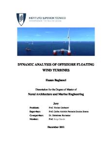
Fig. 3 Aerial photograph of sites one and four.
all wind speed data are included, the mean ratio and ratio of the means are somewhat different, as shown in the results of Table 2. The results at high wind speed can be justified in a general way by the following analysis. Let V{ = Y, + Vi where ^ is the annual average speed at site i, overbars in general denoting annual mean values. Here, by definition, v( = 0. Then: Vt+Vt
v6
(1)
where the binomial expansion is justified by the fact that, at least when the data is restricted to V6 5 6.9 m s"1, the ratio vJV6 is always less than one and is usually quite small compared to one. Taking mean values of equation (1) 17 1
~ We
+ {
^~
(2)
For the mean ratio to be essentially equal to the ratio of the means, the difference between the last two terms on the right-hand side of (2) must be
152 / Z. Vasanji and I.S. Gartshore small compared to one .The coefficient v^lV^ will probably be positive, with large or small winds at two nearby sites generally occurring together. For high winds (F6 ^ 6.9 m s -1 ) the last term on the right has a maximum value of 0.084 occurring in the centre west quadrant, and the small difference between the mean ratio (VjV6) and the ratio of the means VJV6 even in the centre west quadrant suggests that the coefficient v^mv6 has the same magnitude and is positive. This coefficient will be assessed again later. Because the difference between the mean ratio and the ratio of the means in (2) is greater when all data are included than when only the high winds are considered (see Table 2), the arguments presented above are apparently not as applicable when all wind speeds are considered. Larger magnitudes ofvjVi and vJV6 occur when all data are included. This could make the binomial expansion of (1) less accurate, and lead to errors in (2). In addition the individual magnitudes of the last two terms of (2) may be larger in comparison to one, so that their difference could be larger than for the high wind case. The standard deviation of VjVt about its annual mean value can be considered in a similar way. Restricting attention to the high wind case, so that (Jj/F6) is essentially equal to VJV6, (1) can be written:
- (We) ~
v,
v^
v,
v.
+
• • ••
The higher order terms omitted from this equation will be small if rç/Îj is always reasonably small compared to one. Then:
Since three of the four terms of (3) have been evaluated from the data, and are listed in Table 2, the fourth term, which is twice the coefficient already discussed, can be evaluated by subtraction. From the data in Table 2 for high wind speeds only, the coefficient v¿v¿lV¡V6 found from (3) has values between 0.014 and 0.089 with most values lying about 0.025. These magnitudes support the discussion following (2) which suggests that this coefficient is positive, small compared to one and of the same order of magnitude as the normalized mean square (vJV6)2, whose values run from 0.029 to 0.084. Some of the variation in {VJV6), contributing to the rather large standard deviation of this quantity, might be attributed to the fact that one-minute averages have been taken at site 6, so that fairly short-period fluctuations at that site can influence the velocity ratio VJV6. Had the records at site 6 been of hourly average readings, as those at sites 1 to 4, a somewhat lower value of viKlVe) might be expected. In order to investigate this possibility, some of the data were reduced using site 2 as the reference site. Hourly average readings
Six Simultaneous Wind Records Taken Near Vancouver /153
12
10
Fig. 4 Probability density distribution for the wind magnitude ratio, site 1, east quadrant winds.
are taken at sites 1 to 4, so that the variation of (Pj/F2) about its mean value, should be considerably lower, for i = 1 to 4 than variation of (VJV6) about its mean value, if the differences between one-minute averages and hourly averages are important. Table 3 shows data for the east quadrant only, reduced using site 2 as the reference site. _Again, the high wind data (defined now by V2 ^ 6.9 m s"1) shows that VilV2 is essentially identical to (VJV2). The variation of (VilV2) expressed as a fraction of its mean value, is not significantly smaller in Table 3 than the corresponding values in Table 2 of the variation of {VilV6), considering east quadrant winds only. We therefore conclude that the short averaging time used in defining values at site 6 is not contributing significantly to the large variation of Vx\Vk about its mean value. To emphasize the caution with which mean speed ratios must be treated, Fig. 4 shows a probability density distribution for the ratio (VJV6), for the east quadrant, high wind case only. Although the mean value of the ratio VtIV6 is 1.37, there are a significant number of observations for which VilV6 is above 1.8. The distribution is compared in Fig. 4 to a normal curve having the same observed mean and standard deviation. To complete the wind correlation picture, Table 4 gives mean values of (06 - 6j) for each site together with mean values of 96 and standard deviations
154 / Z. Vasanji and I.S. Gartshore TABLE 4. Summary of high wind direction relations for all sites Site Number Parameter
1
2
3
4
5
o« - e() cr(86 - e,) Centre South Quadrant 9 e = 185; o(9 6 ) = 24
13 37
-7 22
-18 35
4 37
19 55
(ee - o.)
41 58
1 22
-9 23
16 35
1 38
20 45
-5 24
-12 27
12 54
65 36
Centre East Quadrant 6 6 = 102; CT(66) = 21